Math Is Fun Forum
You are not logged in.
- Topics: Active | Unanswered
- Index
- » This is Cool
- » Plateau
Pages: 1
#1 2025-08-17 18:26:45
- Jai Ganesh
- Administrator

- Registered: 2005-06-28
- Posts: 53,831
Plateau
Plateau
Gist
A plateau is a flat, elevated area of land, often described as a tableland, that rises sharply above the surrounding area. It's characterized by a relatively flat top and steep slopes on one or more sides. Plateaus can be formed by various geological processes, including volcanic activity, tectonic uplift, and erosion.
Many plateaus form as magma deep inside the Earth pushes toward the surface but fails to break through the crust. Instead, the magma lifts up the large, flat, impenetrable rock above it. Geologists believe a cushion of magma may have given the Colorado Plateau its final lift beginning about ten million years ago.
Summary
A plateau is a flat, elevated landform that rises sharply above the surrounding area on at least one side. Plateaus occur on every continent and take up a third of the Earth's land. They are one of the four major landforms, along with mountains, plains, and hills.
There are two kinds of plateaus: dissected plateaus and volcanic plateaus. A dissected plateau forms as a result of upward movement in the Earths crust. The uplift is caused by the slow collision of tectonic plates. The Colorado Plateau, in the western United States, has been rising about .03 centimeter (.01 inch) a year for more than 10 million years.
A volcanic plateau is formed by numerous small volcanic eruptions that slowly build up over time, forming a plateau from the resulting lava flows. The North Island Volcanic Plateau covers most of the central part of the North Island of New Zealand. This volcanic plateau still has three active volcanoes: Mount Tongariro, Mount Ngauruhoe, and Mount Ruapehu.
Erosion can influence the shape of a plateau. Soft rock often erodes away on the top of a plateau. Many plateaus are therefore topped with a hard, durable surface called caprock. Caprock protects the plateau from erosion of the soil underneath it.
Valleys form when river water cuts through the plateau. The Columbia Plateau, between the Cascade and Rocky mountains in the northwestern United States, is cut through by the Columbia River.
Erosion shapes plateaus in other ways. Sometimes, a plateau is so eroded that it is broken up into smaller raised sections called outliers. Many outlier plateaus are composed of very old, dense rock formations. Iron ore and coal often are found in plateau outliers.
The largest plateau in the world is the Tibetan Plateau, located in central Asia. It stretches through the countries of Tibet, China, and India and occupies an area of 2.5 million square kilometers (1.5 million square miles), which is four times the size of the U.S. state of Texas.
Details
In geology and physical geography, a plateau, also called a high plain or a tableland, is an area of highland consisting of flat terrain that is raised sharply above the surrounding area on at least one side. Often one or more sides have deep hills or escarpments. Plateaus can be formed by a number of processes, including upwelling of volcanic magma, extrusion of lava, and erosion by water and glaciers. Plateaus are classified according to their surrounding environment as intermontane, piedmont, or continental. A few plateaus may have a small flat top while others have wider ones.
Formation
Plateaus can be formed by a number of processes, including upwelling of volcanic magma, extrusion of lava, plate tectonics movements, and erosion by water and glaciers.
Volcanic
Volcanic plateaus are produced by volcanic activity. They may be formed by upwelling of volcanic magma or extrusion of lava. The underlining mechanism in forming plateaus from upwelling starts when magma rises from the mantle, causing the ground to swell upward. In this way, large, flat areas of rock are uplifted to form a plateau. For plateaus formed by extrusion, the rock is built up from lava spreading outward from cracks and weak areas in the crust. The Antrim Plateau in Northern Ireland, the Deccan Plateau in India, the Big Raven Plateau in Canada, and the Columbia Plateau in the United States are examples of lava plateaus.
Tectonic
Tectonic plateaus are formed by tectonic plate movements which cause uplift, and are normally of a considerable size, and a fairly uniform altitude. Examples are the Deccan Plateau in India and the Meseta Central on the Iberian Peninsula.
Erosion
Plateaus can also be formed by the erosional processes of glaciers on mountain ranges, leaving them sitting between the mountain ranges. Water can also erode mountains and other landforms down into plateaus. Dissected plateaus are highly eroded plateaus cut by rivers and broken by deep narrow valleys. An example is the Scottish Highlands.
Classification
Plateaus are classified according to their surrounding environment.
* Intermontane plateaus are some of the highest and most extensive plateaus in the world, enclosed by fold mountains. Examples are the Tibetan Plateau between the Himalayas and Kunlun Mountains, and the Altiplano plateau between two ranges of the Andes.
* Piedmont plateaus are bordered on one side by mountains and on the other by a plain or a sea. The Piedmont Plateau of the Eastern United States between the Appalachian Mountains and the Atlantic Plain is an example.
* Continental plateaus are bordered on all sides by plains or oceans, forming away from the mountains. An example of a continental plateau is the Antarctic Plateau in East Antarctica.
Large plateaus by continent:
Africa
The highest African plateau is the Ethiopian Highlands which cover the central part of Ethiopia. It forms the largest continuous area of its altitude in the continent, with little of its surface falling below 1,500 metres (4,921 ft), while the summits reach heights of up to 4,556 metres (14,928 ft). It is sometimes called the Roof of Africa due to its height and large area
Another example is the Highveld which is the portion of the South African inland plateau which has an altitude above approximately 1,500 metres, but below 2,100 metres, thus excluding the Lesotho mountain regions. It is home to some of the largest South African urban agglomerations.
In Egypt are the Giza Plateau and Galala Mountain, which was once called Gallayat Plateaus, rising 3,300 ft above sea level.
Antarctica
Another very large plateau is the icy Antarctic Plateau, which is sometimes referred to as the Polar Plateau or King Haakon VII Plateau, home to the geographic South Pole and the Amundsen–Scott South Pole Station, which covers most of East Antarctica where there are no known mountains but rather 3,000 m (9,800 ft) high of superficial ice and which spreads very slowly toward the surrounding coastline through enormous glaciers. The polar ice cap is so massive that the echolocation measurements of ice thickness have shown that large areas are below sea level. But, as the ice melts, the land beneath will rebound through isostasy and ultimately rise above sea level.
Asia
The largest and highest plateau in the world is the Tibetan Plateau, sometimes metaphorically described as the "Roof of the World", which is still being formed by the collisions of the Indo-Australian and Eurasian tectonic plates. The Tibetan Plateau covers approximately 2,500,000 sq km2 (970,000 sq mi), at about 5,000 m (16,000 ft) above sea level. The plateau is sufficiently high to reverse the Hadley cell convection cycles and to drive the monsoons of India towards the south. The Deosai Plains in Pakistan are situated at an average elevation of 4,114 meters (13,497 ft) above sea level. They are considered to be the second highest plateaus in the world.
Other major plateaus in Asia are: Najd on the Arabian Peninsula, elevation 762 to 1,525 m (2,500 to 5,003 ft), Armenian Highlands (≈400,000 km2 (150,000 sq mi), elevation 900–2,100 metres (3,000–6,900 ft)), Iranian Plateau (≈3,700,000 km2 (1,400,000 sq mi), elevation 300–1,500 metres (980–4,920 ft)), Anatolian Plateau, Mongolian Plateau (≈2,600,000 sq km(1,000,000 sq mi), elevation 1,000–1,500 metres (3,300–4,900 ft)), and the Deccan Plateau (≈1,900,000 sq km (730,000 sq mi), elevation 300–600 metres (980–1,970 ft)).
North America
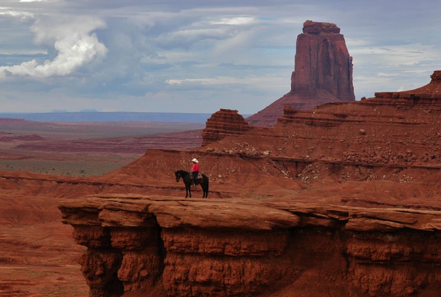
A large plateau in North America is the Colorado Plateau, which covers about 337,000 sq km (130,000 sq mi) in Colorado, Arizona, New Mexico, and Utah.
In northern Arizona and southern Utah the Colorado Plateau is bisected by the Grand Canyon of the Colorado River. This came to be over 10 million years ago, the river was already there, though not necessarily on exactly the same course. Then, subterranean geological forces caused the land in that part of North America to gradually rise by about a centimeter per year for millions of years. An unusual balance occurred: the river that would become the Colorado River was able to erode into the crust of the Earth at a nearly equal rate to the uplift of the plateau. Now, millions of years later, the North Rim of the Grand Canyon is at an elevation of about 2,450 m (8,040 ft) above sea level, and the South Rim of the Grand Canyon is about 2,150 m (7,050 ft) above sea level. At its deepest, the Colorado River is about 1,830 m (6,000 ft) below the level of the North Rim.
Another high-altitude plateau in North America is the Mexican Plateau. With an area of 601,882 sq km (232,388 sq mi) and average height of 1,825 metres, it is the home of more than 70 million people.
Oceania
The Western Plateau, part of the Australian Shield, is an ancient craton covering much of the continent's southwest, an area of some 700,000 square kilometres. It has an average elevation between 305 and 460 metres.
The North Island Volcanic Plateau is an area of high land occupying much of the centre of the North Island of New Zealand, with volcanoes, lava plateaus, and crater lakes, the most notable of which is the country's largest lake, Lake Taupō. The plateau stretches approximately 100 km east to west and 130 km north to south. The majority of the plateau is more than 600 metres above sea level.
The Northern Tablelands are the largest highland area in Australia, covering approximately 18,197 square kilometres. There are widespread high points over 1,000 metres including The Brothers (1,508m), Ben Lomond (1,505m), Mount Rumbee (1,503m), Point Lookout (1,564m), Campoompeta (1,510m), Mount Spirabo (1,492m), Mount Mitchell (1,475m), Chandler's Peak (1,471m), Mount Grundy (1,462m), Mount Bajimba (1,448 m) and the highest point at Round Mountain is 1,584 metres above sea level. The now closed railway station at Ben Lomond, was the highest railway station in Australia. Apart from Antarctica it is the most extensive highland region in the Southern Hemisphere with an average elevation of over 1,000 metres.
South America
The parallel Sierra of Andes delimit one of the world highest plateaux: the Altiplano, (Spanish for "high plain"), Andean Plateau or Bolivian Plateau. It lies in west-central South America, where the Andes are at their widest, is the most extensive area of high plateau on Earth outside of Tibet. The bulk of the Altiplano lies within Bolivian and Peruvian territory while its southern parts lie in Chile. The Altiplano plateau hosts several cities like Puno, Oruro, El Alto and La Paz the administrative seat of Bolivia. Northeastern Altiplano is more humid than the Southwestern, the latter of which hosts several salares, or salt flats, due to its aridity. At the Bolivia-Peru border lies Lake Titicaca, the largest lake in South America.
The Colombian capital city of Bogota sits on another Andean plateau known as the Altiplano Cundiboyacense roughly the size of Switzerland. Averaging a height of 2,600 m (8,500 ft) above sea level, this northern Andean plateau is situated in the country's eastern range and is divided into three main flat regions: the Bogotá savanna, the valleys of Ubaté and Chiquinquirá, and the valleys of Duitama and Sogamoso.
Additional Information
A plateau is an extensive area of flat upland usually bounded by an escarpment (i.e., steep slope) on all sides but sometimes enclosed by mountains. The essential criteria for plateaus are low relative relief and some altitude.
Although plateaus stand at higher elevation than surrounding terrain, they differ from mountain ranges in that they are remarkably flat. Some plateaus, like the Altiplano in southern Peru and western Bolivia, are integral parts of mountain belts. Others, such as the Colorado Plateau (across which the Colorado River has cut the Grand Canyon), were produced by processes very different from those that built neighbouring mountain ranges. Some plateaus—for example, the Deccan plateau of central India—occur far from mountain ranges. The differences among plateaus can be ascribed to the different geologic processes that have created them.
Geomorphic characteristics
The high flat surface that defines a plateau can continue for hundreds or even thousands of kilometres, as in the case of the Plateau of Tibet. In spite of the paucity of roads, one can drive over most of that plateau, where elevations exceed 4,500 metres (about 14,760 feet), and encounter less relief than in some major cities of the world (e.g., San Francisco or Rio de Janeiro). Although ranges of hills and mountains rise above the rest of the plateau, their topography too is rather gentle.
Plateaus dissected (eroded) by rivers have remarkably uniform maximum elevations, but their surfaces can be interrupted by deep canyons. In the case of some regions described as plateaus, the surface is so dissected that one does not see any flat terrain. Instead, such a plateau is defined by a uniform elevation of the highest ridges and mountains. The eastern part of the Plateau of Tibet, which constitutes the headwaters of many of the great rivers of Asia (e.g., Huang He, Yangtze, Mekong, Salween, and Irrawaddy), is dissected into deep canyons separated by narrow, steep ridges; the high uniform elevation that characterizes plateaus is only barely discernible in that area.
Formative processes
The formation of a plateau requires one of the same three types of tectonic processes that create mountain ranges—volcanism, crustal shortening (by the thrusting of one block or slice of crust over another or by the folding of layers of rock), and thermal expansion. The simplest of these is thermal expansion of the lithosphere (or the replacement of cold mantle lithosphere by hot asthenosphere).
When the lithosphere underlying a broad area is heated rapidly—e.g., by an upwelling of hot material in the underlying asthenosphere—the consequent warming and thermal expansion of the uppermost mantle causes an uplift of the overlying surface. If the uplifted surface had originally been low and without prominent relief, it is likely to remain relatively flat when uplifted to a relatively uniform elevation. The high plateaus of East Africa and Ethiopia were formed that way. As in parts of Africa, plateaus of that sort can be associated with volcanism and with rift valleys, but those features are not universal. Most of the high plateau in East Africa that holds Lake Victoria does not contain volcanic rock and is cut only by small, minor rift valleys.
Where the uplifted surface lay at a low elevation for a very long time and was covered by resistant sedimentary rock, the flatness of the plateau can be particularly marked. The rock underlying the Colorado Plateau has undergone only very mild deformation since about 1.7 billion years ago during Precambrian time (4.6 billion to 541 million years ago), and layers of very resistant limestone and sandstone deposited during the Paleozoic Era (541 million to 252 million years ago) form its top surface in many areas. The warming of the underlying lithosphere in late Cenozoic time (66 million years ago to the present) caused that area to rise to its present elevation, and those erosion-resistant formations dating to Paleozoic time define the surfaces that make the remarkably flat horizons at the Grand Canyon.
The great heights of some plateaus, such as the Plateau of Tibet or the Altiplano, are due to crustal shortening. The geologic structure of plateaus of that kind is entirely different from that of the Colorado Plateau, for instance. Crustal shortening, which thickens the crust as described above, has created high mountains along what are now the margins of such plateaus. In most mountain ranges, streams and rivers transport eroded material from the mountains to the neighbouring plains. When drainage is internal and streams and rivers deposit their debris in the valleys between mountains, however, a plateau can form. The surface of this sort of plateau is defined by very flat, broad valleys surrounded by eroded hills and mountains. The rocks that make up the mountains and the basement of the valleys are often strongly deformed, but the young sediment deposited in the valleys usually lies flat. Those plateaus generally survive erosion only in dry climates where erosion is slow. In many cases, the valleys, or basins, are occupied by flat dry lake beds (playas). Thus, plateaus built by crustal shortening are really mountain ranges buried in their own debris.
A third type of plateau can form where extensive lava flows (called flood basalts or traps) and volcanic ash bury preexisting terrain, as exemplified by the Columbia Plateau in the northwestern United States. The volcanism involved in such situations is commonly associated with hot spots. The lavas and ash are generally carried long distances from their sources, so that the topography is not dominated by volcanoes or volcanic centres. The thickness of the volcanic rock can be tens to even hundreds of metres, and the top surface of flood basalts is typically very flat but often with sharply incised canyons and valleys.
The separation of plateaus into the above three types is not always easy, because two or even all three of the processes involved frequently operate simultaneously. For instance, where the uppermost mantle is particularly hot, volcanism is common. The Ethiopian Plateau, on which Precambrian rocks crop out, stands high because the underlying lithosphere has been heated, but Cenozoic volcanic rocks cover much of the plateau, especially those areas that are the flattest. Although the scale is different, there are active volcanoes and young lavas covering some broad basins on the northern part of the Plateau of Tibet. All three processes—thermal expansion, crustal shortening, and volcanism—may have contributed to the high, flat elevation of at least part of that plateau.
Geographic distribution
Plateaus of one type or another can be found on most continents. Those caused by thermal expansion of the lithosphere are usually associated with hot spots. The Yellowstone Plateau in the United States, the Massif Central in France, and the Ethiopian Plateau in Africa are prominent examples. Most hot spots are associated with the upwelling of hot material in the asthenosphere, and the hot upwelling not only heats the overlying lithosphere and melts holes through it to produce volcanoes but also uplifts the lithosphere. The relationship of such plateaus to hot spots ensures both a wide distribution of plateaus and an absence of belts of plateaus or of interrelated plateaus.
Some plateaus, like the Colorado Plateau, the Ordos Plateau in northern China, or the East African Highlands, do not seem to be related to hot spots or to vigorous upwelling in the asthenosphere but appear to be underlain by unusually hot material. The reason for localized heating beneath such areas is poorly understood, and thus an explanation for the distribution of plateaus of that type is not known.
Plateaus that were formed by crustal shortening and internal drainage lie within major mountain belts and generally in arid climates. They can be found in North Africa, Turkey, Iran, and Tibet, where the African, Arabian, and Indian continental masses have collided with the Eurasian continent. The Altiplano lies between the Cordillera Occidental composed of volcanoes and the Cordillera Oriental beneath which the Brazilian shield is being thrust. All those areas have undergone crustal shortening during Cenozoic time (66 million years ago to the present), and in each case the surface of the plateau includes both strongly deformed pre-Cenozoic rocks and very young flat-lying sediment.
There are some plateaus whose origin is not known. Those of the Iberian Peninsula and north-central Mexico exhibit a topography that is largely high and relatively flat. Crustal shortening clearly occurred in Mexico during the Late Cretaceous and Early Cenozoic (between 100.5 million and 23 million years ago) and in some parts of Spain during the Cenozoic, but the high elevations in either case do not seem to be supported by thick crust. Those areas are probably underlain by a hot uppermost mantle, but proof of that is still lacking.
Volcanic plateaus are commonly associated with eruptions that occurred during the Cenozoic or Mesozoic. Eruptions on the scale needed to produce volcanic plateaus are rare, and none seems to have taken place in recent time. The volcanic eruptions that produce lava plateaus tend to be associated with hot spots. For example, the basalts of the Deccan Traps, which cover the Deccan plateau in India, were erupted 60–65 million years ago when India lay in the Southern Hemisphere, probably over the same hot spot that presently underlies the volcanic island of Réunion. The Serra Geral basalts that cap a plateau of the same name on the Atlantic coast of Brazil were erupted some 135 million years ago, before Africa and South America separated from each other and when the future continental margins overlay the hot spot now beneath the volcanic island of Tristan da Cunha in the South Atlantic Ocean. In North America the Columbia River basalts may have been ejected over the same hot spot that underlies the Yellowstone area today. Lava plateaus of the scale of those three are not common features on Earth.
It appears to me that if one wants to make progress in mathematics, one should study the masters and not the pupils. - Niels Henrik Abel.
Nothing is better than reading and gaining more and more knowledge - Stephen William Hawking.
Offline
Pages: 1
- Index
- » This is Cool
- » Plateau