Math Is Fun Forum
You are not logged in.
- Topics: Active | Unanswered
#2601 2025-09-28 17:40:16
- Jai Ganesh
- Administrator

- Registered: 2005-06-28
- Posts: 52,569
Re: Miscellany
2401) Duck-billed platypus
Gist
Along with echidnas, Platypuses are grouped in a separate order of mammals known as monotremes, which are distinguished from all other mammals because they lay eggs.
They outdo all waterfowl by having a bill that can detect electrical signals created by the muscular activity of animals swimming underwater. Using the special organs on their bill to detect electrical impulses created by prey, platypuses can locate worms and insect larvae in dark, murky waters.
Sometimes known as a duck-billed platypus, this curious mammal combines the characteristics of many different species in one. The platypus is a duck-billed, beaver-tailed, otter-footed, egg-laying aquatic creature native to Australia.
Summary
Duck-billed platypuses are small, shy animals. They have a flattened head and body to help them glide through the water. Their fur, dark brown on top and tan on their bellies, is thick and repels water to keep them warm and dry even after hours of swimming.
The duck-billed platypus's head and body grow to about 15 inches (38 centimeters) and its tail grows to about 5 inches long (13 centimeters). Their most remarkable feature is their amazing snout. It looks like a duck's bill, but is actually quite soft and covered with thousands of receptors that help the platypus detect prey.
Males are also venomous. They have sharp stingers on the heels of their rear feet and can use them to deliver a strong toxic blow to any foe.
Platypuses spend most of their time alone, sleeping or eating.
These mammals are bottom feeders. They scoop up insects and larvae, shellfish, and worms in their bill along with bits of gravel and mud from the bottom. All this material is stored in cheek pouches and, at the surface, mashed for consumption. Platypuses do not have teeth, so the bits of gravel help them to "chew" their meal.
Platypuses are long-lived, surviving 20 years or more in captivity and up to 12 years in the wild. Scientists think these fascinating creatures are the earliest relatives of modern mammals. Recent studies show that they first evolved more than 112 million years ago, well before the extinction of the dinosaurs.
Details
The platypus (Ornithorhynchus anatinus), sometimes referred to as the duck-billed platypus, is a semiaquatic, egg-laying mammal endemic to eastern Australia, including Tasmania. The platypus is the sole living representative of its family Ornithorhynchidae and genus Ornithorhynchus, though a number of related species appear in the fossil record. Together with the four species of echidna, it is one of the five extant species of monotremes, mammals that lay eggs instead of giving birth to live young. Like other monotremes, the platypus has a sense of electrolocation, which it uses to detect prey in water while its eyes, ears and nostrils are closed. It is one of the few species of venomous mammals, as the male platypus has a spur on each hind foot that delivers an extremely painful venom.
The unusual appearance of this egg-laying, duck-billed, beaver-tailed mammal at first baffled European naturalists. In 1799, the first scientists to examine a preserved platypus body judged it a fake made of several animals sewn together. The unique features of the platypus make it important in the study of evolutionary biology, and a recognisable and iconic symbol of Australia. It is culturally significant to several Aboriginal peoples, who also used to hunt it for food, and has appeared on stamps and currency.
The platypus was hunted for its fur, but it has been a legally protected species in all states where it occurs since 1912. Captive breeding programs have had slight success, and it is vulnerable to pollution, bycatching and climate change. It is classified as a near-threatened species by the IUCN, but a November 2020 report has recommended that it be upgraded to threatened species under the federal EPBC Act, due to habitat destruction and declining numbers in all states.
Description
Most of the platypus' small streamlined body is covered with short, dense, brown, fur that traps a layer of insulating air to keep the animal warm, both in and out of water. The fur coat is waterproof and consists of flattened guard hairs and curvy underfur hairs. It is one of the most densely furred mammals, behind only otters. It is also biofluorescent and glows cyan and green when under ultraviolet light; this may serve to camouflage it in low lighting from UV-sensitive predators. The duck-like bill consists of a long snout and lower jaw which is covered in soft skin. The nostrils are located near the tip of the snout's dorsal surface, while the eyes and ears are just behind the snout in a groove which closes underwater. Its has cheek pouches for storing food. The platypus's wide, flat tail is compared to a beaver's but is furry rather than scaly; it stores fat reserves and can act as a rudder during swimming. The legs are short and have a sprawling stance. Webbing is more significant on the front feet. While walking on land, the feet are folded up in knuckle-walking to protect the webbing.
The platypus has an interclavicle in the shoulder girdle, a trait which they share in common with reptiles. As in many other aquatic and semiaquatic vertebrates, the bones show osteosclerosis, increasing their density to reduce buoyancy. Adult platypuses lack teeth and instead have heavily keratinised food-grinding pads. Young platypuses have one premolar tooth and two molars on each maxillae, and three molars on the dentaries. The first upper and third lower cheek teeth have only one major cusp, while the rest have two. They lose their teeth around the time they leave their natal burrow.
Male platypuses have an average length of 50 cm (20 in) and weight of 1,700 g (3.7 lb), while females are smaller with an average length of 43 cm (17 in) and weight of 900 g (2.0 lb). The species follows Bergmann's rule, with individuals being larger the farther south they are, due to colder climates; there are local variations, however. The platypus has an average body temperature of about 32 °C (90 °F), lower than the 37 °C (99 °F) typical of placental mammals. Research suggests this has been a gradual adaptation to harsh environmental conditions among the few marginal surviving monotreme species, rather than a general characteristic of past monotremes.
The platypus has a single opening, called a cloaca, for both the reproductive and waste systems.
Senses
Monotremes are the only mammals (apart from the Guiana dolphin) known to have a sense of electroreception. The playtpus relies on electrolocation when feeding, as the eyes, ears, and nose are closed while underwater. Digging in the bottom of streams with its bill, its electroreceptors detect tiny electric currents generated by the muscular contractions of its prey. Experiments have shown the platypus will even react to an "artificial shrimp" if a small electric current is passed through it.
The 40,000 electroreceptors are arranged in rows in the skin of the bill from front to back, while mechanoreceptors for touch are uniformly distributed across the bill. The electrosensory area of the cerebral cortex is in the tactile somatosensory area, and some cortical cells receive input from both electroreceptors and mechanoreceptors, suggesting the platypus feels electric fields as touches. These receptors in the bill dominate the somatotopic map of the platypus brain, in the same way human hands dominate the Penfield homunculus map. The platypus can feel the direction of an electric source, perhaps by comparing differences in signal strength across the array of electroreceptors, enhanced by the characteristic side-to-side motion of the animal's head while hunting. It may also be able to determine the distance of moving prey via the timing difference between electrical and mechanical pressure sensations. Monotreme electrolocation for hunting in murky waters may be tied to their tooth loss. The extinct Obdurodon was electroreceptive, but unlike the modern platypus it foraged in open water.
The eyes of the platypus have basal traits also found in lungfish and amphibians, such as scleral cartilage, double cones, and droplets. The platypus's eyes are small and shut under water, though several features indicate its ancestors relied on vision. As with other aquatic mammals, the eye has a flattened cornea and surrounding lens, while the posterior surface of the lens is sharply inclined. A temporal (ear side) concentration of retinal ganglion cells, important for binocular vision, indicates a vestigial role in predation, though the actual visual acuity is insufficient for such activities. Limited acuity is matched by low cortical magnification, a small lateral geniculate nucleus, and a large optic tectum, suggesting that the visual midbrain plays a more important role than the visual cortex, as in some rodents. These features suggest that the platypus has adapted to an aquatic and nocturnal lifestyle, developing its electrosensory system at the cost of its visual system. This contrasts with the small number of electroreceptors in the short-beaked echidna, which dwells in dry environments, while the long-beaked echidna, which lives in wetter habitats is intermediate between the other two monotremes.
The ears of the platypus are adapted for hearing while out of water. As in all true mammals, it has three middle ear bones, though the cochlea lacks spirals, but is described as "well organised". Within the cochlea, there are rows of inner and outer hair cells. As in placental mammals, the outer hair cells of the platypus are adapted for hearing high frequencies, suggesting it is an ancestral mammalian trait. However it also possesses more rows of inner hair cells. The olfactory (smelling) systems of the platypus and the echidna independently evolved from an ancestor with less advanced smelling. The main olfactory bulb of the platypus lacks the complex layers of the echidna, while both the piriform cortex and flaps (lamella) are simpler. Monotremes differ from placental mammals in that their mitral cells are distributed throughout the outer plexiform layer of the olfactory bulb rather than packed as a monolayer.
Venom
While both male and female platypuses are born with back ankle spurs, only the males retain them into adulthood. Similar spurs are found on many archaic mammal groups, indicating that this was an ancient general characteristic among mammals. The spurs of the male injects venom, which is powerful enough to inflict pain in humans. Starting from the wounded area, the affect limb develops edema (swelling via fluid buildup) which can lead to an excruciating hyperalgesia (heightened sensitivity to pain) that can last as long as months.
The venom is composed largely of defensin-like proteins (DLPs) produced by the immune system, some of which are unique to the species. It is produced in kidney-shaped alveolar glands located in each of the thighs of the hind limbs and connected to the spur. The venomous spurs of male platypuses serve as weapons in battles with other males for breeding.
Distribution and habitat
The platypus is native to the freshwaters of eastern Australia, from Queenland to Tasmania (including King Island but not the Furneaux Group). It was believed to be extinct on the South Australian mainland, with the last sighting recorded at Renmark in 1975. Platypuses were captively bred at Warrawong Sanctuary in 1990-91. In October 2020 a nesting platypus was filmed in the wild after the previously abandoned Sanctuary reopened. There is a population on Kangaroo Island introduced in the 1920s, said to stand at 150 individuals in the Rocky River region of Flinders Chase National Park. In the 2019–20 Australian bushfire season, large portions of the island burned, decimating wildlife. However, SA Department for Environment and Water recovery teams worked to restore their habitat, with a number of sightings reported by April 2020. The platypus has almost disappeared from the Murray–Darling Basin, possibly due to poor water management. Platypuses can be found in a variety of freshwater habitats including rivers, streams, lakes and lagoon-like pools. The surrounding terrestrial environment includes tropical rainforests and colder alpine areas.
Additional Information
A platypus, (Ornithorhynchus anatinus) is a a small amphibious Australian mammal noted for its odd combination of primitive features and special adaptations, especially the flat, almost comical bill that early observers thought was that of a duck sewn onto the body of a mammal. Adding to its distinctive appearance are conspicuous white patches of fur under the eyes. The fur on the rest of the body is dark to light brown above, with lighter fur on the underside.
The platypus is common in waterways of eastern Australia, where it generally feeds on bottom-dwelling invertebrates but also takes an occasional frog, fish, or insect at the water’s surface. This shy creature forages most actively from dusk to dawn, sheltering during the day in burrows dug into stream banks. It is exquisitely adapted for its aquatic lifestyle, having a flattened torpedo-like body, dense waterproof fur, and strong front limbs used for swimming as well as digging. Even the head is streamlined, each ear being housed in a groove together with a small eye. The senses of sight, smell, and hearing are essentially shut down while the platypus is submerged to feed, but it possesses a unique electromechanical system of electroreceptors and touch receptors that allow it to navigate perfectly underwater. Similar electroreceptors are also present in echidnas, which, together with the platypus, make up the mammalian order Monotremata, a unique group with an exceptionally ancient history.
Natural history
Platypuses are generally solitary, spending their lives either feeding along the bottoms of rivers, streams, and lakes or resting in burrows dug into the banks. They are extremely energetic, feeding almost continuously while in the water, shoveling through streambed debris with their flat bills as they hunt for larval insects and freshwater crustaceans (a favourite food). The platypus uses its sophisticated electromechanical system to detect minute electrical signals given off by the muscles of its prey. After feeding, it retires to its burrow, the entrance of which is large enough to admit only the platypus and serves to squeeze excess moisture from the fur.
The platypus is found in terrain ranging from the high country of Tasmania and the Australian Alps to lowland areas close to the sea. Although it has on occasion been seen swimming in salt water, the platypus must feed in fresh water, where its electrical navigation system is operative. The platypus is present in all eastern Australian states in both eastward- and westward-flowing river systems, but it is absent from far northern Queensland and, unlike its relatives, the echidnas, does not appear to have colonized the island of New Guinea.
Generally most active around dawn and dusk (crepuscular), platypuses can also be active during the day depending on the season, cloud cover, stream productivity, and even individual preference. Platypuses are not known to hibernate. However, they have an unusually low body temperature for mammals (about 32 °C [90 °F]). Studies have shown that they can maintain a constant body temperature even after extended periods in water with temperatures as low as 4 °C (39 °F), a fact that puts to rest the belief that monotremes cannot regulate their body temperature.
Form and function
Platypuses range in length from 38 to 60 cm (15 to 24 inches); males are generally larger than females. Aquatic adaptations include the flat streamlined body, dorsally placed eyes and nostrils, and dense waterproof fur that keeps the platypus well insulated. Long guard hairs protect the soft underfur, which remains dry even after hours in the water. The extensive webbing on the front feet extends well past the claws and is essential in propelling the animal through the water. The paddlelike tail acts as a stabilizer during swimming, while the back feet act as rudders and brakes.
Odd skeletal features of platypuses include an archaic robust shoulder girdle and a short, wide humerus providing extensive muscle attachment areas for the exceptionally strong front limbs. The outside of the bill is covered by soft, sensitive skin. Inside the bill, adult platypuses do not have true teeth but instead have developed flat pads of hardened gum tissue. Male platypuses have a spur on the inner side of each ankle that is connected to a venom gland located over the thighs. The spurs can be wielded in defense, and the venom is potent enough to kill small animals and cause intense pain in humans if the spur penetrates the skin.
Life cycle and reproduction
Despite their abundance, little is known about the life cycle of the platypus in the wild, and few of them have been kept successfully in captivity. The sexes avoid each other except to mate, and they do not mate until they are at least four years old. Males often fight during the breeding season, inflicting wounds on each other with their sharp ankle spurs. Courtship and mating take place in the water from late winter through spring; timing varies with latitude, mating occurring earlier in the more northern parts of the range and later in the more southerly regions. Mating is a strenuous affair; in one recorded session the male was seen tightly grasping the tail of the female with his bill as she led him on an exhaustive chase.
Males take no part in rearing the young. Females construct specially built nursery burrows, where they usually lay two small leathery eggs. Gestation is at least two weeks (possibly up to a month), and incubation of the eggs takes perhaps another 6 to 10 days. The female incubates the eggs by curling around them with her tail touching her bill. Each tiny platypus hatches from the egg with the aid of an egg tooth and fleshy nub (caruncle), structural holdovers from a reptilian past. The young drag milk from special mammary hairs and remain protected in the burrow, suckling for three to four months before becoming independent. Hatchlings, whose weight often increases by a factor of 20 during their first 14 weeks of life, possess vestigial teeth that are shed shortly after the young platypus leaves the burrow to feed on its own.
Males and females become fully grown between ages 12 and 18 months, and they become sexually mature at about age 18 months. They are long-lived for small mammals. Some studies have documented individuals living more than 20 years in the wild. The platypus can survive for nearly 23 years in captivity.
Evolution, paleontology, and classification
Aquatically adapted platypus-like monotremes probably evolved from a more-generalized terrestrial monotreme. The first occurrence in the fossil record of a platypus-like monotreme is from about 110 million years ago, in the early Cretaceous Period, when Australia was still connected to South America by Antarctica. Until recently this Cretaceous monotreme (Steropodon galmani, known by a stunning opalized jaw) was placed within the platypus family, but, partly on the basis of molecular studies and partly on dental structure, it is now classified in its own family, Steropodontidae.
The living platypus family (Ornithorhynchidae) includes the extinct genera Monotrematum (which dates to the Paleocene Epoch some 61 million years ago) and Obdurodon (which may have first emerged near the boundary of the Oligocene and Miocene epochs some 23 million years ago) and the living Ornithorhychus. The discovery of M. sudamericanum in 62-million-year-old Patagonian sediments confirmed that platypuses were once distributed through the southern continents that were once linked geographically (Gondwana). Species of Monotrematum and Obdurodon retained functional teeth and were more robust than the living platypus, Obdurodon measuring up to 60 cm (24 inches) long.
:max_bytes(150000):strip_icc():format(webp)/GettyImages-635477020-14202280a8714a179f5850decf0d254e.jpg)
It appears to me that if one wants to make progress in mathematics, one should study the masters and not the pupils. - Niels Henrik Abel.
Nothing is better than reading and gaining more and more knowledge - Stephen William Hawking.
Offline
#2602 2025-09-29 19:05:00
- Jai Ganesh
- Administrator
- Registered: 2005-06-28
- Posts: 52,569
Re: Miscellany
2402) Gypsum
Gist
Gypsum is a soft, white-to-grey sulfate mineral, chemically known as calcium sulfate dihydrate (CaSO4·2H2O), which is commonly used in construction for drywall, as a soil conditioner in agriculture, and as a food additive. Found in naturally occurring sedimentary deposits, gypsum releases its water when heated, allowing it to be mixed with water to form a hard, durable material suitable for building and art.
Gypsum is a mineral primarily used for construction, especially in making drywall/wallboard and cement. It's also used in agriculture to condition soil by providing calcium and sulfur and improving water movement. Other uses include creating plaster of Paris for decorative elements, as a filler in paper and textiles, and in the production of some foods like tofu.
Summary
Gypsum is a soft sulfate mineral composed of calcium sulfate dihydrate, with the chemical formula CaSO4·2H2O. It is widely mined and is used as a fertilizer and as the main constituent in many forms of plaster, drywall and blackboard or sidewalk chalk. Gypsum also crystallizes as translucent crystals of selenite. It forms as an evaporite mineral and as a hydration product of anhydrite.[citation needed] The Mohs scale of mineral hardness defines gypsum as hardness value 2 based on scratch hardness comparison.
Fine-grained white or lightly tinted forms of gypsum known as alabaster have been used for sculpture by many cultures including Ancient Egypt, Mesopotamia, Ancient Rome, the Byzantine Empire, and the Nottingham alabasters of Medieval England.
Physical properties
Gypsum is moderately water-soluble (~2.0–2.5 g/L at 25 °C) and, in contrast to most other salts, it exhibits retrograde solubility, becoming less soluble at higher temperatures. When gypsum is heated in air it loses water and converts first to calcium sulfate hemihydrate (bassanite, often simply called "plaster") and, if heated further, to anhydrous calcium sulfate (anhydrite). As with anhydrite, the solubility of gypsum in saline solutions and in brines is also strongly dependent on sodium chloride (common table salt) concentration.
The structure of gypsum consists of layers of calcium (Ca2+) and sulfate ions tightly bound together. These layers are bonded by sheets of anion water molecules via weaker hydrogen bonding, which gives the crystal perfect cleavage along the sheets (in the {010} plane).
Crystal varieties
Gypsum occurs in nature as flattened and often twinned crystals, and transparent, cleavable masses called selenite. In the form of selenite, gypsum forms some of the largest crystals found in nature, up to 12 m (39 ft) long. Selenite contains no significant selenium; rather, both substances were named for the ancient Greek word for the Moon.
Selenite may also occur in a silky, fibrous form, in which case it is commonly called "satin spar".
It may also be granular or quite compact. In hand-sized samples, it can be anywhere from transparent to opaque.
A very fine-grained white or lightly tinted variety of gypsum, called alabaster, is prized for ornamental work of various sorts.
In arid areas, gypsum can occur in a flower-like form, typically opaque, with embedded sand grains called desert rose.
Details
Gypsum is common sulfate mineral of great commercial importance, composed of hydrated calcium sulfate (CaSO4·2H2O). In well-developed crystals the mineral commonly has been called selenite. The fibrous massive variety has a silky lustre and is called satin spar; it is translucent and opalescent and is valued for ornaments and jewelry. The fine-grained massive variety called alabaster is carved and polished for statuary and ornamental use when pure and translucent. Gypsite is the earthy pulverulent variety.
Gypsum occurs in extensive beds associated with other evaporite minerals (e.g., anhydrite and halite), particularly in Permian and Triassic sedimentary formations; it is deposited from ocean brine, followed by anhydrite and halite. It also occurs in considerable quantity in saline lakes and salt pans and is an important constituent of cap rock, an anhydrite-gypsum rock forming a covering on salt domes, as in Texas and Louisiana. Very commonly it is formed from the hydration of anhydrite by surface waters and groundwaters, and, thus, many gypsiferous strata grade downward into anhydrite rocks. This replacement causes a 30 percent to 50 percent volume increase and results in intense, tight folding of the remaining anhydrite layers. Gypsum also occurs disseminated in limestones, dolomitic limestones, and some shales.
Gypsum deposits occur in many countries, but Spain, Thailand, the United States, Turkey, and Russia are among the leading producers. The largest gypsum crystal was found in the Braden mine in Chile and exceeds 3 metres (about 10 feet) in length and 0.4 metre (about 1.5 feet) in diameter. In the U.S., commercial sedimentary gypsum deposits occur in New York and Michigan; others of economic importance occur in Virginia, Ohio, Iowa, Kansas, Texas, Nevada, and southern California. In Canada, gypsum is produced for export in Nova Scotia and New Brunswick. In France, gypsum is common in the marls and clays of the Paris Basin (hence the name plaster of paris), especially in Montmartre.
Crude gypsum is used as a fluxing agent, fertilizer, filler in paper and textiles, and retarder in portland cement. About three-fourths of the total production is calcined for use as plaster of paris and as building materials in plaster, Keene’s cement, board products, and tiles and blocks. Gypsum plaster is a white cementing material made by partial or complete dehydration of the mineral gypsum, commonly with special retarders or hardeners added. Applied in a plastic state (with water), it sets and hardens by chemical recombination of the gypsum with water.
For an especially hard-finish plaster, the gypsum is completely dehydrated at a high temperature, and such chemicals as alkali sulfate, alum, or borax are added. Hair or fibre and lime or clay may be added to plasters during manufacture. The plaster coats, except for some finish coats, are sanded.
Additional Information
Gypsum is a common mineral. It is found in layers that were formed under salt water millions of years ago. When water evaporated, it left the mineral behind.
Gypsum is mined from sedimentary rock formations around the world. It takes the form of crystals which can at times be found projecting from rock – leading to its old English name of the Spear Stone. The largest gypsum quarries in Europe are found in France, Germany, Italy, Poland, Spain, and the UK. There is also evidence of gypsum dunes on Mars.
Gypsum is composed of calcium sulphate (CaSO4) and water (H2O). Its chemical name is calcium sulphate dihydrate (CaSO4.2H2O).
Gypsum can be milled mixed with water and then resume its original rock-like state. This means it can be shaped and hardened. Gypsum also has a “closed recycling loop”, meaning it can be endlessly recycled while maintaining a high quality.
One alternative to natural gypsum is Flue Gas Desulphurisation Gypsum, or FGD Gypsum. This is a by-product of coal-fired power stations.

It appears to me that if one wants to make progress in mathematics, one should study the masters and not the pupils. - Niels Henrik Abel.
Nothing is better than reading and gaining more and more knowledge - Stephen William Hawking.
Offline
#2603 2025-09-30 22:36:39
- Jai Ganesh
- Administrator
- Registered: 2005-06-28
- Posts: 52,569
Re: Miscellany
2403) Bronchospasm
Gist
Bronchospasm is the sudden tightening of muscles in the airways of the lungs, which constricts the air passages and makes breathing difficult. It is often a symptom of asthma, but can also be triggered by allergens, infections, exercise, or irritants, causing wheezing, coughing, and shortness of breath. While it can be a mild inconvenience, it can also become a severe, life-threatening condition, so proper diagnosis and treatment are crucial.
Bronchospasm is caused by irritants, allergens, infections, and underlying conditions like asthma. Common triggers include cigarette smoke, dust mites, pollen, pet dander, cold air, chemical fumes, and viral infections. Exercise, certain medications (beta-blockers, NSAIDs), and general anesthesia can also induce bronchospasm. (Non-Steroidal Anti-inflammatory Drug).
Summary
Bronchospasm or a bronchial spasm is a sudden constriction of the muscles in the walls of the bronchioles. It is caused by the release (degranulation) of substances from mast cells or basophils under the influence of anaphylatoxins. It causes difficulty in breathing which ranges from mild to severe.
Bronchospasms occur in asthma, chronic bronchitis and anaphylaxis. Bronchospasms are a possible side effect of some drugs: pilocarpine, beta blockers (used to treat hypertension), a paradoxical result of using LABA drugs (to treat COPD), and other drugs. Bronchospasms can present as a sign of giardiasis.
Some factors that contribute to bronchospasm include consuming certain foods, taking certain medicines, allergic responses to insects, and fluctuating hormone levels, particularly in women. Bronchospasms are one of several conditions associated with cold housing.
The overactivity of the bronchioles' muscle is a result of exposure to a stimulus which under normal circumstances would cause little or no response. The resulting constriction and inflammation causes a narrowing of the airways and an increase in mucus production; this reduces the amount of oxygen that is available to the individual causing breathlessness, coughing and hypoxia.
Bronchospasms are a serious potential complication of placing a breathing tube during general anesthesia. When the airways spasm or constrict in response to the irritating stimulus of the breathing tube, it is difficult to maintain the airway and the patient can become apneic. During general anesthesia, signs of bronchospasm include wheezing, high peak inspiratory pressures, increased intrinsic PEEP, decreased expiratory tidal volumes, and an upsloping capnograph (obstructive pattern). In severe cases, there may be complete inability to ventilate and loss of ETCO2 as well as hypoxia and desaturation.
LABA: Long-acting beta-adrenoceptor agonist.
COPD: Chronic obstructive pulmonary disease.
PEEP: Positive end-expiratory pressure.
ETCO2: ETCO2, or end-tidal carbon dioxide, is the concentration of carbon dioxide in the last part of an exhaled breath.
Details
Bronchospasms happen when the muscles that line the airways in your lungs tighten. It causes wheezing, coughing and other symptoms. Many things cause bronchospasm, including asthma. Medications can usually manage bronchospasm.
What Is a Bronchospasm?:
With bronchospasm, the muscles that line your bronchi tighten and make it harder for air to pass through your airways.
A bronchospasm (pronounced “BRONG-kuh-spaz-uhm”) is when the muscles that line your bronchi tighten. Your bronchi are the tubes that air travels through to get to your lungs. They connect your windpipe (trachea) to your lungs. If the muscles in your bronchi tighten or squeeze, your airways narrow. This limits how much oxygen your body receives. Bronchospasms can occur alongside many different lung conditions, including:
* Asthma
* Chronic obstructive pulmonary disease (COPD)
* Emphysema
* Lung infections
* Allergic reactions, including anaphylaxis
They can be scary because it feels like you can’t get enough air to breathe. Go to the nearest emergency room if you have sudden or severe breathing problems.
Symptoms and Causes:
What are the symptoms of bronchospasm?
The main symptom of bronchospasm is the feeling that you can’t catch your breath. Other bronchospasm symptoms include:
* Wheezing
* Chest pain or chest tightness
* Coughing
* Shortness of breath
* Dizziness
* Fatigue
What is the cause of bronchospasm?
Asthma is the most common cause of bronchospasm. But many other things can also cause irritation and swelling in your airways. Irritation and swelling can cause bronchospasm. These include:
* Allergens, like dust, pollen and pet dander
* Bacterial, fungal or viral infections in your lungs or airways
* Chemical fumes or other irritants, like perfume or cologne
* Cold or hot/humid temperatures
* Exercise (exercise-induced bronchospasm)
* General anesthesia
* Smoking or vaping
* Poor air quality
Just because you have a condition or are around a trigger, it doesn’t mean you’ll have a bronchospasm. In rare cases, bronchospasm medications like albuterol can actually make your symptoms worse. This is a paradoxical bronchospasm. If this happens, stop using your bronchodilator immediately and tell your healthcare provider. They’ll work with you to find a different treatment.
Is it contagious?
No, bronchospasms aren’t contagious. But some bronchospasm causes are contagious, like bacterial or viral infections.
Diagnosis and Tests:
How doctors diagnose bronchospasm
A healthcare provider can diagnose bronchospasm. They’ll review your medical history, ask about your symptoms and perform a physical exam. During the exam, they may listen to your lungs with a stethoscope. If they think you’re having bronchospasms, they may refer you to a pulmonologist or allergist.
What does it sound like?
Healthcare providers listen to your lungs with a stethoscope. Stethoscopes pick up very quiet sounds. When they use one, they listen for high-pitched whistling sounds.
Tests that are used
Your healthcare provider may recommend pulmonary (lung) function tests to see how well your lungs work. These may include:
* Spirometry: You use a spirometer that measures the force of air as you breathe in and out.
* Lung diffusion capacity: You breathe into a tube to determine how well oxygen transfers or diffuses between your lungs and blood.
* Lung volume assessment: This tells your provider how much air your lungs can hold.
* Pulse oximetry: Your provider places a device on your finger or ear to measure how much oxygen is in your blood.
Depending on your history, your provider may also recommend:
* Methacholine challenge or provocation tests: These test for the presence of asthma. They measure how your lungs respond to methacholine. Methacholine is a medication that can induce bronchospasm.
* Imaging tests: Chest X-rays and CT scans can help your provider see infections or other lung problems.
* Arterial blood gas: This test measures the amount of oxygen and carbon dioxide in your blood. It also measures the levels of acids and bases (alkaline) in your blood (pH level).
* Eucapnic voluntary hyperventilation: This test checks for exercise-induced bronchospasm. You breathe in a mixture of oxygen and carbon dioxide. The mixture mimics breathing during exercise.
You likely have exercise-induced bronchospasm if the mixture negatively affects your lungs.
Additional Information:
Definition
Bronchospasm is an abnormal contraction of the smooth muscle of the bronchi, resulting in an acute narrowing and obstruction of the respiratory airway. A cough with generalized wheezing usually indicates this condition.
Bronchospasm is a chief characteristic of asthma and bronchitis.
Description
Bronchospasm is a temporary narrowing of the bronchi (airways into the lungs) caused by contraction of the muscles in the lung walls, by inflammation of the lung lining, or by a combination of both.
This contraction and relaxation is controlled by the autonomic nervous system. Contraction may also be caused by the release of substances during an allergic reaction.
The most common cause of bronchospasm is asthma, though other causes include respiratory infection, chronic lung disease (including emphysema and chronic bronchitis), anaphylactic shock, or an allergic reaction to chemicals.
The bronchial muscle goes into a state of tight contraction (bronchospasm), which narrows the diameter of the bronchus. The mucosa becomes swollen and inflamed which further reduces the bronchial diameter.
In addition, bronchial glands produce excessive amounts of very sticky mucus which is difficult to cough out and which may form plugs in the bronchus, further obstructing the flow of air.
When bronchi become obstructed, greater pressures are needed to push air through them in order to meet the body's requirement for oxygen. This requires greatly increased muscular effort. Breathing during bronchospasm requires more effort than normal breathing.
The excessive amounts of sticky mucus caught in the bronchi are highly irritating, and often trigger coughing.
Causes
Excessive bronchial irritability is the root of asthma. Asthmatic attacks in children can be caused by a number of triggers:
* Allergy
When foreign substances such as bacteria, viruses or toxic substances enter the body, one of the natural defenses is the formation of antibodies - molecules which combine with the foreign substances so as to render them harmless. This process is called immunity. Allergic children form protective antibodies just as do normal children. However, the allergic child forms other kinds of antibodies - which, rather than being protective, may actually do harm.
The ones that commonly cause problems are animal dander, pollen, dusts, molds and foods. Inhalation of an allergen triggers bronchoconstriction.
* Exercise
This is a very common trigger for the symptoms in asthmatic children. This may take the form of obvious wheezing after exercise, or simply coughing.
* Emotions
Psychological stress may trigger symptoms but asthma is not a psychosomatic disease.
* Upper Respiratory Infections
When an asthmatic child has an upper respiratory infection, asthma may be triggered. Viral respiratory infections can provoke and alter asthmatic responses. Viral respiratory illnesses may produce their effect by causing epithelial damage, producing specific Immunoglobulin E (IgE) antibodies directed against respiratory viral antigens and enhancing mediator release. Antibiotics are not usually helpful -- either in clearing up the infection or in preventing bronchospasm. The best treatment of a cold is prevention through frequent handwashing.
* Irritants
There is a wide variety of substances which irritate the nose, throat or bronchi. Cigarette smoke is one of the most common, but dust, aerosol sprays, and strong odors may serve as irritants.
Symptoms
Cough is a major symptom, and may be a more important symptom than wheezing in some asthmatic children, especially infants and toddlers. Wheezing and tightness in the chest are also very common.
Diagnosis
Diagnosis is based upon the clinical exam in which wheezing, poor air flow and generalized signs of an asthma attack may be found. Chest x-ray may show little if any change from normal.
Treatment
Beta2-agonists relax airway smooth muscle and may modulate mediator release from mast cells and basophils. Beta-agonist inhalers (bronchodilators) act to ease symptoms of asthma by relaxing muscles surrounding the walls of the bronchial tubes. Most beta-agonist drugs are prescription medications. Those sold in the U.S. include albuterol (Proventil, Ventolin), bitolterol (Tornalate), isoetharine (Bronkometer), metaproterenol (Alupent), pirbuterol (Maxair), and terbutaline (Brethaire).
While anti-inflammatory drugs, such as inhaled corticosteroids or cromolyn sodium, treat the underlying inflammation that causes the airways to react and narrow, beta-agonists only treat symptoms.

It appears to me that if one wants to make progress in mathematics, one should study the masters and not the pupils. - Niels Henrik Abel.
Nothing is better than reading and gaining more and more knowledge - Stephen William Hawking.
Offline
#2604 2025-10-01 16:41:50
- Jai Ganesh
- Administrator
- Registered: 2005-06-28
- Posts: 52,569
Re: Miscellany
2404) Cerebral Atrophy
Gist
Cerebral atrophy is the progressive loss of neurons (brain cells) and their connections, resulting in a reduced brain volume or shrinkage. While some atrophy is normal with aging, it can also be a symptom of serious neurological conditions like dementia, stroke, or Huntington's disease, leading to cognitive, motor, and functional impairments. Diagnosis involves imaging tests like MRI, and treatment focuses on managing the underlying condition.
Symptoms of brain atrophy include memory problems, difficulty with problem-solving and decision-making, changes in mood and personality, speech and language difficulties, and impaired motor skills such as coordination and balance. The specific symptoms depend on the affected areas of the brain, and some symptoms like sudden confusion or severe memory loss warrant immediate medical attention.
Summary
Cerebral atrophy is a common feature of many of the diseases that affect the brain. Atrophy of any tissue means a decrement in the size of the cell, which can be due to progressive loss of cytoplasmic proteins. In brain tissue, atrophy describes a loss of neurons and the connections between them. Brain atrophy can be classified into two main categories: generalized and focal atrophy. Generalized atrophy occurs across the entire brain whereas focal atrophy affects cells in a specific location. If the cerebral hemispheres (the two lobes of the brain that form the cerebrum) are affected, conscious thought and voluntary processes may be impaired.
Some degree of cerebral shrinkage occurs naturally with the dynamic process of aging. Structural changes continue during adulthood as brain shrinkage commences after the age of 35, at a rate of 0.2% per year. The rate of decline is accelerated when individuals reach 70 years old. By the age of 90, the human brain will have experienced a 15% loss of its initial peak weight. Besides brain atrophy, aging has also been associated with cerebral microbleeds.
Details
Brain atrophy refers to a loss of brain cells, or a loss in the number of connections between brain cells. It can occur as a result of the natural aging process, injury, infection, or certain health conditions.
There are two main types of brain atrophy: focal atrophy, which occurs in specific brain regions, and generalized atrophy, which occurs across the brain.
People who experience brain atrophy typically develop lower cognitive functioning as a result of this type of brain damage.
This article describes the symptoms and causes of brain atrophy.
Symptoms of brain atrophy
The symptoms of brain atrophy will vary depending on the location of the atrophy and its severity. They may include:
Seizures
A seizure is a sudden spike of electrical activity in the brain. There are two main types of seizure: partial seizures, which affects just one part of the brain, and generalized seizures, which affects both sides of the brain.
The symptoms of a seizure depend on which part of the brain it affects. Some people may not experience any noticeable symptoms, whereas others may experience one or more of the following:
* behavioral changes
* jerking eye movements
* a bitter or metallic taste in the mouth
* drooling or frothing at the mouth
* teeth clenching
* grunting and snorting
* muscle spasms
* convulsions
* loss of consciousness
Aphasia
Aphasia refers to a group of symptoms that affect a person’s ability to communicate. Some types of aphasia can affect a person’s ability to produce or understand speech. Others can affect a person’s ability to read or write.
According to the National Aphasia Association, there are eight different types of aphasia. The type of aphasia a person experiences depends on the part or parts of the brain that sustain damage.
Some cases of aphasia are relatively mild, whereas others may severely impair a person’s ability to communicate.
Dementia
Dementia refers to a continuing decline in brain function. The symptoms may include:
* memory loss
* difficulty with reasoning or judgment
* difficulty with language or communication
* problems with movement and coordination
* mood or personality changes
* hallucinations
* difficulty carrying out daily activities
There are several different types of dementia. Alzheimer’s disease is the most common.
A person’s risk of dementia increases with age. However, it is not a natural part of the aging process.
Causes of brain atrophy
Brain atrophy can occur as a result of injury, either from a traumatic brain injury (TBI) or a stroke. It may also occur as a result of one of infections, such as HIV or those that cause brain inflammation (encephalitis).
In some cases, brain atrophy may occur as a result of a chronic condition, such as:
* multiple sclerosis (MS)
* Huntington’s disease
* Alzheimer’s disease
* Parkinson’s disease
* cerebral palsy
* leukodystrophies, which are a group of rare genetic conditions affecting the nervous system
Diagnosis
When diagnosing brain atrophy, a doctor may begin by taking a full medical history and asking about a person’s symptoms. This may include asking questions about when the symptoms began and if there was an event that triggered them.
The doctor may also carry out language or memory tests or other specific tests of brain function.
If they suspect that a person has brain atrophy, they will need to locate the brain damage and assess its severity. This will require an MRI or CT scan.
Additional Information
Brain atrophy (cerebral atrophy) is a loss of neurons and connections between neurons. Different conditions cause brain atrophy, including cerebral palsy, dementia and infectious diseases. Symptoms and severity of brain atrophy depend on the specific disease and location of damage. Treatment involves managing the underlying disorder.
What is brain atrophy?
People with brain atrophy, also called cerebral atrophy, lose brain cells (neurons), and connections between their brain cells and brain volume often decreases. This loss can lead to problems with thinking, memory and performing everyday tasks. The greater the loss, the more impairment someone has.
There are two types of brain atrophy:
* Focal: Damage occurs in one area of your brain.
* Generalized: Damage expands to your entire brain.
Is brain atrophy a normal part of aging?
People lose some brain cells as they get older, and brain volume decreases as well, but healthcare providers use the term “brain atrophy” when a person has more brain changes than expected for age. Here, the damage happens faster than the typical aging process.
Who is at risk for brain atrophy?
Some factors may increase your chances of developing brain atrophy, such as:
* Advanced age.
* Family history of genetic disorders, such as Huntington’s disease.
* Family history of neurological disorders, such as Alzheimer’s disease.
* Head or brain injury.
* Heavy drinking (alcohol use disorder).
* Smoking.
Does brain atrophy lead to dementia?
There’s a connection between brain atrophy and dementia. Specifically, dementia causes extreme brain atrophy. Dementia is a general term that describes severe thinking problems that interfere with daily life.
The most common type of dementia is Alzheimer’s disease.
Does brain atrophy cause aphasia?
People with aphasia (speaking and language problems) as part of an underlying neurodegenerative disease like Alzheimer’s disease often have brain atrophy as well. Here, damage occurs in areas responsible for producing and processing language. This disorder ranges in severity. Some people have trouble recalling the correct name for people, places and things. Others are completely unable to communicate.
Symptoms and Causes:
What causes brain atrophy?
Many different disorders, neurodegenerative diseases, infectious diseases and severe injuries can cause brain atrophy, including:
* Cerebral palsy.
* Encephalitis.
* HIV and AIDS.
* Huntington’s disease.
* Leukodystrophies.
* Multiple sclerosis.
* Stroke.
* Syphilis.
* Traumatic brain injury.
* Alzheimer’s disease.
What are the symptoms of brain atrophy?
Symptoms of brain atrophy vary depending on which specific part of your brain is damaged. Symptoms also range from mild to severe.
In general, brain atrophy happens with various conditions, and symptoms can vary to include:
Aphasia
* Difficulty speaking.
* Difficulty writing.
* Inability to understand the meaning of words.
Dementia
* Hallucinations.
* Loss of language.
* Memory problems.
* Mood and personality changes.
* Poor judgment.
Seizures
* Bitter or metallic taste.
* Convulsions.
* Loss of consciousness.
* Spasms.
* Teeth clenching.

It appears to me that if one wants to make progress in mathematics, one should study the masters and not the pupils. - Niels Henrik Abel.
Nothing is better than reading and gaining more and more knowledge - Stephen William Hawking.
Offline
#2605 2025-10-02 19:54:23
- Jai Ganesh
- Administrator
- Registered: 2005-06-28
- Posts: 52,569
Re: Miscellany
2405) Coal
Gist
Coal is a black or brownish-black sedimentary rock that is a fossil fuel formed from the remains of plants over millions of years under heat and pressure. It is rich in carbon and is a major source of energy for electricity production, although its combustion releases carbon dioxide, a greenhouse gas that contributes to climate change.
Coal is a fossil fuel, a combustible black or brownish-black sedimentary rock, formed from the remains of ancient plants that were buried, compacted, and chemically altered by heat and pressure over millions of years. It consists mainly of carbon and contains stored energy from the plants, which is released when it's burned for power generation or industrial uses.
Summary
Coal is a combustible black or brownish-black sedimentary rock, formed as rock strata called coal seams. Coal is mostly carbon with variable amounts of other elements, chiefly hydrogen, sulfur, oxygen, and nitrogen. It is a type of fossil fuel, formed when dead plant matter decays into peat which is converted into coal by the heat and pressure of deep burial over millions of years. Vast deposits of coal originate in former wetlands called coal forests that covered much of the Earth's tropical land areas during the late Carboniferous (Pennsylvanian) and Permian times.
Coal is used primarily as a fuel. While coal has been known and used for thousands of years, its usage was limited until the Industrial Revolution. With the invention of the steam engine, coal consumption increased. In 2020, coal supplied about a quarter of the world's primary energy and over a third of its electricity. Some iron and steel-making and other industrial processes burn coal.
The extraction and burning of coal damages the environment and human health, causing premature death and illness, and it is the largest anthropogenic source of carbon dioxide contributing to climate change. Fourteen billion tonnes of carbon dioxide were emitted by burning coal in 2020, which is 40% of total fossil fuel emissions and over 25% of total global greenhouse gas emissions. As part of worldwide energy transition, many countries have reduced or eliminated their use of coal power. The United Nations Secretary General asked governments to stop building new coal plants by 2020.
Global coal use was 8.3 billion tonnes in 2022, and is set to remain at record levels in 2023. To meet the Paris Agreement target of keeping global warming below 2 °C (3.6 °F) coal use needs to halve from 2020 to 2030, and "phasing down" coal was agreed upon in the Glasgow Climate Pact.
The largest consumer and importer of coal in 2020 was China, which accounts for almost half the world's annual coal production, followed by India with about a tenth. Indonesia and Australia export the most, followed by Russia.
Details
Coal is the one of the most important primary fossil fuels, a solid carbon-rich material that is usually brown or black and most often occurs in stratified sedimentary deposits.
Coal is defined as having more than 50 percent by weight (or 70 percent by volume) carbonaceous matter produced by the compaction and hardening of altered plant remains—namely, peat deposits. Different varieties of coal arise because of differences in the kinds of plant material (coal type), degree of coalification (coal rank), and range of impurities (coal grade). Although most coals occur in stratified sedimentary deposits, the deposits may later be subjected to elevated temperatures and pressures caused by igneous intrusions or deformation during orogenesis (i.e., processes of mountain building), resulting in the development of anthracite and even graphite. Although the concentration of carbon in Earth’s crust does not exceed 0.1 percent by weight, it is indispensable to life and constitutes humankind’s main source of energy.
History of the use of coal:
In ancient times
The discovery of the use of fire helped to distinguish humans from other animals. Early fuels were primarily wood (and charcoal derived from it), straw, and dried dung. References to the early uses of coal are meagre. Aristotle referred to “bodies which have more of earth than of smoke” and called them “coal-like substances.” (It should be noted that biblical references to coal are to charcoal rather than to the rock coal.) Coal was used commercially by the Chinese long before it was used in Europe. Although no authentic record is available, coal from the Fushun mine in northeastern China may have been employed to smelt copper as early as 1000 bce. Stones used as fuel were said to have been produced in China during the Han dynasty (206 bce–220 ce).
In Europe
Coal cinders found among Roman ruins in England suggest that the Romans were familiar with coal use before 400 ce. The first documented proof that coal was mined in Europe was provided by the monk Reinier of Liège, who wrote (about 1200) of black earth very similar to charcoal used by metalworkers. Many references to coal mining in England and Scotland and on the European continent began to appear in the writings of the 13th century. Coal was, however, used only on a limited scale until the early 18th century, when Abraham Darby of England and others developed methods of using in blast furnaces and forges coke made from coal. Successive metallurgical and engineering developments—most notably the invention of the coal-burning steam engine by James Watt—engendered an almost insatiable demand for coal.
In the New World
Up to the time of the American Revolution, most coal used in the American colonies came from England or Nova Scotia. Wartime shortages and the needs of the munitions manufacturers, however, spurred small American coal-mining operations such as those in Virginia on the James River near Richmond. By the early 1830s mining companies had emerged along the Ohio, Illinois, and Mississippi rivers and in the Appalachian region. As in European countries, the introduction of the steam locomotive gave the American coal industry a tremendous impetus. Continued expansion of industrial activity in the United States and in Europe further promoted the use of coal.
Modern utilization
Coal is an abundant natural resource that can be used as a source of energy, as a chemical source from which numerous synthetic compounds (e.g., dyes, oils, waxes, pharmaceuticals, and pesticides) can be derived, and in the production of coke for metallurgical processes. Coal is a major source of energy in the production of electrical power using steam generation. In addition, gasification and liquefaction of coal produce gaseous and liquid fuels that can be easily transported (e.g., by pipeline) and conveniently stored in tanks. After the tremendous rise in coal use in the early 2000s, which was primarily driven by the growth of China’s economy, coal use worldwide peaked in 2012. Since then coal use has experienced a steady decline, offset largely by increases in natural gas use.
Conversion
In general, coal can be considered a hydrogen-deficient hydrocarbon with a hydrogen-to-carbon ratio near 0.8, as compared with a liquid hydrocarbons ratio near 2 (for propane, ethane, butane, and other forms of natural gas) and a gaseous hydrocarbons ratio near 4 (for gasoline). For this reason, any process used to convert coal to alternative fuels must add hydrogen (either directly or in the form of water).
Gasification refers to the conversion of coal to a mixture of gases, including carbon monoxide, hydrogen, methane, and other hydrocarbons, depending on the conditions involved. Gasification may be accomplished either in situ or in processing plants. In situ gasification is accomplished by controlled, incomplete burning of a coal bed underground while adding air and steam. The gases are withdrawn and may be burned to produce heat or generate electricity, or they may be used as synthesis gas in indirect liquefaction or the production of chemicals.
Coal liquefaction—that is, any process of turning coal into liquid products resembling crude oil—may be either direct or indirect (i.e., by using the gaseous products obtained by breaking down the chemical structure of coal). Four general methods are used for liquefaction: (1) pyrolysis and hydrocarbonization (coal is heated in the absence of air or in a stream of hydrogen), (2) solvent extraction (coal hydrocarbons are selectively dissolved and hydrogen is added to produce the desired liquids), (3) catalytic liquefaction (hydrogenation takes place in the presence of a catalyst—for example, zinc chloride), and (4) indirect liquefaction (carbon monoxide and hydrogen are combined in the presence of a catalyst).
Problems associated with the use of coal:
Hazards of mining and preparation
Coal is abundant and inexpensive. Assuming that current rates of usage and production do not change, estimates of reserves indicate that enough coal remains to last more than 200 years. There are, however, a variety of problems associated with the use of coal.
Mining operations are hazardous. Each year hundreds of coal miners lose their lives or are seriously injured. Major mine hazards include roof falls, rock bursts, and fires and explosions. The latter result when flammable gases (such as methane) trapped in the coal are released during mining operations and accidentally are ignited. Methane may be extracted from coal beds prior to mining through the process of hydraulic fracturing (fracking), which involves high-pressure injection of fluids underground in order to open fissures in rock that would allow trapped gas or crude oil to escape into pipes that would bring the material to the surface. Methane extraction was expected to lead to safer mines and provide a source of natural gas that had long been wasted. However, enthusiasm for this technology has been tempered with the knowledge that fracking has also been associated with groundwater contamination. In addition, miners working belowground often inhale coal dust over extended periods of time, which can result in serious health problems—for example, black lung.
Coal mines and coal-preparation plants have caused much environmental damage. Surface mining, or strip mining, destroys natural habitats, and one type of surface mining, known as mountaintop removal mining, dramatically and irreparably alters the topography of the area. Surface areas exposed during mining, as well as coal and rock waste (which were often dumped indiscriminately), weather rapidly, producing abundant sediment and soluble chemical products such as sulfuric acid and iron sulfates. Nearby streams can become clogged with sediment. Iron oxides have stained rocks, and “acid mine drainage” has caused marked reductions in the numbers of plants and animals living in the vicinity. Potentially toxic elements, leached from the exposed coal and adjacent rocks, are released into the environment and may contaminate groundwater supplies. Since the 1970s, stricter laws have significantly reduced the environmental damage caused by coal mining in developed countries, though more-severe damage continues to occur in many developing countries.
Pollution from coal utilization
Coal utilization is associated with various forms of air pollution. During the incomplete burning or conversion of coal, many compounds are produced, some of which are carcinogenic. The burning of coal also produces sulfur and nitrogen oxides that react with atmospheric moisture to produce sulfuric and nitric acids—so-called acid rain. In addition, it produces particulate matter (fly ash) that can be transported by winds for many hundreds of kilometres and solids (bottom ash and slag) that must be disposed of. Trace elements originally present in the coal may escape as volatiles (e.g., chlorine and mercury) or be concentrated in the ash (e.g., math and barium). Densely populated areas that burn coal directly for heating—such as the Mongolian capital, Ulaanbaatar—can suffer from unhealthy levels of air pollution, and areas near coal-burning power plants frequently have poorer air quality. Some of the harmful pollutants can be trapped by using such devices as electrostatic precipitators, baghouses, and scrubbers, but the technology is less common in developing countries. Current research on alternative means for combustion (e.g., fluidized bed combustion, magnetohydrodynamics, and low nitrogen dioxide burners) is expected to provide efficient and environmentally attractive methods for extracting energy from coal. Regardless of the means used for combustion, acceptable ways of disposing of the waste products have to be found.
The burning of coal, like the burning of all fossil fuels (oil and natural gas included), releases large quantities of carbon dioxide (CO2) into the atmosphere and is a major driver of global warming. A potent greenhouse gas, CO2 molecules allow the shorter-wavelength rays from the Sun to enter the atmosphere and strike Earth’s surface, but they do not allow much of the long-wave radiation reradiated from the surface to escape into space. The CO2 absorbs this upward-propagating infrared radiation and reemits a portion of it downward, causing the lower atmosphere to remain warmer than it would otherwise be. According to the Intergovernmental Panel on Climate Change (IPCC), there is substantial evidence that higher concentrations of CO2 and other greenhouse gases due to human activity have increased the mean temperature of Earth since 1950. Indeed, the burning of coal is the single largest contributor to anthropogenic climate change, with much of those emissions coming from the production of electricity using coal-powered plants. Technologies being considered to reduce carbon dioxide levels include biological fixation, cryogenic recovery, disposal in the oceans and aquifers, and conversion to methanol, but most climate scientists urgently advocate for a global transition away from coal in favour of renewable energies like solar and wind power.
Coal types and ranks
Coals may be classified in several ways. One mode of classification is by coal type; such types have some genetic implications because they are based on the organic materials present and the coalification processes that produced the coal. The most useful and widely applied coal-classification schemes are those based on the degree to which coals have undergone coalification. Such varying degrees of coalification are generally called coal ranks (or classes). In addition to the scientific value of classification schemes of this kind, the determination of rank has a number of practical applications. Many coal properties are in part determined by rank, including the amount of heat produced during combustion, the amount of gaseous products released upon heating, and the suitability of the coals for liquefaction or for producing coke.
Additional Information
Coal is a hard rock which can be burned as a fossil fuel. It is mostly carbon but also contains hydrogen, sulphur, oxygen and nitrogen. It is a sedimentary rock formed from peat, by the pressure of rocks laid down later on top.
Peat, and therefore coal, is formed from the remains of plants which lived millions of years ago in tropical wetlands (coal swamps), such as those of the late Carboniferous period (the Pennsylvanian). Charcoal is made by wood heated in an airless space.
Coal can be burned for energy or heat. About two-thirds of the coal mined today is burned in power stations to make electricity. Like oil, when coal is burned its carbon joins with oxygen in the air and makes a lot of carbon dioxide, which causes climate change. Many people die early because of illnesses from air pollution from coal. Most countries are turning to other sources of energy, such as solar power and wind power. But new coal power plants are still being built in some parts of the world, such as China.
Coal can be roasted (heated very hot in a place where there is no oxygen) to produce coke. Coke can be used in smelting to reduce metals from their ores.
History
Coal was the most important fuel of the Industrial Revolution. Coal was an important part of rail freight in the UK in the 20th century, forming the greater part of several companies' freight volume. Early in the 21st century most coal fired power stations in the United Kingdom and several other countries were closed to reduce greenhouse gas emissions.
Types of coal
* Peat is not yet coal.
* Lignite (brown coal) is the dirtiest coal, is about 60%-70% carbon, and is used as fuel for electric power generation. Jet is a compact form of lignite that is sometimes polished and has long been used as an ornamental stone.
* Sub-bituminous coal is used as fuel for steam-electric power generation. Also, it is a source of light aromatic hydrocarbons for the chemical synthesis industry.
* Bituminous coal is a dense rock, black but sometimes dark brown. It is a relatively soft coal that breaks and burns readily and quickly. It used as fuel in power stations, and for heat and power applications in manufacturing, for blacksmithing; and to make coke to make steel.
* Anthracite is a harder, glossy, black coal. It is longer burning, and used mainly for residential and commercial space heating.
* Graphite is difficult to burn and is not so commonly used as fuel. It is still used in pencils, mixed with clay. When powdered, it can be used as a lubricant.
Diamond is commonly believed to be the result of this process, but this is not true. Diamond is carbon but is not formed from coal.
Coal contains impurities. The particular impurities determine the use. Coking coal has little ash or sulfur or phosphorus. Those would spoil the iron made by the blast furnace.
:max_bytes(150000):strip_icc():format(webp)/GettyImages-946072216-5bae4eab4cedfd0026eae392.jpg)
It appears to me that if one wants to make progress in mathematics, one should study the masters and not the pupils. - Niels Henrik Abel.
Nothing is better than reading and gaining more and more knowledge - Stephen William Hawking.
Offline
#2606 2025-10-03 17:28:43
- Jai Ganesh
- Administrator
- Registered: 2005-06-28
- Posts: 52,569
Re: Miscellany
2406) Superconductivity
Gist
Superconductivity is the property of certain materials to conduct direct current (DC) electricity without energy loss when they are cooled below a critical temperature. These materials also expel magnetic fields as they transition to the superconducting state.
Superconductivity is the phenomenon where certain materials, when cooled below a critical temperature, exhibit zero electrical resistance and expel magnetic fields. This state, characterized by the formation of Cooper pairs of electrons, enables dissipationless current flow and allows for phenomena like magnetic levitation. While high-temperature superconductors have made remarkable discoveries possible, further advancements, especially room-temperature superconductivity, are ongoing research goals for applications in medicine, transportation, and power generation.
Summary
Superconductivity is a set of physical properties observed in superconductors: materials where electrical resistance vanishes and magnetic fields are expelled from the material. Unlike an ordinary metallic conductor, whose resistance decreases gradually as its temperature is lowered, even down to near absolute zero, a superconductor has a characteristic critical temperature below which the resistance drops abruptly to zero. An electric current through a loop of superconducting wire can persist indefinitely with no power source.
The superconductivity phenomenon was discovered in 1911 by Dutch physicist Heike Kamerlingh Onnes. Like ferromagnetism and atomic spectral lines, superconductivity is a phenomenon which can only be explained by quantum mechanics. It is characterized by the Meissner effect, the complete cancellation of the magnetic field in the interior of the superconductor during its transitions into the superconducting state. The occurrence of the Meissner effect indicates that superconductivity cannot be understood simply as the idealization of perfect conductivity in classical physics.
In 1986, it was discovered that some cuprate-perovskite ceramic materials have a critical temperature above 35 K (−238 °C). It was shortly found (by Ching-Wu Chu) that replacing the lanthanum with yttrium, i.e. making YBCO, raised the critical temperature to 92 K (−181 °C), which was important because liquid nitrogen could then be used as a refrigerant. Such a high transition temperature is theoretically impossible for a conventional superconductor, leading the materials to be termed high-temperature superconductors. The cheaply available coolant liquid nitrogen boils at 77 K (−196 °C) and thus the existence of superconductivity at higher temperatures than this facilitates many experiments and applications that are less practical at lower temperatures.
Details
Superconductivity is a complete disappearance of electrical resistance in various solids when they are cooled below a characteristic temperature. This temperature, called the transition temperature, varies for different materials but generally is below 20 K (−253 °C).
The use of superconductors in magnets is limited by the fact that strong magnetic fields above a certain critical value, depending upon the material, cause a superconductor to revert to its normal, or nonsuperconducting, state, even though the material is kept well below the transition temperature.
Suggested uses for superconducting materials include medical magnetic-imaging devices, magnetic energy-storage systems, motors, generators, transformers, computer parts, and very sensitive devices for measuring magnetic fields, voltages, or currents. The main advantages of devices made from superconductors are low power dissipation, high-speed operation, and high sensitivity.
Discovery
Superconductivity was discovered in 1911 by the Dutch physicist Heike Kamerlingh Onnes; he was awarded the Nobel Prize for Physics in 1913 for his low-temperature research. Kamerlingh Onnes found that the electrical resistivity of a mercury wire disappears suddenly when it is cooled below a temperature of about 4 K (−269 °C); absolute zero is 0 K, the temperature at which all matter loses its disorder. He soon discovered that a superconducting material can be returned to the normal (i.e., nonsuperconducting) state either by passing a sufficiently large current through it or by applying a sufficiently strong magnetic field to it.
For many years it was believed that, except for the fact that they had no electrical resistance (i.e., that they had infinite electrical conductivity), superconductors had the same properties as normal materials. This belief was shattered in 1933 by the discovery that a superconductor is highly diamagnetic; that is, it is strongly repelled by and tends to expel a magnetic field. This phenomenon, which is very strong in superconductors, is called the Meissner effect for one of the two men who discovered it. Its discovery made it possible to formulate, in 1934, a theory of the electromagnetic properties of superconductors that predicted the existence of an electromagnetic penetration depth, which was first confirmed experimentally in 1939. In 1950 it was clearly shown for the first time that a theory of superconductivity must take into account the fact that free electrons in a crystal are influenced by the vibrations of atoms that define the crystal structure, called the lattice vibrations. In 1953, in an analysis of the thermal conductivity of superconductors, it was recognized that the distribution of energies of the free electrons in a superconductor is not uniform but has a separation called the energy gap.
The theories referred to thus far served to show some of the interrelationships between observed phenomena but did not explain them as consequences of the fundamental laws of physics. For almost 50 years after Kamerlingh Onnes’s discovery, theorists were unable to develop a fundamental theory of superconductivity. Finally, in 1957 such a theory was presented by the physicists John Bardeen, Leon N. Cooper, and John Robert Schrieffer of the United States; it won for them the Nobel Prize for Physics in 1972. It is now called the BCS theory in their honour, and most later theoretical work is based on it. The BCS theory also provided a foundation for an earlier model that had been introduced by the Russian physicists Lev Davidovich Landau and Vitaly Lazarevich Ginzburg (1950). This model has been useful in understanding electromagnetic properties, including the fact that any internal magnetic flux in superconductors exists only in discrete amounts (instead of in a continuous spectrum of values), an effect called the quantization of magnetic flux. This flux quantization, which had been predicted from quantum mechanical principles, was first observed experimentally in 1961.
In 1962 the British physicist Brian D. Josephson predicted that two superconducting objects placed in electric contact would display certain remarkable electromagnetic properties. These properties have since been observed in a wide variety of experiments, demonstrating quantum mechanical effects on a macroscopic scale.
The theory of superconductivity has been tested in a wide range of experiments, involving, for example, ultrasonic absorption studies, nuclear-spin phenomena, low-frequency infrared absorption, and electron-tunneling experiments. The results of these measurements have brought understanding to many of the detailed properties of various superconductors.
Additional Information
In 1911, while studying the properties of matter at very low temperature, the Dutch physicist Heike Kamerlingh Onnes and his team discovered that the electrical resistance of mercury goes to zero below 4.2 K (-269°C). This was the very first observation of the phenomenon of superconductivity. The majority of chemical elements become superconducting at sufficiently low temperature.
Superconducting heroes despite the zeroes
Below a certain “critical” temperature, materials undergo transition into the superconducting state, characterized by two basic properties: firstly, they offer no resistance to the passage of electrical current. When resistance falls to zero, a current can circulate inside the material without any dissipation of energy. Secondly, provided they are sufficiently weak, external magnetic fields will not penetrate the superconductor, but remain at its surface. This field expulsion phenomenon is known as the Meissner effect, after the physicist who first observed it in 1933.
Three names, three letters and an incomplete theory
Conventional physics does not adequately explain the superconducting state and neither does the elementary quantum theory of the solid state, which treats the behaviour of the electrons separately from that of the ions in the crystalline lattice. It was only in 1957 that three American researchers - John Bardeen, Leon Cooper and John Schrieffer - established the microscopic theory of superconductivity. According to their “BCS” theory, electrons group into pairs through interaction with vibrations of the lattice (so-called “phonons”), thus forming “Cooper pairs” which move around inside the solid without friction. The solid can be seen as a lattice of positive ions immersed in a cloud of electrons. As an electron passes through this lattice, the ions move slightly, attracted by the electron’s negative charge. This movement generates an electrically positive area which, in turn, attracts another electron. The energy of the electron interaction is quite weak and the pairs can be easily broken up by thermal energy – this is why superconductivity usually occurs at very low temperature. However, the BCS theory offers no explanation for the existence of “high-temperature” superconductors around 80 K (-193°C) and above, for which other electron coupling mechanisms must be invoked.
Type-I or Type-II, different states
The superconducting state can be destroyed by a rise in temperature or in the applied magnetic field, which then penetrates the material and suppresses the Meissner effect. From this perspective, a distinction is made between two types of superconductors. Type-I materials remain in the superconducting state only for relatively weak applied magnetic fields. Above a given threshold, the field abruptly penetrates into the material, shattering the superconducting state. Conversely, Type-II superconductors tolerate local penetration of the magnetic field, which enables them to preserve their superconducting properties in the presence of intense applied magnetic fields. This behaviour is explained by the existence of a mixed state where superconducting and non-superconducting areas coexist within the material. Type-II superconductors have made it possible to use superconductivity in high magnetic fields, leading to the development, among other things, of magnets for particle accelerators.

It appears to me that if one wants to make progress in mathematics, one should study the masters and not the pupils. - Niels Henrik Abel.
Nothing is better than reading and gaining more and more knowledge - Stephen William Hawking.
Offline
#2607 2025-10-04 18:22:53
- Jai Ganesh
- Administrator
- Registered: 2005-06-28
- Posts: 52,569
Re: Miscellany
2407) Caribbean Sea
Gist
The sea was named after the Carib Indians. The Carib lived on islands in the sea hundreds of years ago. The Caribbean Sea has a mainly tropical climate. Temperatures are warm year-round.
The Caribbean Sea does not belong to a single country; instead, it is bordered by many countries and territories across North and South America, including Mexico, Central American nations like Costa Rica and Belize, South American nations like Colombia and Venezuela, and numerous island nations in the Caribbean, such as Cuba, Jamaica, and the Dominican Republic.
There are 13 independent Caribbean countries, but the total number of political entities in the region is around 33, which includes dependencies and overseas territories. The region is also home to numerous smaller island nations and various non-independent territories, which can cause confusion about the total count.
Summary
The Caribbean Sea is a sea of the North Atlantic Ocean in the tropics of the Western Hemisphere, located south of the Gulf of Mexico and southwest of the Sargasso Sea. It is bounded by the Greater Antilles to the north from Cuba to Puerto Rico, the Lesser Antilles to the east from the Virgin Islands to Trinidad and Tobago, South America to the south from the Venezuelan coastline to the Colombian coastline, and Central America and the Yucatán Peninsula to the west from Panama to Mexico. The geopolitical region around the Caribbean Sea, including the numerous islands of the West Indies and adjacent coastal areas in the mainland of the Americas, is known as the Caribbean.
The Caribbean Sea is one of the largest seas on Earth and has an area of about 2,754,000 sq km (1,063,000 sq mi). The sea's deepest point is the Cayman Trough, between the Cayman Islands and Jamaica, at 7,686 m (25,217 ft) below sea level. The Caribbean coastline has many gulfs and bays: the Gulf of Gonâve, the Gulf of Venezuela, the Gulf of Darién, Golfo de los Mosquitos, the Gulf of Paria and the Gulf of Honduras.
The Caribbean Sea has the world's second-largest barrier reef, the Mesoamerican Barrier Reef. It runs 1,000 km (620 mi) along the Mexico, Belize, Guatemala, and Honduras coasts.
Details
Caribbean Sea is a suboceanic basin of the western Atlantic Ocean, lying between latitudes 9° and 22° N and longitudes 89° and 60° W. It is approximately 1,063,000 square miles (2,753,000 square km) in extent. To the south it is bounded by the coasts of Venezuela, Colombia, and Panama; to the west by Costa Rica, Nicaragua, Honduras, Guatemala, Belize, and the Yucatán Peninsula of Mexico; to the north by the Greater Antilles islands of Cuba, Hispaniola, Jamaica, and Puerto Rico; and to the east by the north-south chain of the Lesser Antilles, consisting of the island arc that extends from the Virgin Islands in the northeast to Trinidad, off the Venezuelan coast, in the southeast. Within the boundaries of the Caribbean itself, Jamaica, to the south of Cuba, is the largest of a number of islands.
Together with the Gulf of Mexico, the Caribbean Sea has been erroneously termed the American Mediterranean, owing to the fact that, like the Mediterranean Sea, it is located between two continental landmasses. In neither hydrology nor climate, however, does the Caribbean resemble the Mediterranean. The preferred oceanographic term for the Caribbean is the Antillean-Caribbean Sea, which, together with the Gulf of Mexico, forms the Central American Sea. The Caribbean’s greatest known depth is Cayman Trench (Bartlett Deep) between Cuba and Jamaica, approximately 25,216 feet (7,686 metres) below sea level.
Physical features:
Geology
The geologic age of the Caribbean is not known with certainty. As part of the Central American Sea, it is presumed to have been connected with the Mediterranean during Paleozoic times (i.e., about 541 to 252 million years ago) and then gradually to have separated from it as the Atlantic Ocean was formed. The ancient sediments overlying the seafloor of the Caribbean, as well as of the Gulf of Mexico, are about a half mile (about one kilometre) in thickness, with the upper strata representing sediments from the Mesozoic and Cenozoic eras (from about 252 million years ago to the present) and the lower strata presumably representing sediments of the Paleozoic and Mesozoic eras (from about 541 to 66 million years ago). Three phases of sedimentation have been identified. During the first and second phases the basin was free of deformation. The Central American Sea apparently became separated from the Atlantic before the end of the first phase. Near the end of the second phase, gentle warping and faulting occurred, forming the Aves and Beata ridges. Forces producing the Panamanian isthmus and the Antillean arc were vertical, resulting in no ultimate horizontal movement. The sediment beds tend to arch in the middle of the basins and to dip as landmasses are approached. The younger Cenozoic beds (formed during the last 65 million years) are generally horizontal, having been laid down after the deformations occurred. Connections were established with the Pacific Ocean during the Cretaceous Period (from about 145 to 66 million years ago) but were broken when the land bridges that permitted mammals to cross between North and South America were formed in the Miocene and Pliocene epochs (about 23 to 2.6 million years ago).
The existing sediment cover of the seabed consists of red clay in the deep basins and trenches, globigerina ooze (a calcareous marine deposit) on the rises, and pteropod ooze on the ridges and continental slopes. Clay minerals appear to have been washed down by the Amazon and Orinoco rivers, as well as by the Magdalena River in Colombia. Coral reefs fringe most of the islands.
Physiography
The Caribbean Sea is divided into five submarine basins, each roughly elliptical in shape, which are separated from one another by submerged ridges and rises. These are the Yucatán, Cayman, Colombian, Venezuelan, and Grenada basins. The northernmost of these, the Yucatán Basin, is separated from the Gulf of Mexico by the Yucatán Channel, which runs between Cuba and the Yucatán Peninsula and has a sill depth (i.e., the depth of the submarine ridge between basins) of about 5,250 feet (1,600 metres). The Cayman Basin, to the south, is partially separated from the Yucatán Basin by Cayman Ridge, an incomplete fingerlike ridge that extends from the southern part of Cuba toward Guatemala, rising above the surface at one point to form the Cayman Islands. The Nicaraguan Rise, a wide triangular ridge with a sill depth of about 4,000 feet (1,200 metres), extends from Honduras and Nicaragua to Hispaniola, bearing the island of Jamaica and separating the Cayman Basin from the Colombian Basin. The Colombian Basin is partly separated from the Venezuelan Basin by the Beata Ridge. The basins are connected by the submerged Aruba Gap at depths greater than 13,000 feet (4,000 metres). The Aves Ridge, incomplete at its southern extremity, separates the Venezuelan Basin from the small Grenada Basin, which is bounded to the east by the Antillean arc of islands.
Subsurface water enters the Caribbean Sea across two sills. These sills are located below the Anegada Passage, which runs between the Virgin Islands and the Lesser Antilles, and the Windward Passage, which stretches between Cuba and Hispaniola. The sill depth of Anegada Passage is between 6,400 and 7,700 feet (1,950 and 2,350 metres), whereas that of the Windward Passage is between 5,250 and 5,350 feet (1,600 and 1,630 metres).
Hydrology
North Atlantic deep water enters the Caribbean beneath the Windward Passage and is characterized by its rich oxygen content and by a salinity of slightly less than 35 parts per thousand. From there it divides to fill the Yucatán, Cayman, and Colombian basins at depths near 6,500 feet (2,000 metres). This Caribbean bottom water also enters the Venezuelan Basin, thus introducing high-oxygen water at depths of 5,900 to 9,800 feet (1,800 to 3,000 metres). Subantarctic intermediate water (i.e., water differing in several characteristics from the surface and bottom layers of water that it separates) enters the Caribbean below the Anegada Passage at depths of 1,600 to 3,300 feet (500 to 1,000 metres). Above this water, the subtropical undercurrent and surface water enter. The shallow sill depths of the Antillean arc block the entry of Antarctic bottom water, so that the bottom temperature of the Caribbean Sea is close to 39 °F (4 °C), as compared with the Atlantic bottom temperature of less than 36 °F (2 °C).
Surface currents, bearing both high- and low-salinity water depending on the source, enter the Caribbean mainly through the channels and passages of the southern Antilles. These waters are then forced by the trade winds through the narrow Yucatán Channel into the Gulf of Mexico. The wind-driven surface water accumulates in the Yucatán Basin and the Gulf of Mexico, where it results in a higher average sea level than in the Atlantic, forming a hydrostatic head that is believed to constitute the main driving force of the Gulf Stream. Of the water passing through the Yucatán Channel each second, only about one-fourth represents the deeper Subantarctic intermediate water. The remainder is the surface water that passed over the Antillean arc at depths of less than 2,600 feet (800 metres).
Climate
The climate of the Caribbean generally is tropical, but there are great local variations, depending on mountain elevation, water currents, and the trade winds. Rainfall varies from about 10 inches (25 cm) per year on the island of Bonaire off the coast of Venezuela to some 350 inches (900 cm) annually in parts of Dominica. The northeast trade winds dominate the region with an average velocity of 10 to 20 miles (16 to 32 km) per hour. Tropical storms reaching a hurricane velocity of more than 75 miles (120 km) per hour are seasonally common in the northern Caribbean as well as in the Gulf of Mexico; they are almost nonexistent in the far south. The hurricane season is from June to November, but hurricanes occur most frequently in September. The yearly average is about eight such storms. The Caribbean has fewer hurricanes than either the western Pacific (where these storms are called typhoons) or the Gulf of Mexico. Most hurricanes form in the eastern Atlantic near the Cape Verde Islands and follow the path of the trade winds into the Caribbean and the Gulf of Mexico, although the exact path of any hurricane is unpredictable. In 1963 one of the deadliest hurricanes on record, Flora, caused the loss of more than 7,000 lives and extensive property damage in the Caribbean alone. Such storms also have been a major cause of crop failure in the region.
Economic aspects:
Resources
While the vegetation of the Caribbean region is generally tropical, variations in topography, soils, rainfall, humidity, and soil nutrients have made it diverse. The porous limestone terraces of the islands are generally nutrient-poor. Near the seashore, black and red mangroves form dense forests around lagoons and estuaries, and coconut palms typify the sandy vegetation of the littoral. Both the Central American region and the Antillean islands are on the routes of birds migrating to or from North America, so that large seasonal variations occur in the bird populations. Parrots, bananaquits, and toucans are typical resident Caribbean birds, while frigate birds, boobies, and tropic birds can be seen over the open ocean.
The shallow-water marine fauna and flora of the Caribbean centres around the submerged fringing coral reefs, which support diverse assemblages of fishes and other forms of marine life. The marine biota is derived from the Indian and western Pacific oceans via the Panamanic Seaway, which was closed by the rise of the Isthmus of Panama some four million years ago. Coral reef growth throughout the Antillean region is favoured by uniformly warm temperatures, clear water, and little change in salinity. Submerged fields of turtle grass are found in the lagoons on the leeward sides of reefs. Sea turtles of several species, the manatee, and the manta (devil) ray (Manta birostris) are also characteristic of the region. The spiny lobster is harvested throughout the Caribbean and is sold mainly to restaurants and tourist hotels, while the queen conch and reef fishes are local staples.
Fishes of commerce are sardines from Yucatán and species of tuna. Among common game fish are the bonefishes of the Bahamian reefs, barracuda, dolphin, marlin, and wahoo.
Since the signing of the Law of the Sea Treaty in the early 1980s, no part of the Caribbean remains outside the extended mineral, fishing, and territorial zones of the sea’s bordering countries. Explosive human population growth and the overexploitation of marine resources in the region have stimulated international initiatives toward managing and preserving the environment. The Convention for the Protection and Development of the Marine Environment of the Wider Caribbean Region (Cartegena Convention) was adopted officially by about half of the countries of the Caribbean in 1983, but its measures have since been implemented more broadly across the Caribbean community. The Cartegena Convention calls for its signatories to provide—individually and jointly—protection, development, and management of the common waters of the wider Caribbean. Three protocols have been developed and launched under the framework of the convention: cooperation on combating oil spills (1983); establishment of specially protected areas and wildlife (1990); and prevention, reduction, and control of land-based marine pollution (1999).
Tourism is an important part of the Caribbean economy, serving primarily the populations of the United States and Canada to the north and Brazil and Argentina to the south. Connections by air and sea between the Caribbean and North America are generally more developed than are interisland connections. With its typically sunny climate and recreational resources, the Caribbean has become one of the world’s principal winter vacation resort areas.
Trade and transportation
The Caribbean has a complex pattern of trade and communications. The volume of trade per capita is high, but most of this trade is conducted with countries outside the region. Each Caribbean country tends to trade with countries elsewhere that share a common language. Cuba, an exception, trades with a variety of countries, trade with former communist-bloc countries accounting for much of the total. Intra-Caribbean trade is small, owing to limited industrial resources and the monocultural economic pattern. Goods and commodities exchanged within the Caribbean economy are relatively few—rice from Guyana; lumber from Belize; refined petroleum from Trinidad and Curaçao; salt, fertilizer, vegetable oils, and fats from the eastern islands; and a few manufactured products. A lack of capital and limited natural resources generally have discouraged industrial development, although low labour costs and tax incentives have attracted some industry. Markets for most Caribbean products are in the United States and Canada, which import bananas, sugar, coffee, bauxite, rum, and oil. All Atlantic-Pacific shipping via the Panama Canal passes through the Caribbean.
Study and exploration
The first European to enter the Caribbean Sea was Christopher Columbus, who made landfall in the Bahamas in 1492 convinced that he had discovered a new route to Asia. He continued south to found a key Spanish colony on the island of Hispaniola (now divided politically between Haiti and the Dominican Republic). In his subsequent three voyages, Columbus discovered the major features of the region.
The study of Caribbean natural history began with observations published by early voyagers, notably those of the English buccaneer and explorer William Dampier in the late 17th century. The British Challenger Expedition briefly passed through the Caribbean in 1873, followed by more-extensive American expeditions (1877–89) on the Blake. Danish and American expeditions from 1913 to the late 1930s initiated the systematic research of the basin that has continued to the present day, with periodic expeditions mounted by various countries.
The invention of scuba equipment, the development of research submarines, and the establishment of marine research laboratories in a number of countries in the Caribbean region led to a rapid increase in the level of scientific activity in the second half of the 20th century. One of the more-recent areas of research has focused on coral "bleaching" events, including those in 1995 and 1998 off the coast of Belize (on the largest coral barrier reef in the Northern Hemisphere) and in 2005 on the reefs near Puerto Rico and the Virgin Islands. Coral bleaching occurs when the animals that constitute the reef expel associated algae in response to changes in water chemistry (temperature, salinity, acidity, or increases in silt or pollution). The process ultimately kills those animals. One of the leading hypotheses for this phenomenon has been that Caribbean waters have increased in temperature, perhaps as a result of global climate change.
Additional Information
The Caribbean Sea sits between the islands of the West Indies and the coasts of Central and South America. It is a section of the Atlantic Ocean. The sea was named after the Carib Indians. The Carib lived on islands in the sea hundreds of years ago.
The Caribbean Sea has a mainly tropical climate. Temperatures are warm year-round. Tropical storms are common in summer in the northern Caribbean. Hurricanes often strike Caribbean islands between June and November.
The Caribbean region has mostly tropical plants. Rainforests grow in the high parts of Cuba, Jamaica, Puerto Rico, and other islands. Coconut palms are typical on the sandy shores of the islands. Monkeys, cats, sloths, parrots, and toucans live in the forests. In the sea itself, many fishes and other sea animals live along coral reefs. There are sea turtles, manatees, and manta rays.
The Caribbean economy depends heavily on tourism. With its sunny climate, the Caribbean is one of the world’s most popular vacation places. Fishing is also important to the economy. Tuna, sardines, and spiny lobsters are valuable catches. Caribbean countries ship coffee, sugar, and bananas to the United States and Canada.

It appears to me that if one wants to make progress in mathematics, one should study the masters and not the pupils. - Niels Henrik Abel.
Nothing is better than reading and gaining more and more knowledge - Stephen William Hawking.
Offline
#2608 2025-10-05 17:09:30
- Jai Ganesh
- Administrator
- Registered: 2005-06-28
- Posts: 52,569
Re: Miscellany
2408) Bubble Chamber
Gist
A bubble chamber is a particle detector filled with a superheated transparent liquid where electrically charged particles create a visible track of tiny bubbles as they pass through. Invented by Donald A. Glaser in 1952, it was a crucial tool in high-energy physics for studying subatomic particles by making their paths and interactions visible for photography. The chamber works by reducing the pressure on a heated liquid, making it unstable and prone to boiling along the path of an ionizing particle.
Donald Glaser's invention of the bubble chamber in 1952 made it possible to study particles with higher energies. When charged particles rush forward through the chamber filled with a liquid at near-boiling point, they ionize atoms they pass by.
Summary
A bubble chamber is a radiation detector that uses as the detecting medium a superheated liquid that boils into tiny bubbles of vapour around the ions produced along the tracks of subatomic particles. The bubble chamber was developed in 1952 by the American physicist Donald A. Glaser.
The device makes use of the way that a liquid’s boiling point increases with pressure. It consists of a pressure-tight vessel containing liquid (often liquid hydrogen) that is maintained under high pressure but below its boiling point at that pressure. When the pressure on the liquid is suddenly reduced, the liquid becomes superheated; in other words, the liquid is above its normal boiling point at the reduced pressure. As charged particles travel through the liquid, tiny bubbles form along the particle tracks. By photographing the bubble trails it is possible to record the particle tracks, and the photographs can be analyzed to make precision measurements of the processes caused by the high-speed particles. Because of the relatively high density of the bubble-chamber liquid (as opposed to vapour-filled cloud chambers), collisions producing rare reactions are more frequent and are observable in fine detail. New collisions can be recorded every few seconds when the chamber is exposed to bursts of high-speed particles from particle accelerators. The bubble chamber proved very useful in the study of high-energy nuclear physics and subatomic particles, particularly during the 1960s.
Details
A bubble chamber is a vessel filled with a superheated transparent liquid (most often liquid hydrogen) used to detect electrically charged particles moving through it. It was invented in 1952 by Donald A. Glaser, for which he was awarded the 1960 Nobel Prize in Physics. Supposedly, Glaser was inspired by the bubbles in a glass of beer; however, in a 2006 talk, he refuted this story, although saying that while beer was not the inspiration for the bubble chamber, he did experiments using beer to fill early prototypes.
While bubble chambers were extensively used in the past, they have now mostly been supplanted by wire chambers, spark chambers, drift chambers, and silicon detectors. Notable bubble chambers include the Big European Bubble Chamber (BEBC) and Gargamelle.
Function and use
The bubble chamber is similar to a cloud chamber, both in application and in basic principle. It is normally made by filling a large cylinder with a liquid heated to just below its boiling point. As particles enter the chamber, a piston suddenly decreases its pressure, and the liquid enters into a superheated, metastable phase. Charged particles create an ionization track, around which the liquid vaporizes, forming microscopic bubbles. Bubble density around a track is proportional to a particle's energy loss.
Bubbles grow in size as the chamber expands, until they are large enough to be seen or photographed. Several cameras are mounted around it, allowing a three-dimensional image of an event to be captured. Bubble chambers with resolutions down to a few micrometers (μm) have been operated.
It is often useful to subject the entire chamber to a constant magnetic field. It acts on charged particles through Lorentz force and causes them to travel in helical paths whose radii are determined by the particles' charge-to-mass ratios and their velocities. Because the magnitude of the charge of all known, charged, long-lived subatomic particles is the same as that of an electron, their radius of curvature must be proportional to their momentum. Thus, by measuring a particle's radius of curvature, its momentum can be determined.
It appears to me that if one wants to make progress in mathematics, one should study the masters and not the pupils. - Niels Henrik Abel.
Nothing is better than reading and gaining more and more knowledge - Stephen William Hawking.
Offline
#2609 2025-10-06 17:00:04
- Jai Ganesh
- Administrator
- Registered: 2005-06-28
- Posts: 52,569
Re: Miscellany
2409) Rotterdam
Gist
Rotterdam is a city located in the country of the Netherlands. It is a major port and business center, known as home to Europe's largest seaport.
Rotterdam, Netherlands is known for being home to Europe's largest seaport, and is one of the biggest in the world. The Port of Rotterdam is a massive operation that spans nearly 40 kilometers and plays a crucial role in global trade.
Summary
Rotterdam (lit. 'The Dam on the River Rotte') is the second-largest city in the Netherlands by population and the largest by area (319.4 sq km). It is in the province of South Holland, part of the North Sea mouth of the Rhine–Meuse–Scheldt delta, via the New Meuse inland shipping channel, dug to connect to the Meuse at first and now to the Rhine.
Rotterdam's history goes back to 1270, when a dam was constructed in the Rotte. In 1340, Rotterdam was granted city rights by William IV, Count of Holland. The Rotterdam–The Hague metropolitan area, with a population of approximately 2.7 million, is the 10th-largest in the European Union and the most populous in the country.
A major logistic and economic centre, Rotterdam is Europe's largest seaport. In 2022, Rotterdam had a population of 655,468 and is home to over 180 different nationalities.
Rotterdam is known for its university, riverside setting, lively cultural life, maritime heritage and modern architecture. The near-complete destruction of the city centre during the World War II German bombing has resulted in a varied architectural landscape, including skyscrapers designed by architects such as Rem Koolhaas, Piet Blom and Ben van Berkel.
The Rhine, Meuse and Scheldt give waterway access into the heart of Western Europe, including the highly industrialized Ruhr. The extensive distribution system including rail, roads, and waterways have earned Rotterdam the nicknames "Gateway to Europe" and "Gateway to the World".
Details
Rotterdam is a major European port and second largest city of the Netherlands. It lies about 19 miles (30 km) from the North Sea, to which it is linked by a canal called the New Waterway. The city lies along both banks of the New Meuse (Nieuwe Maas) River, which is a northern distributary of the Rhine River.
The name Rotterdam was first mentioned in 1283, when a small tract of reclaimed land was created by draining the mouth of the Rotte River (another distributary in the Rhine River delta). Rotterdam developed as a fishing village and was chartered in 1328. In 1340 the town received permission to dig a canal to the Schie (another tributary of the New Meuse River), and it became the major port of the province. In the 17th century, when the discovery of the sea route to the Indies gave an enormous impetus to Dutch commerce and shipping, Rotterdam expanded its harbours and accommodations along the Meuse. Before the end of the century it was, after Amsterdam, the second merchant city of the country.
Rotterdam adjusted to the changed circumstances after the French occupation, which, from 1795 until the fall of Napoleon in 1815, halted most trade. Transit trade grew more important, and between 1866 and 1872 the New Waterway was dug from Rotterdam to the North Sea to accommodate larger oceangoing steamships. In 1877 the city was connected with the southern Netherlands by a railroad crossing the Meuse River. The simultaneous construction of a traffic bridge across the Meuse opened that river’s south bank, where large harbour facilities, extending westward, sprang up between 1892 and 1898. Between 1906 and 1930 Rotterdam’s Waal Harbour was built; it became the largest dredged harbour in the world.
During World War II Rotterdam’s city centre and more than one-third of the port’s facilities were destroyed by the Germans. The city hall (1918), the main post office (1923), and the stock exchange were among the few public buildings that escaped destruction. The 15th-century Grote Kerk (Great Church), or St. Laurenskerk (St. Lawrence’s Church), was burned in 1940 but was later restored.
Rotterdam literally rose from its ashes after its devastation by bombing during World War II. A totally new inner city was laid out, with a spacious and functional architecture oriented toward the river and a series of experiments at complete city planning that have attracted both professional and touristic admiration. The Lijnbaan Shopping Centre became the prototype for similar centres in Europe and America that allowed only pedestrian traffic.
Rotterdam’s economy is still almost completely based on shipping. The port lies at the heart of the densely populated and industrialized triangle of London, Paris, and the German Ruhr district and at the mouths of two important rivers (the Rhine and the Meuse), yet it is also open to the North Sea, the world’s most heavily navigated sea. The amount of sea-transported goods that pass through Rotterdam’s harbour and that of its outport, Europoort, is the largest in the world in terms of capacity, with much of its cargoes consisting of crude oil or petroleum products. Rotterdam is also one of the largest grain and general-cargo harbours on the continent. It is a major transshipment port for inland Europe, with tens of thousands of Rhine River barges using its facilities.
Since the late 1940s Rotterdam’s oil-processing, or petrochemical, industry has grown in importance. The city has several large oil refineries. Pipelines from Rotterdam transport seaborne crude oil, refinery products, ethylene and natural gas, and naphtha to Amsterdam, the province of Limburg, the southern island district of Zeeland, the Belgian city of Antwerp, and to Germany. Rotterdam is served by Zestienhoven Airport to the northwest of the city.
Cultural institutions in Rotterdam include De Doelen concert hall (1966), noted for its acoustic perfection. The Boymans-van Beuningen Museum has a remarkable collection of paintings by Dutch and Flemish masters. Other museums in the city include the Museum of Ethnology, the Prince Henry Maritime Museum, and the Historical Museum. The city is also the home of the Erasmus University of Rotterdam (1973). The Royal Rotterdam Zoological Garden Foundation is a well-known zoo. Pop. (2007 est.) city, 584,058; urban agglom., 985,950.
Additional Information
One of the world’s busiest ports, Rotterdam is the second largest city in the Netherlands. Located in the province of South Holland, it lies on the New Maas (Meuse) River, about 19 miles (30 kilometers) from the North Sea. The New Waterway, a canal that accommodates large steamships, connects the city with the sea.
Rotterdam holds a central position in culture. The city’s tradition of organ playing draws many people to its churches. The Erasmus University of Rotterdam (1973) is established there. Noteworthy museums are the Boymans-van Beuningen Museum, the Museum of Ethnology, and the Prince Henry Maritime Museum. The Lijnbaan Shopping Center, which allows only pedestrian traffic, was the first of its kind in Europe or the Americas.
The free port of Rotterdam-Europoort has tremendous transshipment activity. Its Waal Harbor is the world’s largest dredged harbor. The city’s economy is almost completely based on shipping, but the petrochemical industry is gaining significance. The city has several large oil refineries. Pipelines from Rotterdam transport seaborne crude oil, refinery products, ethylene and natural gas, and naphtha throughout the country and to Belgium and Germany.
Settlement began in feudal times, and the town was granted municipal rights by John I, count of Holland, in 1299. It grew as a fishing village and was chartered in 1328. With the expansion of Dutch trade, a large number of warehouses and wharves were built along the river to handle the transfer of ocean freight to canal barges. Trade was chiefly with the industrial centers of the Netherlands, Germany, and Belgium. Residential and commercial buildings were built beside tree-lined canals north of the river.
Rotterdam was badly damaged during World War II. The central city and more than one third of the port’s equipment were destroyed. The 15th-century St. Lawrence’s Church burned in 1940 but has been restored. A totally new inner city was designed and rebuilt by the 1960s, and the port was expanded. In 1968 Rotterdam opened the first subway system in the Netherlands. Population (2013 estimate), city, 615,726; (2012 estimate), metropolitan area, 1,175,477.

It appears to me that if one wants to make progress in mathematics, one should study the masters and not the pupils. - Niels Henrik Abel.
Nothing is better than reading and gaining more and more knowledge - Stephen William Hawking.
Offline
#2610 2025-10-07 17:08:05
- Jai Ganesh
- Administrator
- Registered: 2005-06-28
- Posts: 52,569
Re: Miscellany
2410) Prime Meridian
Gist
The Prime Meridian is a specific meridian of longitude that serves as the reference point for longitude, being assigned 0°. It is also known as the Greenwich Meridian because it passes through the Royal Observatory in Greenwich, London, the location of the 0° longitude line. This line divides the Earth into the Eastern and Western Hemispheres and serves as the basis for Greenwich Mean Time (GMT).
The Prime Meridian is the line of longitude at 0° that serves as the reference point for measuring longitude east and west around the Earth, also dividing it into the Eastern and Western Hemispheres. It was established as the Greenwich Meridian in 1884, passing through the Royal Observatory in Greenwich, London. This line also forms the basis for the world's standard time zones, with time zones measured in hours and minutes relative to the time at the Prime Meridian, formerly known as Greenwich Mean Time (GMT) and now Coordinated Universal Time (UTC).
Summary
A prime meridian is an arbitrarily chosen meridian (a line of longitude) in a geographic coordinate system at which longitude is defined to be 0°. On a spheroid, a prime meridian and its anti-meridian (the 180th meridian in a 360°-system) form a great ellipse. This divides the body (e.g. Earth) into two hemispheres: the Eastern Hemisphere and the Western Hemisphere (for an east-west notational system). For Earth's prime meridian, various conventions have been used or advocated in different regions throughout history. Earth's current international standard prime meridian is the IERS Reference Meridian. It is derived, but differs slightly, from the Greenwich Meridian, the previous standard.
Longitudes for the Earth and Moon are measured from their prime meridian (at 0°) to 180° east and west. For all other Solar System bodies, longitude is measured from 0° (their prime meridian) to 360°. West longitudes are used if the rotation of the body is prograde (or 'direct', like Earth), meaning that its direction of rotation is the same as that of its orbit. East longitudes are used if the rotation is retrograde.
History
The Greenwich meridian is a prime meridian, a geographical reference line that passes through the Royal Observatory, Greenwich, in London, England. From 1884 to 1974, the Greenwich meridian was the international standard prime meridian, used worldwide for timekeeping and navigation. The modern standard, the IERS Reference Meridian, is based on the Greenwich meridian, but differs slightly from it. This prime meridian (at the time, one of many) was first established by Sir George Airy (in 1851). In 1883, the International Geodetic Association formally recommended to governments that the meridian through Greenwich be adopted as the international standard prime meridian. In October of the following year, at the invitation of the President of the United States, 41 delegates from 25 nations met in Washington, D.C., United States, for the International Meridian Conference. This inter-governmental conference selected the meridian passing through Greenwich as the world standard prime meridian. However, France abstained from the vote, and French maps continued to use the Paris meridian for several decades. In the 18th century, London lexicographer Malachy Postlethwayt published his African maps showing the "Meridian of London" intersecting the Equator a few degrees west of the later meridian and Accra, Ghana.
The plane of the prime meridian contains the local gravity vector at the Airy transit circle instrument (51°28′40.1″N 0°0′5.3″W) of the Greenwich observatory. The prime meridian was therefore long symbolised by a brass strip in the courtyard, now replaced by stainless steel, and since 16 December 1999, it has been marked by a powerful green laser shining north across the London night sky.
The Global Positioning System (GPS) receivers show that the marking strip for the prime meridian at Greenwich is not exactly at zero longitude (zero degrees, zero minutes, and zero seconds) but at approximately 5.3 seconds of arc to the west of the meridian, meaning that the meridian appears to be 102 metres east. In the past, this offset has been attributed to the establishment of reference meridians for space-based location systems such as WGS-84 (which the GPS relies on) or to the fact that errors gradually crept into the International Time Bureau timekeeping process. The actual reason for the discrepancy is that the difference between geodetic coordinates and astronomically determined coordinates everywhere remains a localized gravity effect due to vertical deflection; thus, no systematic rotation of global longitudes occurred between the former astronomical system and the current geodetic system.
Details
The prime meridian is the line of 0° longitude, the starting point for measuring distance both east and west around Earth. The prime meridian is arbitrary, meaning it could be chosen to be anywhere.
The prime meridian is the line of 0° longitude, the starting point for measuring distance both east and west around Earth.
The prime meridian is arbitrary, meaning it could be chosen to be anywhere. Any line of longitude (a meridian) can serve as the 0° longitude line. However, there is an international agreement that the meridian that runs through Greenwich, England, is considered the official prime meridian.
Governments did not always agree that the Greenwich meridian was the prime meridian, making navigation over long distances very difficult. Different countries published maps and charts with longitude based on the meridian passing through their capital city. France published maps with 0° longitude running through Paris. Cartographers in China published maps with 0° longitude running through Beijing. Even different parts of the same country published materials based on local meridians.
Finally, at an international convention called by U.S. President Chester Arthur in 1884, representatives from 25 countries agreed to pick a single, standard meridian. They chose the meridian passing through the Royal Observatory in Greenwich, England. The Greenwich Meridian became the international standard for the prime meridian.
UTC
The prime meridian also sets Coordinated Universal Time (UTC). UTC never changes for daylight savings or anything else. Just as the prime meridian is the standard for longitude, UTC is the standard for time. All countries and regions measure their time zones according to UTC.
There are 24 time zones in the world. If an event happens at 11:00 a.m. in Houston, Texas, United States, it would be reported at 12 p.m. in Orlando, Florida, United States; 4:00 p.m. in Morocco; 9:00 p.m. in Kolkata, India; and 6:00 a.m. in Honolulu, Hawai'i, United States. The event happened at 4:00 p.m. UTC.
The prime meridian also helps establish the International Date Line. Earth's longitude measures 360°, so the halfway point from the prime meridian is the 180° longitude line. The meridian at 180° longitude is commonly known as the International Date Line. As you pass the International Date Line, you either add a day (going west) or subtract a day (going east.)
Hemispheres
The prime meridian and the International Date Line create a circle that divides Earth into the Eastern and Western Hemispheres. This is similar to the way the Equator serves as the 0° latitude line and divides Earth into the northern and southern hemispheres.
The Eastern Hemisphere is east of the prime meridian and west of the International Date Line. Most of Earth's landmasses, including all of Asia and Australia, and most of Africa, are part of the Eastern Hemisphere.
The Western Hemisphere is west of the prime meridian and east of the International Date Line. The Americas, the western part of the British Isles (including Ireland and Wales), and the northwestern part of Africa are land masses in the Western Hemisphere.
Additional Information
The prime meridian is the imaginary line that divides Earth into two equal parts: the Eastern Hemisphere and the Western Hemisphere. The prime meridian is also used as the basis for the world’s time zones.
The prime meridian appears on maps and globes. It is the starting point for the measuring system called longitude. Longitude is a system of imaginary north-south lines called meridians. They connect the North Pole to the South Pole. Meridians are used to measure distance in degrees east or west from the prime meridian. The prime meridian is 0° longitude. The 180th meridian is the line of longitude that is exactly opposite the prime meridian. It is 180° longitude. Lines of longitude east of the prime meridian are numbered from 1 to 179 east (E). Lines of longitude west of the prime meridian are numbered from 1 to 179 west (W).
The prime meridian is also called the Greenwich meridian because it passes through Greenwich, England. Before 1884 map makers usually began numbering the lines of longitude on their maps at whichever meridian passed through the site of their national observatory. Many countries used British maps because Great Britain was a world leader in exploration and map making. In 1884, therefore, scientists decided that the starting point of longitude for everyone would be the meridian running through Britain’s royal observatory in Greenwich.
It appears to me that if one wants to make progress in mathematics, one should study the masters and not the pupils. - Niels Henrik Abel.
Nothing is better than reading and gaining more and more knowledge - Stephen William Hawking.
Offline
#2611 2025-10-08 19:23:54
- Jai Ganesh
- Administrator
- Registered: 2005-06-28
- Posts: 52,569
Re: Miscellany
2411) Toluene
Gist
Toluene is a clear, colorless, volatile, flammable liquid with a sweet, strong odor, also known as methylbenzene. Its chemical formula is C6H5CH3. A common component of gasoline, glues, and paints, it is derived from petroleum and used as a solvent and in the production of various industrial chemicals and products like dyes, TNT, and pharmaceuticals. Toluene is poorly soluble in water but mixes well with organic solvents and poses fire and health hazards, with exposure occurring through inhalation, skin contact, and ingestion.
Toluene is used as a solvent in paints, glues, and nail polish removers; as a gasoline additive to boost octane rating; and as a chemical intermediate in manufacturing benzene, nylon, and explosives like TNT. It's also found in adhesives, lacquers, rubber products, leather tanning, and printing inks.
Summary
Toluene, also known as toluol, is a substituted aromatic hydrocarbon with the chemical formula C6H5CH3, often abbreviated as PhCH3, where Ph stands for the phenyl group. It is a colorless, water-insoluble liquid with the odor associated with paint thinners. It is a mono-substituted benzene derivative, consisting of a methyl group (CH3) attached to a phenyl group by a single bond. As such, its systematic IUPAC name is methylbenzene. Toluene is predominantly used as an industrial feedstock and a solvent.
As the solvent in some types of paint thinner, permanent markers, contact cement and certain types of glue, toluene is sometimes used as a recreational inhalant and has the potential of causing severe neurological harm.
Uses
Toluene is one of the most abundantly produced chemicals. Its main uses are (1) as a precursor to benzene and xylenes, (2) as a solvent for thinners, paints, lacquers, adhesives, and (3) as an additive for gasoline. In 2013, worldwide sales of toluene amounted to about 24.5 billion US dollars.
Details
Toluene is a clear, colorless liquid with a distinctive smell. Toluene occurs naturally in crude oil and in the tolu tree. It is also produced in the process of making gasoline and other fuels from crude oil and making coke from coal. Toluene is used in making paints, paint thinners, fingernail polish, lacquers, adhesives, and rubber and in some printing and leather tanning processes.
Toluene appears as a clear colorless liquid with a characteristic aromatic odor. Flash point 40 °F. Less dense than water (7.2 lb / gal) and insoluble in water. Hence floats on water. Vapors heavier than air. May be toxic by inhalation, ingestion or skin contact. Used in aviation and automotive fuels, as a solvent, and to make other chemicals.
Toluene is the simplest member of the class toluenes consisting of a benzene core which bears a single methyl substituent. It has a role as a non-polar solvent, a cholinergic antagonist, a neurotoxin and a fuel additive. It is a methylbenzene, a volatile organic compound and a member of toluenes.
Toluene is a colorless, liquid that is immiscible in water. It is a mono-substituted benzene derivative used in veterinary medicine as a treatment for various parasites in dogs and cats.
Toluene is added to gasoline, used to produce benzene, and used as a solvent. Exposure to toluene may occur from breathing ambient or indoor air affected by such sources. The central nervous system (CNS) is the primary target organ for toluene toxicity in both humans and animals for acute (short-term) and chronic (long-term) exposures. CNS dysfunction and narcosis have been frequently observed in humans acutely exposed to elevated airborne levels of toluene; symptoms include fatigue, sleepiness, headaches, and nausea. CNS depression has been reported to occur in chronic abusers exposed to high levels of toluene. Chronic inhalation exposure of humans to toluene also causes irritation of the upper respiratory tract and eyes, sore throat, dizziness, and headache. Human studies have reported developmental effects, such as CNS dysfunction, attention deficits, and minor craniofacial and limb anomalies, in the children of pregnant women exposed to high levels of toluene or mixed solvents by inhalation. EPA has concluded that that there is inadequate information to assess the carcinogenic potential of toluene.
Additional Information
Toluene is a aromatic hydrocarbon used extensively as starting material for the manufacture of industrial chemicals. It comprises 15–20 percent of coal-tar light oil and is a minor constituent of petroleum. Both sources provide toluene for commercial use, but larger amounts are made by catalytic reforming of petroleum naphtha. The compound is used in the synthesis of trinitrotoluene (TNT), benzoic acid, saccharin, dyes, photographic chemicals, and pharmaceuticals. It is also used as a solvent and antiknock additive for aviation gasoline. Pure toluene (melting point, -95° C [-139° F]; boiling point, 110.6° C [231.1° F]) is a colourless, flammable, toxic liquid, insoluble in water but soluble in all common organic solvents. Its chemical formula is that of methylbenzene, C6H5CH3.
It appears to me that if one wants to make progress in mathematics, one should study the masters and not the pupils. - Niels Henrik Abel.
Nothing is better than reading and gaining more and more knowledge - Stephen William Hawking.
Offline
#2612 2025-10-09 18:16:03
- Jai Ganesh
- Administrator
- Registered: 2005-06-28
- Posts: 52,569
Re: Miscellany
2412) Calcium hypochlorite
Gist
Calcium hypochlorite, or Ca(ClO)2, is a white solid used as a widely applied bleaching, disinfecting, and sanitation agent for water treatment and general cleaning. It's a powerful oxidizer that, when dissolved in water, releases hypochlorous acid to kill microorganisms like algae and bacteria, and is a key component of bleaching powder. Though relatively stable, it decomposes in moist air to produce a chlorine odor and can be hazardous, requiring careful handling.
Calcium hypochlorite is a powerful disinfectant, bleaching agent, and oxidizer used to sanitize swimming pools, drinking water, and wastewater, {1, 2, 4}. It is also used to disinfect surfaces in food processing plants and hospitals, and to remove algae and weeds. Additionally, it serves as a component in some commercial bleaches, cleaning solutions, and in the manufacture of other chemicals like chloroform.
Summary
Calcium hypochlorite is an inorganic compound with chemical formula Ca(ClO)2, also written as Ca(OCl)2. It is a white solid, although commercial samples appear yellow. It strongly smells of chlorine, owing to its slow decomposition in moist air. This compound is relatively stable as a solid and solution and has greater available chlorine than sodium hypochlorite. "Pure" samples have 99.2% active chlorine. Given common industrial purity, an active chlorine content of 65-70% is typical. It is the main active ingredient of commercial products called bleaching powder, used for water treatment and as a bleaching agent.
History
Charles Tennant and Charles Macintosh developed an industrial process in the late 18th century for the manufacture of chloride of lime, patenting it in 1799. Tennant's process is essentially still used today, and became of military importance during World War I, because calcium hypochlorite was the active ingredient in trench disinfectant.
Uses:
Sanitation
Calcium hypochlorite is commonly used to sanitize public swimming pools and disinfect drinking water. Generally the commercial substances are sold with a purity of 65% to 73% with other chemicals present, such as calcium chloride and calcium carbonate, resulting from the manufacturing process. In solution, calcium hypochlorite could be used as a general purpose sanitizer, but due to calcium residue (making the water harder), sodium hypochlorite (bleach) is usually preferred.
Organic chemistry
Calcium hypochlorite is a general oxidizing agent and therefore finds some use in organic chemistry. For instance the compound is used to cleave glycols, α-hydroxy carboxylic acids and keto acids to yield fragmented aldehydes or carboxylic acids. Calcium hypochlorite can also be used in the haloform reaction to manufacture chloroform. Calcium hypochlorite can be used to oxidize thiol and sulfide byproducts in organic synthesis and thereby reduce their odour and make them safe to dispose of. The reagent used in organic chemistry is similar to the sanitizer at ~70% purity.
Details:
Calcium hypochlorite is an inorganic compound with formula Ca(ClO)2. Calcium hypochlorite is one of the most widely used bleaching, sanitation and disinfecting agents in the world. Calcium hypochlorite is considered to be the best product to be used in swimming pool water treatment.
As a mixture with lime and calcium chloride, it is marketed as chlorine powder or bleach powder for water treatment and as a bleaching agent. It is an integral component of bleaching powder which also includes calcium chloride and slaked lime. Calcium hypochlorite is the second most used chemical type in the hypochlorite market; sodium hypochlorite (liquid bleach) being the most used type.
However calcium hypochlorite has more available chlorine and is relatively more stable than liquid bleach. It smells of chlorine, owing to its slow decomposition in moist air it is used in a variety of applications, the most important being as a disinfectant and cleaner.
Calcium hypochlorite is extensively used as a chlorine compound, which is highly effective against several micro organisms such as algae, bacteria, fungi, slime and other harmful and unwanted micro-organisms which exist in the environment. The market is primarily driven by its use in swimming pools, hot tub water and spas. It is used in the swimming pools to kill thriving micro organisms which pose a threat to human health and also to prevent contamination.
Strong solutions of calcium hypochlorite are used to disinfect and sanitize pool sides, pool bottom, diving boards, decks, ladders and other surfaces. It is also extensively used to treat waste water and disinfect sewages. It is commonly used as a bleaching agent and also finds application as industrial sanitizer. Hence another important application of calcium hypochlorite is in the municipal water treatment plants.
Calcium hypochlorite is preferred over chlorine liquid/gas and liquid bleach in water treatment application. It is also very effective for treating wells, ponds, lakes, controlling and removing algae in reservoirs, water bodies filters and other water treatment equipments. Calcium hypochlorite in tablet form is also used in potable water treatment applications.
Some other uses of calcium hypochlorite include sanitation of food (vegetables, fruits etc) and beverage containers, equipments in dairy farming, restaurants, farms and hospitals. It is also used to treat toxic waste water emitted by tanneries, textile mills, paper mills, and food processing plants among others.
The market demand for calcium hypochlorite has been on the rise owing to the increased health and sanitation consciousness of the general population post the epidemic outbreak of swine flu, avian flu, cholera, pertussis, common flu, West Nile virus, ebola virus and various other diseases in the past decade.
Additional Information
Calcium hypochlorite appears as a white granular solid (or tablets compressed from the granules) with an odor of chlorine. Toxic, irritating to the skin. Noncombustible, but will accelerate the burning of combustible materials. Prolonged exposure to fire or heat may result in the vigorous decomposition of the material and rupture of the container. Diluted samples may undergo reactions as described above if they contain less than 39% available chlorine but take longer to become involved and react less vigorously. Used for water purification, disinfectant for swimming pools, for bleaching paper and textiles.
Calcium hypochlorite is a calcium salt and an inorganic calcium salt. It has a role as a bleaching agent. It contains a hypochlorite.

It appears to me that if one wants to make progress in mathematics, one should study the masters and not the pupils. - Niels Henrik Abel.
Nothing is better than reading and gaining more and more knowledge - Stephen William Hawking.
Offline
#2613 2025-10-10 17:52:31
- Jai Ganesh
- Administrator
- Registered: 2005-06-28
- Posts: 52,569
Re: Miscellany
2413) Glycerol
Gist
Glycerin is used for its moisturizing properties in skincare products, acting as a humectant to draw moisture to the skin. It also functions as an emollient in cosmetics, a laxative for constipation, a component of e-liquids for e-cigarettes, and a solvent in biological labs. Additionally, it is used in the food industry as an artificial sweetener, in antifreeze to prevent freezing in engines and on runways, and to reduce pressure in the eyes and skull.
Glycerin is a type of carbohydrate known as a sugar alcohol or a polyol. This odorless liquid has a sweet taste and a syrupy consistency. While glycerin occurs naturally in plants through the fermentation of sugars, most of the glycerin nowadays is produced from the hydrolysis of fats and oils.
Summary
Glycerol is a simple triol compound. It is a colorless, odorless, sweet-tasting, viscous liquid. The glycerol backbone is found in lipids known as glycerides. It is also widely used as a sweetener in the food industry and as a humectant in pharmaceutical formulations. Because of its three hydroxyl groups, glycerol is miscible with water and is hygroscopic in nature.
Modern use of the word glycerine (alternatively spelled glycerin) refers to commercial preparations of less than 100% purity, typically 95% glycerol.
Structure
Although achiral, glycerol is prochiral with respect to reactions of one of the two primary alcohols. Thus, in substituted derivatives, the stereospecific numbering labels the molecule with a sn- prefix before the stem name of the molecule.
Details
Glycerol, is a clear, colourless, viscous, sweet-tasting liquid belonging to the alcohol family of organic compounds; molecular formula HOCH2CHOHCH2OH. Until 1948 all glycerol was obtained as a by-product in making soaps from animal and vegetable fats and oils, but industrial syntheses based on propylene or sugar has accounted for an increasingly large percentage of production since that time. The term glycerin (or glycerine), introduced in 1811 by French chemist Michel-Eugène Chevreul, is ordinarily applied to commercial materials containing more than 95 percent glycerol. Though Chevreul gave glycerin its name, the substance was first isolated in 1783 by German Swedish chemist Carl Wilhelm Scheele, who described it as the “sweet principle of fat.”
Glycerol has numerous uses. It is a basic ingredient in the gums and resins used to make many modern protective coatings such as automotive enamels and exterior house paints. Glycerin reacted with nitric and sulfuric acid forms the explosive nitroglycerin (or nitroglycerine).
Glycerol is also a component of mono- and diglyceride emulsifiers, which are used as softening agents in baked goods, plasticizers in shortening, and stabilizers in ice cream. Its varied uses in the pharmaceutical and toilet goods fields include skin lotions, mouthwashes, cough medicines, drug solvents, serums, vaccines, and suppositories. Another significant use is as a protective medium for freezing red blood cells, sperm cells, eye corneas, and other living tissues. At one time, its largest single use was as automotive antifreeze; methanol and ethylene glycol have replaced it for this purpose.
Fats and oils are valued chiefly as sources of the carboxylic acids that are present, combined in the form of esters with glycerol. When the acids are set free from these compounds, glycerol remains as a solution in water and is purified by coagulating and settling extraneous matter, evaporating the water, and distilling.
Additional Information
Glycerol is a naturally occurring alcohol. It is an odorless liquid that is used as a solvent, sweetening agent, and also as medicine.
When glycerol is in the intestines, it attracts water into the gut, softening stools and relieving constipation. When glycerol is in the blood, it attracts water so that the water stays in the body longer. This might help an athlete exercise for longer.
People use glycerol for constipation, improving athletic performance, and for certain skin conditions. It is also used for stroke, obesity, ear infections, and many other conditions, but there is no good scientific evidence to support these uses.
Glycerol is banned by the World Anti-Doping Agency (WADA).
Uses & Effectiveness
Likely Effective for
Constipation. Using glycerol as a suppository or as an enema in the rectum decreases constipation in adults and children at least 2 years of age. It is US FDA approved for this use.
Possibly Effective for
Athletic performance. Taking glycerol by mouth along with water helps to keep the body hydrated for longer during exercise. But it's not clear if this helps improve athletic performance.
An inherited skin disorder that causes dry, scaly skin (ichthyosis). Applying a specific product (Dexeryl, Pierre Fabre Laboratoires) containing glycerol and paraffin to the skin reduces symptoms like itching and scales in children with ichthyosis. It's not clear if applying glycerol alone helps.
Possibly Ineffective for
Swelling (inflammation) of membranes that protect the brain and spinal cord (meningitis). Taking glycerol by mouth doesn't reduce the risk of death or seizures in people with bacterial meningitis. But it might reduce the risk of deafness in children who survive the infection.
Growth and development in premature infants. Giving glycerol into the rectum, as a suppository or as an enema, doesn't seem to help premature infants start to take food by mouth sooner.
Likely Ineffective for
Stroke. Giving glycerol by IV doesn't improve symptoms after a stroke. IV products can only be given by a healthcare provider.
There is interest in using glycerol for a number of other purposes, but there isn't enough reliable information to say whether it might be helpful.
Note: Glycerol is a naturally occurring alcohol. It is an odorless liquid that is used as a solvent, sweetening agent, and also as medicine.

It appears to me that if one wants to make progress in mathematics, one should study the masters and not the pupils. - Niels Henrik Abel.
Nothing is better than reading and gaining more and more knowledge - Stephen William Hawking.
Offline
#2614 2025-10-11 16:29:31
- Jai Ganesh
- Administrator
- Registered: 2005-06-28
- Posts: 52,569
Re: Miscellany
2414) Benzaldehyde
Gist
Benzaldehyde (C6H5CHO) is the simplest aromatic aldehyde, known for its strong bitter almond-like odor. It is a colorless liquid used as a flavoring and fragrance agent, a solvent, and an intermediate in the production of dyes, pharmaceuticals, and other organic compounds. Benzaldehyde can be synthesized by oxidizing benzyl alcohol or through the hydrolysis of benzal chloride, and it has a melting point of -26 degrees Centigrade and a boiling point of 178.1 degrees Centigrade.
Benzaldehyde has numerous uses, most notably as a flavoring in foods to mimic almond, and as a fragrance in perfumes and other scented products. It is also a crucial intermediate in the synthesis of various organic compounds, including pharmaceuticals like ephedrine, as well as dyes, plastics, and other chemicals. Other applications include its use as a bee repellent and as a preservative in cosmetics and personal care products.
Summary
Benzaldehyde (C6H5CHO) is an organic compound consisting of a benzene ring with a formyl substituent. It is among the simplest aromatic aldehydes and one of the most industrially useful.
It is a colorless liquid with a characteristic odor similar to that of bitter almonds and cherry, and is commonly used in cherry-flavored sodas. A component of bitter almond oil, benzaldehyde can be extracted from a number of other natural sources. Synthetic benzaldehyde is the flavoring agent in imitation almond extract, which is used to flavor cakes and other baked goods.
Production
Benzaldehyde can be produced from both petroleum-based chemicals or plant-derived chemicals. Synthetic benzaldehyde is primarily produced using liquid phase chlorination and oxidation of toluene. Numerous other methods have been developed, such as the partial oxidation of benzyl alcohol, alkali hydrolysis of benzal chloride, and the carbonylation of benzene (the Gatterman-Koch reaction).
Natural benzaldehyde is produced from cinnamaldehyde obtained from cassia oil by the retro-aldol reaction: the cinnamaldehyde is heated in an aqueous/alcoholic solution between 90 °C and 150 °C with a base (most commonly sodium carbonate or bicarbonate) for 5 to 80 hours, followed by distillation of the formed benzaldehyde. This reaction also yields acetaldehyde. The natural status of benzaldehyde obtained in this way is controversial.
Occurrence
Benzaldehyde and similar chemicals occur naturally in many foods. Most of the benzaldehyde that people eat is from natural plant foods, such as almonds.
Almonds, apricot seeds, apple seeds, and cherry seed contain significant amounts of amygdalin. This glycoside breaks up under enzyme catalysis into benzaldehyde, hydrogen cyanide and two equivalents of glucose.
Details
Benzaldehyde (C6H5CHO) is the simplest representative of the aromatic aldehydes, occurring naturally as the glycoside amygdalin. Prepared synthetically, it is used chiefly in the manufacture of dyes, cinnamic acid, and other organic compounds, and to some extent in perfumes and flavouring agents.
Benzaldehyde was first isolated in 1803, and in the 1830s the German chemists Justus von Liebig and Friedrich Wöhler investigated the compound in studies that laid the foundation for the structural theory of organic chemistry. Industrially, benzaldehyde is made by a process in which toluene is treated with chlorine to form benzal chloride, followed by treatment of benzal chloride with water.
Benzaldehyde is readily oxidized to benzoic acid and is converted to addition products by hydrocyanic acid or sodium bisulfite. It undergoes simultaneous oxidation and reduction with alcoholic potassium hydroxide (a Cannizzaro reaction), giving potassium benzoate and benzyl alcohol; with alcoholic potassium cyanide, it is converted to benzoin; with anhydrous sodium acetate and acetic anhydride, it gives cinnamic acid.
Benzaldehyde is a colourless liquid with an odour of almond oil. It has a melting point of −26 °C (−14.8 °F) and a boiling point of 179 °C (354.2 °F). It is only slightly soluble in water and is completely soluble in ethanol and diethyl ether.
Additional Information
Benzaldehyde is an aromatic aldehyde in which the -CHO group is directly bonded to the aromatic ring. It is a compound with a molecular formula C7H6O that has several industrial applications, including the preparation of dyes, cosmetic products, and flavoring agents. It is also known as the oil of bitter almonds, as it is found in the glucoside amygdalin, which occurs in bitter almonds.
Benzoic acid, the simplest benzene-based carboxylic acid, has been known since the 16th century. One of its discoverers was the legendary clairvoyant Nostradamus. Its most common natural source is gum benzoin, a resin found in the bark of trees of the genus Styrax.
Most benzoic acid produced today is synthetic. Its first industrial synthesis was the hydrolysis of benzotrichloride to calcium benzoate, followed by acidification. This method has been completely displaced by the air oxidation of toluene, which avoids the problem of product contamination with chlorinated byproducts.
Many processed foods contain benzoic acid or one of its salts as a preservative. The acid inhibits the growth of bacteria, molds, and yeasts; it works best when the food has an acidic pH value. Benzoic acid also is often found in topical antifungal preparations.

It appears to me that if one wants to make progress in mathematics, one should study the masters and not the pupils. - Niels Henrik Abel.
Nothing is better than reading and gaining more and more knowledge - Stephen William Hawking.
Offline
#2615 2025-10-12 16:47:58
- Jai Ganesh
- Administrator
- Registered: 2005-06-28
- Posts: 52,569
Re: Miscellany
2415) Poly tetrafluoro Ethylene
Gist
PTFE, or polytetrafluoroethylene, is a versatile synthetic fluoropolymer known for its non-stick, low-friction, and high-temperature resistant properties. Commonly recognized by the brand name Teflon, it is used in applications like non-stick cookware, electrical insulation for wires, and industrial parts such as bearings and pipe liners.
Polytetrafluoroethylene (PTFE) is used in various applications due to its nonstick, chemical-resistant, and low-friction properties, including cookware coatings (like Teflon), industrial components such as seals and gaskets, electrical insulation for wires, medical implants like grafts and catheters, and fabric treatments to provide water and stain resistance. Its ability to withstand extreme temperatures and harsh environments makes it a versatile material in many fields.
Summary
Polytetrafluoroethylene (PTFE) is a synthetic fluoropolymer of tetrafluoroethylene, and has numerous applications because it is chemically inert. The commonly known brand name of PTFE-based composition is Teflon by Chemours, a spin-off from DuPont, which originally invented the compound in 1938.
Polytetrafluoroethylene is a fluorocarbon solid, as it is a high-molecular-weight polymer consisting wholly of carbon and fluorine. PTFE is hydrophobic: neither water nor water-containing substances wet PTFE, as fluorocarbons exhibit only small London dispersion forces due to the low electric polarizability of fluorine. PTFE has one of the lowest coefficients of friction of any solid.
Polytetrafluoroethylene is used as a non-stick coating for pans and other cookware. It is non-reactive, partly because of the strength of carbon–fluorine bonds, so it is often used in containers and pipework for reactive and corrosive chemicals. When used as a lubricant, PTFE reduces friction, wear, and energy consumption of machinery. It is used as a graft material in surgery and as a coating on catheters.
PTFE and chemicals used in its production are some of the best-known and widely applied per- and polyfluoroalkyl substances (PFAS), which are persistent organic pollutants. PTFE occupies more than half of all fluoropolymer production, followed by polyvinylidene fluoride (PVDF).
For decades, DuPont used perfluorooctanoic acid (PFOA, or C8) during production of PTFE, later discontinuing its use due to legal actions over ecotoxicological and health effects of exposure to PFOA. DuPont's spin-off Chemours currently manufactures PTFE using an alternative chemical it calls GenX, another PFAS. Although GenX was designed to be less persistent in the environment compared to PFOA, its effects may be equally harmful or even more detrimental than those of the chemical it has replaced.
Details
Polytetrafluoroethylene (PTFE) is a a strong, tough, waxy, nonflammable synthetic resin produced by the polymerization of tetrafluoroethylene. Known by such trademarks as Teflon, Fluon, Hostaflon, and Polyflon, PTFE is distinguished by its slippery surface, high melting point, and resistance to attack by almost all chemicals. These properties have made it familiar to consumers as the coating on nonstick cookware; it is also fabricated into industrial products, including bearings, pipe liners, and parts for valves and pumps.
PTFE was discovered serendipitously in 1938 by Roy Plunkett, an American chemist for E.I. du Pont de Nemours & Company (now DuPont Company), who found that a tank of gaseous tetrafluoroethylene refrigerant had polymerized to a white powder. During World War II it was applied as a corrosion-resistant coating to protect metal equipment used in the handling of radioactive material for the Manhattan Project. For more than a decade after the war, PTFE saw little commercial use, owing to difficulties encountered in devising methods for processing the slippery, high-melting material. DuPont released its trademarked Teflon-coated nonstick cookware in 1960.
Tetrafluoroethylene (C2F4), a colourless, odourless gas, is made by heating chlorodifluoromethane (CHClF2) in the range of 600–700 °C (1,100–1,300 °F). Chlorodifluoromethane in turn is obtained by reacting hydrogen fluoride (HF) with chloroform (CHCl3). Tetrafluoroethylene monomers (small, single-unit molecules) are suspended or emulsified in water and then polymerized (linked into giant, multiple-unit molecules) under high pressure in the presence of free-radical initiators.
The fluorine atoms surround the carbon chain like a protective sheath, creating a chemically inert and relatively dense molecule with very strong carbon-fluorine bonds. The polymer is inert to most chemicals, does not melt below 327 °C (620 °F), and has the lowest coefficient of friction of any known solid. These properties allow it to be used for bushings and bearings that require no lubricant, as liners for equipment used in the storage and transportation of strong acids and organic solvents, as electrical insulation under high-temperature conditions, and in its familiar application as a cooking surface that does not require the use of fats or oils.
Fabrication of PTFE products is difficult because the material does not flow readily even above its melting point. Molded parts can be made by compressing and heating fine powders mixed with volatile lubricants. Metallic surfaces can be sprayed or dipped with aqueous dispersions of PTFE particles to form a permanent coating. Dispersions of PTFE can also be spun into fibres.
Additional Information
PTFE is used as an inner coating material in non-stick cookware. This unique polymer coating prevents food from sticking in the pans during the cooking process. Such cookware is also easy to wash. At normal cooking temperatures, PTFE-coated cookware releases various gases and chemicals that present mild to severe toxicity. Only few studies describe the toxicity of PTFE but without solid conclusions. The toxicity and fate of ingested PTFE coatings are also not understood. Moreover, the emerging, persistent, and well-known toxic environmental pollutant PFOA is also used in the synthesis of PTFA. There are some reports where PFOA was detected in the gas phase released from the cooking utensils under normal cooking temperatures. Due to toxicity concerns, PFOA has been replaced with other chemicals such as GenX, but these new alternatives are also suspected to have similar toxicity. Therefore, more extensive and systematic research efforts are required to respond the prevailing dogma about human exposure and toxic effects to PTFE, PFOA, and GenX and other alternatives.

It appears to me that if one wants to make progress in mathematics, one should study the masters and not the pupils. - Niels Henrik Abel.
Nothing is better than reading and gaining more and more knowledge - Stephen William Hawking.
Offline
#2616 2025-10-13 17:25:20
- Jai Ganesh
- Administrator
- Registered: 2005-06-28
- Posts: 52,569
Re: Miscellany
2416) Calcium Carbonate
Gist
Calcium carbonate (CaCO3) is a common inorganic compound found naturally in rocks such as limestone, marble, and chalk, and is a major component of sea animal shells and eggshells. It is a white, odorless powder that is practically insoluble in water but dissolves readily in acid.
Calcium carbonate (CaCO3) is a substance widely used for various purposes, for example, as a filler and pigment material not only in paper, plastics, rubbers, paints, and inks but also in pharmaceutics, cosmetics, construction materials, and asphalts and as a nutritional supplement in animal foods.
Summary
Calcium carbonate is a chemical compound with the chemical formula CaCO3. It is a common substance found in rocks as the minerals calcite and aragonite, most notably in chalk and limestone, eggshells, gastropod shells, shellfish skeletons and pearls. Materials containing much calcium carbonate or resembling it are described as calcareous. Calcium carbonate is the active ingredient in agricultural lime and is produced when calcium ions in hard water react with carbonate ions to form limescale. It has medical use as a calcium supplement or as an antacid, but excessive consumption can be hazardous and cause hypercalcemia and digestive issues.
Preparation
The vast majority of calcium carbonate used in industry is extracted by mining or quarrying. Pure calcium carbonate (such as for food or pharmaceutical use), can be produced from a pure quarried source (usually marble).
Alternatively, calcium carbonate is prepared from calcium oxide. Water is added to give calcium hydroxide then carbon dioxide is passed through this solution to precipitate the desired calcium carbonate, referred to in the industry as precipitated calcium carbonate (PCC).
In a laboratory, calcium carbonate can easily be crystallized from calcium chloride (CaCl2), by placing an aqueous solution of CaCl2 in a desiccator alongside ammonium carbonate [NH4]2CO3. In the desiccator, ammonium carbonate is exposed to air and decomposes into ammonia, carbon dioxide, and water. The carbon dioxide then diffuses into the aqueous solution of calcium chloride, reacts with the calcium ions and the water, and forms calcium carbonate.
Details
Calcium carbonate (CaCO3) is a chemical compound consisting of one atom of calcium, one of carbon, and three of oxygen that is the major constituent of limestone, marble, chalk, eggshells, bivalve shells, and corals. Calcium carbonate is either a white powder or a colorless crystal. When heated, it produces carbon dioxide and calcium oxide (also called quicklime). Calcium carbonate has a molecular weight of 100.1 grams per mole.
Calcium carbonate occurs naturally in three mineral forms: calcite, aragonite, and vaterite. Calcite, the most common form, is known for the beautiful development and great variety of its crystals. A large percentage of calcite occurs in limestones, and calcite is also the chief component of marls, travertines, calcite veins, most cave deposits, many marbles and carbonatites, and some ore-bearing veins. Calcite is the stable form of calcium carbonate at most temperatures and pressures. Aragonite is the orthorhombic (i.e., having three unequal crystalline axes at right angles to one another) form of calcium carbonate. Though frequently deposited in nature, it is metastable at room temperature and pressure and readily inverts to calcite. Vaterite, the hexagonal form of calcium carbonate, is extremely rare and transforms into calcite or aragonite or both.
Calcium carbonate has many uses. Since ancient times, limestone has been burned to quicklime (CaO), slaked to hydrated lime [Ca(OH)2], and mixed with sand to make mortar. Limestone is one of the ingredients used in the manufacture of portland cement and is often employed as a flux in metallurgical processes, such as the smelting of iron ores. Crushed limestone is used widely as riprap, as aggregate for both concrete and asphalt mixes, as agricultural lime, and as an inert ingredient of medicines.
As marble, calcium carbonate is used for statuary and carvings and is a popular facing stone as polished slabs. The term marble is used differently in the marketplace from the way it is used in geology: in the marketplace, it is applied to any coarse-grained carbonate rock that will take a good polish rather than to metamorphic carbonate-rich rocks exclusively. Some coarsely crystalline diagenetic limestones are among the most widely used commercial “marbles.” Travertine and onyx marble (banded calcite) are also popular facing stones, usually for interior use.
Calcium carbonate obtained from its natural sources is used as a filler in a variety of products, such as paper, ceramics, glass, plastics, and paint. Synthetic calcium carbonate, called “precipitated” calcium carbonate, is employed when high purity is required, as in medicine (antacids and dietary calcium supplements), in food (baking powder), and for laboratory purposes.
Additional Information
Calcium carbonate is an ionic compound used as a calcium supplement or antacid used for the symptomatic relief of heartburn, acid indigestion, and sour stomach.
Calcium carbonate is an inorganic salt used as an antacid. It is a basic compound that acts by neutralizing hydrochloric acid in gastric secretions. Subsequent increases in pH may inhibit the action of pepsin. An increase in bicarbonate ions and prostaglandins may also confer cytoprotective effects. Calcium carbonate may also be used as a nutritional supplement or to treat hypocalcemia.
Calcium carbonate is a basic inorganic salt that acts by neutralizing hydrochloric acid in gastric secretions. It also inhibits the action of pepsin by increasing the pH and via adsorption. Cytoprotective effects may occur through increases in bicarbonate ion (HCO3-) and prostaglandins. Neutralization of hydrochloric acid results in the formation of calcium chloride, carbon dioxide and water. Approximately 90% of calcium chloride is converted to insoluble calcium salts (e.g. calcium carbonate and calcium phosphate).

It appears to me that if one wants to make progress in mathematics, one should study the masters and not the pupils. - Niels Henrik Abel.
Nothing is better than reading and gaining more and more knowledge - Stephen William Hawking.
Offline
#2617 2025-10-14 23:31:40
- Jai Ganesh
- Administrator
- Registered: 2005-06-28
- Posts: 52,569
Re: Miscellany
2417) Locomotive
Gist
A locomotive is a rail vehicle that provides the motive power for a train, either by pulling or pushing it. Powered by sources like electricity or diesel, locomotives have machinery that transmits power to the driving wheels to move the train along the tracks.
A locomotive is a self-propelled, wheeled vehicle that provides the power for a train. It is typically a separate unit that pulls or pushes a train, though the power source can also be incorporated into a car. Modern locomotives are powered by diesel or electricity, which replaced steam as the most common source of power after World War II.
Summary
A locomotive is a rail vehicle that provides the motive power for a train. Traditionally, locomotives pulled trains from the front. However, push–pull operation has become common, and in the pursuit for longer and heavier freight trains, companies are increasingly using distributed power: single or multiple locomotives placed at the front and rear and at intermediate points throughout the train under the control of the leading locomotive.
Etymology
The word locomotive originates from the Latin loco 'from a place', ablative of locus 'place', and the Medieval Latin motivus 'causing motion', and is a shortened form of the term locomotive engine, which was first used in 1814 to distinguish between self-propelled and stationary steam engines.
Classifications
Prior to locomotives, the motive force for railways had been generated by various lower-technology methods such as human power, horse power, gravity or stationary engines that drove cable systems. Few such systems are still in existence today. Locomotives may generate their power from fuel (wood, coal, petroleum or natural gas), or they may take power from an outside source of electricity. It is common to classify locomotives by their source of energy.
Details
A locomotive is any of various self-propelled vehicles used for hauling railroad cars on tracks.
Although motive power for a train-set can be incorporated into a car that also has passenger, baggage, or freight accommodations, it most often is provided by a separate unit, the locomotive, which includes the machinery to generate (or, in the case of an electric locomotive, to convert) power and transmit it to the driving wheels. Today there are two main sources of power for a locomotive: oil (in the form of diesel fuel) and electricity. Steam, the earliest form of propulsion, was in almost universal use until about the time of World War II; since then it has been superseded by the more efficient diesel and electric traction.
The steam locomotive was a self-sufficient unit, carrying its own water supply for generating the steam and coal, oil, or wood for heating the boiler. The diesel locomotive also carries its own fuel supply, but the diesel-engine output cannot be coupled directly to the wheels; instead, a mechanical, electric, or hydraulic transmission must be used. The electric locomotive is not self-sufficient; it picks up current from an overhead wire or a third rail beside the running rails. Third-rail supply is employed only by urban rapid-transit railroads operating on low-voltage direct current.
In the 1950s and ’60s the gas turbine was adopted by one American railroad and some European ones as an alternative to the diesel engine. Although its advantages have been nullified by advances in diesel traction technology and increases in oil price, it is still proposed as an alternative means for installing high-speed rail service for regions where no infrastructure for electric power is in place.
Steam locomotives
The basic features that made George and Robert Stephenson’s Rocket of 1829 successful—its multitube boiler and its system of exhausting the steam and creating a draft in its firebox—continued to be used in the steam locomotive to the end of its career. The number of coupled drive wheels soon increased. The Rocket had only a single pair of driving wheels, but four coupled wheels soon became common, and eventually some locomotives were built with as many as 14 coupled drivers.
Steam-locomotive driving wheels were of various sizes, usually larger for the faster passenger engines. The average was about a 1,829–2,032-mm (72–80-inch) diameter for passenger engines and 1,372–1,676 mm (54–66 inches) for freight or mixed-traffic types.
Supplies of fuel (usually coal but sometimes oil) and water could be carried on the locomotive frame itself (in which case it was called a tank engine) or in a separate vehicle, the tender, coupled to the locomotive. The tender of a typical European main-line locomotive had a capacity of 9,000 kg (10 tons) of coal and 30,000 litres (8,000 gallons) of water. In North America, higher capacities were common.
To meet the special needs of heavy freight traffic in some countries, notably the United States, greater tractive effort was obtained by using two separate engine units under a common boiler. The front engine was articulated, or hinge-connected to the frame of the rear engine, so that the very large locomotive could negotiate curves. The articulated locomotive was originally a Swiss invention, with the first built in 1888. The largest ever built was the Union Pacific’s Big Boy, used in mountain freight service in the western United States. Big Boy weighed more than 600 short tons, including the tender. It could exert 61,400 kg (135,400 pounds) of tractive force and developed more than 6,000 horsepower at 112 km (70 miles) per hour.
One of the best-known articulated designs was the Beyer-Garratt, which had two frames, each having its own driving wheels and cylinders, surmounted by water tanks. Separating the two chassis was another frame carrying the boiler, cab, and fuel supply. This type of locomotive was valuable on lightly laid track; it could also negotiate sharp curves. It was widely used in Africa.
Various refinements gradually improved the reciprocating steam locomotive. Some included higher boiler pressures (up to 2,000–2,060 kilopascals [290–300 pounds per square inch] for some of the last locomotives, compared with about 1,300 kilopascals [200 pounds per square inch] for earlier designs), superheating, feed-water preheating, roller bearings, and the use of poppet (perpendicular) valves rather than sliding piston valves.
Still, the thermal efficiency of even the ultimate steam locomotives seldom exceeded about 6 percent. Incomplete combustion and heat losses from the firebox, boiler, cylinders, and elsewhere dissipated most of the energy of the fuel burned. For this reason the steam locomotive became obsolete, but only slowly, because it had compensating advantages, notably its simplicity and ability to withstand abuse.
Electric traction
Efforts to propel railroad vehicles using batteries date from 1835, but the first successful application of electric traction was in 1879, when an electric locomotive ran at an exhibition in Berlin. The first commercial applications of electric traction were for suburban or metropolitan railroads. One of the earliest came in 1895, when the Baltimore and Ohio electrified a stretch of track in Baltimore to avoid smoke and noise problems in a tunnel. One of the first countries to use electric traction for main-line operations was Italy, where a system was inaugurated as early as 1902.
By World War I a number of electrified lines were operating both in Europe and in the United States. Major electrification programs were undertaken after that war in such countries as Sweden, Switzerland, Norway, Germany, and Austria. By the end of the 1920s nearly every European country had at least a small percentage of electrified track. Electric traction also was introduced in Australia (1919), New Zealand (1923), India (1925), Indonesia (1925), and South Africa (1926). A number of metropolitan terminals and suburban services were electrified between 1900 and 1938 in the United States, and there were a few main-line electrifications. The advent of the diesel locomotive inhibited further trunk route electrification in the United States after 1938, but following World War II such electrification was rapidly extended elsewhere. Today a significant percentage of the standard-gauge track in national railroads around the world is electrified—for example, in Japan (100 percent), Switzerland (92 percent), Belgium (91 percent), the Netherlands (76 percent), Spain (76 percent), Italy (68 percent), Sweden (65 percent), Austria (65 percent), Norway (62 percent), South Korea (55 percent), France (52 percent), Germany (48 percent), China (42 percent), and the United Kingdom (32 percent). By contrast, in the United States, which has some 225,000 km (140,000 miles) of standard-gauge track, electrified routes hardly exist outside the Northeast Corridor, where Amtrak runs the 720-km (450-mile) Acela Express between Boston and Washington, D.C.
The century’s second half also was marked by the creation in cities worldwide of many new electrified urban rapid-transit rail systems, as well as extension of existing systems.
Advantages and disadvantages
Electric traction is generally considered the most economical and efficient means of operating a railroad, provided that cheap electricity is available and that the traffic density justifies the heavy capital cost. Being simply power-converting, rather than power-generating, devices, electric locomotives have several advantages. They can draw on the resources of the central power plant to develop power greatly in excess of their nominal ratings to start a heavy train or to surmount a steep grade at high speed. A typical modern electric locomotive rated at 6,000 horsepower has been observed to develop as much as 10,000 horsepower for a short period under these conditions. Moreover, electric locomotives are quieter in operation than other types and produce no smoke or fumes. Electric locomotives require little time in the shop for maintenance, their maintenance costs are low, and they have a longer life than diesels.
The greatest drawbacks to electrified operation are the high capital investment and maintenance cost of the fixed plant—the traction current wires and structures and power substations—and the costly changes that are usually required in signaling systems to immunize their circuitry against interference from the high traction-current voltages and to adapt their performance to the superior acceleration and sustained speeds obtainable from electric traction.
Types of traction systems
Electric-traction systems can be broadly divided into those using alternating current and those using direct current. With direct current, the most popular line voltages for overhead wire supply systems have been 1,500 and 3,000. Third-rail systems are predominantly in the 600–750-volt range. The disadvantages of direct current are that expensive substations are required at frequent intervals and the overhead wire or third rail must be relatively large and heavy. The low-voltage, series-wound, direct-current motor is well suited to railroad traction, being simple to construct and easy to control. Until the late 20th century it was universally employed in electric and diesel-electric traction units.
The potential advantages of using alternating instead of direct current prompted early experiments and applications of this system. With alternating current, especially with relatively high overhead-wire voltages (10,000 volts or above), fewer substations are required, and the lighter overhead current supply wire that can be used correspondingly reduces the weight of structures needed to support it, to the further benefit of capital costs of electrification. In the early decades of high-voltage alternating current electrification, available alternating-current motors were not suitable for operation with alternating current of the standard commercial or industrial frequencies (50 hertz [cycles per second] in Europe; 60 hertz in the United States and parts of Japan). It was necessary to use a lower frequency (16 2/3 hertz is common in Europe; 25 hertz in the United States); this in turn required either special railroad power plants to generate alternating current at the required frequency or frequency-conversion equipment to change the available commercial frequency into the railroad frequency.
Nevertheless, alternating-current supply systems at 16 2/3 hertz became the standard on several European railroads, such as Austria, Germany, and Switzerland, where electrification began before World War II. Several main-line electrifications in the eastern United States were built using 25-hertz alternating current, which survives in the Northeast Corridor operated by Amtrak.
Interest in using commercial-frequency alternating current in the overhead wire continued, however; and in 1933 experiments were carried out in both Hungary and Germany. The German State Railways electrified its Höllenthal branch at 20,000 volts, 50 hertz.
In 1945 Louis Armand, former president of the French railroads, went ahead with further development of this system and converted a line between Aix-Les-Bains and La Roche-sur-Foron for the first practical experiments. This was so successful that the 25,000-volt, 50- or 60-hertz system has become virtually the standard for new main-line electrification systems.
With commercial-frequency, alternating-current systems, there are two practical ways of taking power to the locomotive driving wheels: (1) by a rotary converter or static rectifier on the locomotive to convert the alternating-current supply into direct current at low voltage to drive standard direct-current traction motors and (2) by a converter system to produce variable-frequency current to drive alternating-current motors. The first method, using nonmechanical rectifiers, was standard practice until the end of the 1970s.
The power-to-weight ratios obtainable with electric traction units had been greatly increased by the end of World War II. Reduction in the bulk of on-board electric apparatus and motors, coupled in the latter with a simultaneous rise in attainable power output, enabled Swiss production for the Bern-Lötschberg-Simplon Railway in 1944 of a 4,000-horsepower locomotive weighing only 80,000 kg (176,370 pounds). Its four axles were all motored. There was no longer need of nonmotorized axles to keep weight on each wheel-set within limits acceptable by the track.
By 1960 the electric industry was producing transformer and rectifier packages slim enough to fit under the frames of a motored urban rapid-transit car, thereby making almost its entire body available for passenger seating. This helped to accelerate and expand the industrialized world’s electrification of metropolitan railway networks for operation by self-powered train-sets (i.e., with some or all vehicles motored). A virtue of the self-powered train-set principle is its easy adaptation to peaks of traffic demand. When two or more sets are coupled, the additional sets have the extra needed traction power. With both electric and diesel traction it is simple to interconnect electrically the power and braking controls of all the train-sets so that the train they form can be driven from a single cab. Because of this facility such train-sets are widely known as multiple-units. Modern multiple-units are increasingly fitted with automatic couplers that combine a draft function with connection of all power, braking, and other control circuits between two train-sets; this is achieved by automatic engagement, when couplers interlock, of a nest of electric contacts built into each coupler head.
From about 1960 major advances in electric traction accrued from the application of electronics. Particularly significant was the perfection of the semiconductor thyristor, or “chopper,” control of current supply to motors. The thyristor—a rapid-action, high-power switch with which the “on” and “off” periods of each cycle can be fractionally varied—achieved smoothly graduated application of voltage to traction motors. Besides eliminating wear-prone parts and greatly improving an electric traction unit’s adhesion, thyristor control also reduced current consumption.
Three-phase alternating-current motor traction became practicable in the 1980s. With electronics it was possible to compress to manageable weight and size the complex equipment needed to transmute the overhead wire or third-rail current to a supply of variable voltage and frequency suitable for feeding to three-phase alternating-current motors. For railroad traction the alternating-current motor is preferable to a direct-current machine on several counts. It is an induction motor with a squirrel-cage rotor (that is, solid conductors in the slots are shorted together by end rings), and it has no commutators or brushes and no mechanically contacting parts except bearings, so that it is much simpler to maintain and more reliable. It is more compact than a direct motor, so more power is obtainable for a specified motor size and weight; the 6,000-kg (14,000-pound) alternating-current motor in each truck of a modern French National Railways electric locomotive delivers a continuous 3,750 horsepower.
The torque of an alternating-current motor increases with speed, whereas that of a direct-current motor is initially high and falls with rising speed; consequently, the alternating-current motor offers superior adhesion for acceleration of heavy trainloads. Finally, the alternating-current motor is more easily switched into a generating mode to act as a dynamic (rheostatic) or regenerative vehicle brake. (In dynamic braking the current generated to oppose the train’s momentum is dissipated through on-board resistances. In regenerative braking, adopted on mountain or intensively operated urban lines where the surplus current can be readily taken up by other trains, it is fed back into the overhead wire or third rail.) The drawbacks of three-phase alternating-current traction are the intricacy of the on-board electrical equipment needed to convert the current supply before it reaches the motors and its higher capital cost by comparison with direct-current motor systems.
A separate traction motor normally serves each axle via a suitably geared drive. For simplicity of final drive it was for many years standard practice to mount the traction motors on a locomotive’s axles. As train speeds rose, it became increasingly important to limit the impact on the track of unsprung masses. Now motors are either suspended within a locomotive’s trucks or, in the case of some high-speed units, suspended from the locomotive’s body and linked to the axles’ final drive gearboxes by flexible drive shafts.
The direct-current motor’s torque:speed characteristics make a locomotive designed for fast passenger trains, whether electric or diesel-electric, generally unsuitable for freight train work. The heavier loads of the latter require different gearing of the final drives—which will reduce maximum speed—and possibly an increase in the number of motored axles, for increased adhesion. But considerable mixed-traffic haulage capability is obtainable with three-phase alternating-current motors because of their superior adhesion characteristics.
Direct-current motor technology was employed in Japan’s first Shinkansen and France’s first Paris-Lyon TGV trains, but by the early 1990s three-phase alternating-current traction had been adopted for both Japanese and European very-high-speed train-sets—and by extension the systems around the world that have been derived from them. In Europe, international train operation without a locomotive change at frontiers is complicated by the railways’ historic adoption of different electrification systems, either 1,500 or 3,000 volts direct current or 25,000 volts 50 hertz or 15,000 volts 16 2/3 hertz alternating current. For instance, TGV-type trains could not operatie at full efficiency between London, Paris, and Brussels on the Eurostar line via the Channel Tunnel as long as they had to accommodate French 25,000-volt alternating-current overhead wire, Belgian 3,000-volt direct-current overhead wire, and British 750-volt third-rail supply. The French had perfected traction units capable of operating on more than one voltage system soon after they decided to adopt 25,000-volt alternating-current electrification in areas not wired at their previous 1,500-volt direct current. Nevertheless, where very-high-speed traction was concerned, it was impossible to contain within acceptable locomotive weight limits the equipment needed for equivalent high-power output under each system. Only after all the new high-speed lines were electrified on high-voltage alternating current was a true high-speed service available on the Eurostar line.
Since about 1980 the performance and economy of both electric and diesel traction units have been considerably advanced by the interposition between driving controls and vital components of microprocessors, which ensure that the components respond with maximum efficiency and that they are not inadvertently overtaxed. Another product of the application of electronics to controls is that in the modern electric locomotive the engine operator can set the train speed he wishes to reach or maintain, and the traction equipment will automatically apply or vary the appropriate power to the motors, taking account of train weight and track gradient. The microprocessors also serve a diagnostic function, continuously monitoring the state of the systems they control for signs of incipient or actual fault. The microprocessors are linked to a main on-board computer that instantly reports the nature and location of an actual or potential malfunction to a visual display in the driving cab, generally with advice for the cab crew on how it might be rectified or its effects temporarily mitigated. The cab display also indicates the effectiveness of the countermeasures taken. The computer automatically stores such data, either for downloading to maintenance staff at the journey’s end or, on a railroad equipped with train-to-ground-installation radio, for immediate transmission to a maintenance establishment so that preparations for repair of a fault are in place as soon as the traction unit ends its run. In newer very-high-speed, fixed-formation train-sets, a through-train fibre-optics transmission system concentrates data from the microprocessor controls—both those of passenger car systems, such as air-conditioning and power-operated entrance doors, and those of the rear locomotive or, in the Japanese Shinkansen train-sets, the traction equipment dispersed among a proportion of its cars.
Diesel traction
By the end of the 1960s, diesel had almost completely superseded steam as the standard railroad motive power on nonelectrified lines around the world. The change came first and most quickly in North America, where, during the 25 years 1935–60 (and especially in the period 1951–60), railroads in the United States completely replaced their steam locomotives.
What caused the diesel to supersede the steam locomotive so rapidly was the pressure of competition from other modes of transport and the continuing rise in wage costs, which forced the railroads to improve their services and adopt every possible measure to increase operating efficiency. Compared with steam, the diesel traction unit had a number of major advantages:
1. It could operate for long periods with no lost time for maintenance; thus, in North America the diesel could operate through on a run of 3,200 km (2,000 miles) or more and then, after servicing, start the return trip. Steam locomotives required extensive servicing after only a few hours’ operation.
2. It used less fuel energy than a steam locomotive, for its thermal efficiency was about four times as great.
3. It could accelerate a train more rapidly and operate at higher sustained speeds with less damage to the track.
In addition, the diesel was superior to the steam locomotive because of its smoother acceleration, greater cleanliness, standardized repair parts, and operating flexibility (a number of diesel units could be combined and run by one operator under multiple-unit control).
The diesel-electric locomotive is, essentially, an electric locomotive that carries its own power plant. Its use, therefore, brings to a railroad some of the advantages of electrification, but without the capital cost of the power distribution and feed-wire system. As compared with an electric locomotive, however, the diesel-electric has an important drawback: since its output is essentially limited to that of its diesel engine, it can develop less horsepower per locomotive unit. Because high horsepower is required for high-speed operation, the diesel is, therefore, less desirable than the electric for high-speed passenger services and very fast freight operations.
Diesel development
Experiments with diesel-engine locomotives and railcars began almost as soon as the diesel engine was patented by the German engineer Rudolf Diesel in 1892. Attempts at building practical locomotives and railcars (for branch-line passenger runs) continued through the 1920s. The first successful diesel switch engine went into service in 1925; “road” locomotives were delivered to the Canadian National and New York Central railroads in 1928. The first really striking results with diesel traction were obtained in Germany in 1933. There, the Fliegende Hamburger, a two-car, streamlined, diesel-electric train, with two 400-horsepower engines, began running between Berlin and Hamburg on a schedule that averaged 124 km (77 miles) per hour. By 1939 most of Germany’s principal cities were interconnected by trains of this kind, scheduled to run at average speeds up to 134.1 km (83.3 miles) per hour between stops.
The next step was to build a separate diesel-electric locomotive unit that could haul any train. In 1935 one such unit was delivered to the Baltimore and Ohio and two to the Santa Fe Railway Company. These were passenger units; the first road freight locomotive, a four-unit, 5,400-horsepower Electro-Motive Division, General Motors Corporation demonstrator, was not built until 1939.
By the end of World War II, the diesel locomotive had become a proven, standardized type of motive power, and it rapidly began to supersede the steam locomotive in North America. In the United States a fleet of 27,000 diesel locomotives proved fully capable of performing more transportation work than the 40,000 steam locomotives they replaced.
After World War II, the use of diesel traction greatly increased throughout the world, though the pace of conversion was generally slower than in the United States.
Elements of the diesel locomotive
Although the diesel engine has been vastly improved in power and performance, the basic principles remain the same: drawing air into the cylinder, compressing it so that its temperature is raised, and then injecting a small quantity of oil into the cylinder. The oil ignites without a spark because of the high temperature. The diesel engine may operate on the two-stroke or four-stroke cycle. Rated operating speeds vary from 350 to 2,000 revolutions per minute, and rated output may be from 10 to 4,000 horsepower. Railroads in the United States use engines in the 1,000-revolutions-per-minute range; in Europe and elsewhere, some manufacturers have favoured more compact engines of 1,500–2,000 revolutions per minute.
Most yard-switching and short-haul locomotives are equipped with diesel engines ranging from 600 to 1,800 horsepower; road units commonly have engines ranging from 2,000 to 4,000 horsepower. Most builders use V-type engines, although in-line types are used on smaller locomotives and for underfloor fitment on railcars and multiple-unit train-sets.
The most commonly employed method of power transmission is electric, to convert the mechanical energy produced by the diesel engine to current for electric traction motors. Through most of the 20th century the universal method was to couple the diesel engine to a direct-current generator, from which, through appropriate controls, the current was fed to the motors. Beginning in the 1970s, the availability of compact semiconductor rectifiers enabled replacement of the direct-current generator by an alternator, which is able to produce more power and is less costly to maintain than an equivalent direct-current machine. For supply of series-wound direct-current traction motors, static rectifiers converted the three-phase alternating-current output of the alternator to direct current. Then in the 1980s European manufacturers began to adopt the three-phase alternating-current motor for diesel-electric traction units seeking advantages similar to those obtainable from this technology in electric traction. This requires the direct-current output from the rectifier to be transmuted by a thyristor-controlled inverter into a three-phase variable voltage and frequency supply for the alternating-current motors.
On some railroads with lightly laid track, generally those with narrow rail gauge, locomotives may still need nonmotored as well as motored axles for acceptable weight and bulk distribution. But the great majority of diesel-electric locomotives now have all axles powered.
Other types of transmissions also are used in diesel locomotives. The hydraulic transmission, which first became quite popular in Germany, is often favoured for diesel railcars and multiple-unit train-sets. It employs a centrifugal pump or impeller driving a turbine in a chamber filled with oil or a similar fluid. The pump, driven by the diesel engine, converts the engine power to kinetic energy in the oil impinging on the turbine blades. The faster the blades move, the less the relative impinging speed of the oil and the faster the locomotive moves.
Mechanical transmission is the simplest type; it is mainly used in very low-power switching locomotives and in low-power diesel railcars. Basically it is a clutch and gearbox similar to those used in automobiles. A hydraulic coupling, in some cases, is used in place of a friction clutch.
Types of diesel motive power
There are three broad classes of railroad equipment that use diesel engines as prime movers:
1. The light passenger railcar or rail bus (up to 200 horsepower), which usually is four-wheeled and has mechanical transmission. It may be designed to haul a light trailer car. Use of such vehicles is very limited.
2. The four-axle passenger railcar (up to 750 horsepower), which can be operated independently, haul a nonpowered trailer, or be formed into a semipermanent train-set such as a multiple-unit with all or a proportion of the cars powered. In the powered cars the diesel engine and all associated traction equipment, including fuel tanks, are capable of fitting under the floor to free space above the frames for passenger seating. Transmission is either electric or hydraulic. Modern railcars and railcar train-sets are mostly equipped for multiple-unit train operation, with driving control from a single cab.
3. Locomotives (10 to 4,000 horsepower), which may have mechanical transmission if very low-powered or hydraulic transmission for outputs of up to about 2,000 horsepower but in most cases have electric transmission, the choice depending on power output and purpose.
A substantial increase of diesel engine power-to-weight ratios and the application of electronics to component control and diagnostic systems brought significant advances in the efficiency of diesel locomotives in the last quarter of the 20th century. In 1990 a diesel engine with a continuous rating of 3,500 horsepower was available at almost half the weight of a similar model in 1970. At the same time, the fuel efficiency of diesel engines was significantly improved.
Electronics have made a particularly important contribution to the load-hauling capability of diesel-electric locomotives in road freight work, by improving adhesion at starting or in grade-climbing. A locomotive accelerating from rest can develop from 33 to 50 percent more tractive force if its powered wheels are allowed to “creep” into a very slight, steady, and finely controlled slip. In a typical “creep control” system, Doppler radar mounted under the locomotive precisely measures true ground speed, against which microprocessors calculate the ideal creep speed limit in the prevailing track conditions and automatically regulate current supply to the traction motors. The process is continuous, so that current levels are immediately adjusted to match a change in track parameters. In the 1960s, North Americans considered that a diesel-electric locomotive of 3,000–3,600 horsepower or more must have six motored axles for effective adhesion: two railroads had acquired a small number of eight-motored-axle locomotives, each powered by two diesel engines, with outputs of 5,000–6,600 horsepower. Since the mid-1980s four-axle locomotives of up to 4,000 horsepower have become feasible and are widely employed in fast freight service (though for heavy freight duty six-axle locomotives were still preferred). But today a 4,000-horsepower rating is obtainable from a 16-cylinder diesel engine, whereas in the 1960s a 3,600-horsepower output demanded a 20-cylinder engine. This, coupled with the reduction in the number of locomotives required to haul a given tonnage due to improved adhesion, has been a key factor in decreasing locomotive maintenance costs.
Outside North America, widespread electrification all but ended production of diesel locomotives purpose-built for passenger train haulage in the 1960s. The last development for high-speed diesel service was on British Railways, which, for its nonelectrified trunk routes, mass-produced a semipermanent train-set, the InterCity 125, that had a 2,250-horsepower locomotive at each end of seven or eight intermediate cars. In 1987 one of these sets established a world speed record for diesel traction of 238 km (148 miles) per hour. Some InterCity 125 sets are expected to remain in service under various other designations until well into the 21st century. In North America, Amtrak in the United States and VIA in Canada, as well as some urban mass-transit authorities, still operate diesel locomotives exclusively on passenger trains. Elsewhere road haul diesel locomotives are designed either for exclusive freight haulage or for mixed passenger and freight work.
Traction operating methods
Multiple-unit connection and operation of locomotives, to adjust power to load and track gradient requirements, is standard practice in North America and is common elsewhere. Where considerable gradients occur or freight trains are unusually long and heavy, concentration of locomotives at a train’s head can strain couplings and undesirably delay transmission of full braking power to the train’s rearmost cars. In such conditions several railroads, principally in North America, employ crewless “slave” locomotives that are inserted partway down the train. Radio signals transmitted from the train’s leading locomotive cause the slave locomotive’s controls to respond automatically and correspondingly to all operations of the controls. A world record for freight train weight and length was set in August 1989 on South Africa’s electrified, 830-km (516-mile), 1,065-mm (3-foot 6-inch) gauge Sishen-Saldanha ore line. In the course of research into the feasibility of increasing the line’s regular trainloads, a 660-car train grossing 71,600 tons and 7.2 km (4.47 miles) long was run from end to end of the route. Power was furnished by five 5,025-horsepower electric locomotives at the front, four more inserted after the 470th freight car, and at the rear, to avoid overtaxing the traction current supply system, seven 2,900-horsepower diesel locomotives.
After World War II easy directional reversibility of passenger train-sets became increasingly important for intensively operated short- and medium-haul services, to reduce terminal turnround times and minimize the number of train-sets needed to provide the service. The most popular medium has been the self-powered railcar or multiple-unit train-set, with a driving cab at each end, so that reversal requires only that the crew change cabs. An alternative, known as push-pull, has a normal locomotive at one end and, at the other, a nonpowered passenger or baggage car, known as the driving or control trailer, with a driving cab at its extremity. In one direction the locomotive pulls the train; in the other, unmanned, it propels the train, driven via through-train wiring from the control trailer’s cab. A potential operating advantage of push-pull as opposed to use of self-powered train-sets on a railroad running both passenger and freight trains is that at night, when passenger operation has ceased, the locomotives can be detached for freight haulage.
Turbine propulsion
In the 1950s gas-turbine instead of diesel propulsion was tried for a few locomotives in the United States and Britain, but the results did not justify continuing development. There was a longer but very limited career in rail use for the compact and lightweight gas turbines developed for helicopters that became available in the 1960s. Their power-to-weight ratio, superior to that of contemporary diesel engines, made them preferable for lightweight, high-speed train-sets. They were applied to Canadian-built train-sets placed in service in 1968 between Montreal and Toronto and in 1969 between New York City and Boston, but these were short-lived because of equipment troubles, operating noise, and the cost of fuel. The technology has not been entirely abandoned, however. At the end of the 20th and beginning of the 21st centuries, the Bombardier company of Canada presented its gas-turbine JetTrain locomotive as an alternative to electric traction for new North American high-speed systems.
Several attempts have been made to adapt the steam turbine to railroad traction. One of the first such experiments was a Swedish locomotive built in 1921. Other prototypes followed in Europe and the United States. They all functioned, but they made their appearance too late to compete against the diesel and electrification.

It appears to me that if one wants to make progress in mathematics, one should study the masters and not the pupils. - Niels Henrik Abel.
Nothing is better than reading and gaining more and more knowledge - Stephen William Hawking.
Offline
#2618 2025-10-15 17:54:57
- Jai Ganesh
- Administrator
- Registered: 2005-06-28
- Posts: 52,569
Re: Miscellany
2418) Protein
Gist
Protein is a complex molecule made of amino acids that performs vital functions in the body, such as building and repairing tissues, and acting as enzymes and hormones. It is essential for the structure, function, and regulation of the body's tissues and organs. The sequence of amino acids determines a protein's unique three-dimensional shape and specific function.
Protein is important because it serves as the building blocks for your body's cells, helping to build and repair tissues like muscle, bone, and skin. It is essential for numerous bodily functions, including making enzymes and hormones, supporting your immune system, and transporting nutrients.
Summary
Proteins are large biomolecules and macromolecules that comprise one or more long chains of amino acid residues. Proteins perform a vast array of functions within organisms, including catalysing metabolic reactions, DNA replication, responding to stimuli, providing structure to cells and organisms, and transporting molecules from one location to another. Proteins differ from one another primarily in their sequence of amino acids, which is dictated by the nucleotide sequence of their genes, and which usually results in protein folding into a specific 3D structure that determines its activity.
A linear chain of amino acid residues is called a polypeptide. A protein contains at least one long polypeptide. Short polypeptides, containing less than 20–30 residues, are rarely considered to be proteins and are commonly called peptides. The individual amino acid residues are bonded together by peptide bonds and adjacent amino acid residues. The sequence of amino acid residues in a protein is defined by the sequence of a gene, which is encoded in the genetic code. In general, the genetic code specifies 20 standard amino acids; but in certain organisms the genetic code can include selenocysteine and—in certain archaea—pyrrolysine. Shortly after or even during synthesis, the residues in a protein are often chemically modified by post-translational modification, which alters the physical and chemical properties, folding, stability, activity, and ultimately, the function of the proteins. Some proteins have non-peptide groups attached, which can be called prosthetic groups or cofactors. Proteins can work together to achieve a particular function, and they often associate to form stable protein complexes.
Once formed, proteins only exist for a certain period and are then degraded and recycled by the cell's machinery through the process of protein turnover. A protein's lifespan is measured in terms of its half-life and covers a wide range. They can exist for minutes or years with an average lifespan of 1–2 days in mammalian cells. Abnormal or misfolded proteins are degraded more rapidly either due to being targeted for destruction or due to being unstable.
Like other biological macromolecules such as polysaccharides and nucleic acids, proteins are essential parts of organisms and participate in virtually every process within cells. Many proteins are enzymes that catalyse biochemical reactions and are vital to metabolism. Some proteins have structural or mechanical functions, such as actin and myosin in muscle, and the cytoskeleton's scaffolding proteins that maintain cell shape. Other proteins are important in cell signaling, immune responses, cell adhesion, and the cell cycle. In animals, proteins are needed in the diet to provide the essential amino acids that cannot be synthesized. Digestion breaks the proteins down for metabolic use.
Details
Protein is a highly complex substance that is present in all living organisms. Proteins are of great nutritional value and are directly involved in the chemical processes essential for life. The importance of proteins was recognized by chemists in the early 19th century, including Swedish chemist Jöns Jacob Berzelius, who in 1838 coined the term protein, a word derived from the Greek prōteios, meaning “holding first place.” Proteins are species-specific; that is, the proteins of one species differ from those of another species. They are also organ-specific; for instance, within a single organism, muscle proteins differ from those of the brain and liver.
A protein molecule is very large compared with molecules of sugar or salt and consists of many amino acids joined together to form long chains, much as beads are arranged on a string. There are about 20 different amino acids that occur naturally in proteins. Proteins of similar function have similar amino acid composition and sequence. Although it is not yet possible to explain all of the functions of a protein from its amino acid sequence, established correlations between structure and function can be attributed to the properties of the amino acids that compose proteins.
Plants can synthesize all of the amino acids; animals cannot, even though all of them are essential for life. Plants can grow in a medium containing inorganic nutrients that provide nitrogen, potassium, and other substances essential for growth. They utilize the carbon dioxide in the air during the process of photosynthesis to form organic compounds such as carbohydrates. Animals, however, must obtain organic nutrients from outside sources. Because the protein content of most plants is low, very large amounts of plant material are required by animals, such as ruminants (e.g., cows), that eat only plant material to meet their amino acid requirements. Nonruminant animals, including humans, obtain proteins principally from animals and their products—e.g., meat, milk, and eggs. The seeds of legumes are increasingly being used to prepare inexpensive protein-rich food.
The protein content of animal organs is usually much higher than that of the blood plasma. Muscles, for example, contain about 30 percent protein, the liver 20 to 30 percent, and red blood cells 30 percent. Higher percentages of protein are found in hair, bones, and other organs and tissues with a low water content. The quantity of free amino acids and peptides in animals is much smaller than the amount of protein; protein molecules are produced in cells by the stepwise alignment of amino acids and are released into the body fluids only after synthesis is complete.
The high protein content of some organs does not mean that the importance of proteins is related to their amount in an organism or tissue; on the contrary, some of the most important proteins, such as enzymes and hormones, occur in extremely small amounts. The importance of proteins is related principally to their function. All enzymes identified thus far are proteins. Enzymes, which are the catalysts of all metabolic reactions, enable an organism to build up the chemical substances necessary for life—proteins, nucleic acids, carbohydrates, and lipids—to convert them into other substances, and to degrade them. Life without enzymes is not possible. There are several protein hormones with important regulatory functions. In all vertebrates, the respiratory protein hemoglobin acts as oxygen carrier in the blood, transporting oxygen from the lung to body organs and tissues. A large group of structural proteins maintains and protects the structure of the animal body.
Additional Information
Protein is found throughout the body—in muscle, bone, skin, hair, and virtually every other body part or tissue. It makes up the enzymes that power many chemical reactions and the hemoglobin that carries oxygen in your blood. At least 10,000 different proteins make you what you are and keep you that way.
Protein is made from twenty-plus basic building blocks called amino acids. Because we don’t store amino acids, our bodies make them in two different ways: either from scratch, or by modifying others. Nine amino acids—histidine, isoleucine, leucine, lysine, methionine, phenylalanine, threonine, tryptophan, and valine—known as the essential amino acids, must come from food.
The National Academy of Medicine recommends that adults get a minimum of 0.8 grams of protein for every kilogram of body weight per day, or just over 7 grams for every 20 pounds of body weight.
The National Academy of Medicine also sets a wide range for acceptable protein intake—anywhere from 10% to 35% of calories each day. Beyond that, there’s relatively little solid information on the ideal amount of protein in the diet or the healthiest target for calories contributed by protein. Individual needs will vary based on factors such as age, exercise level, health conditions, and overall dietary pattern. A registered dietitian can help determine one’s individual protein needs.
In an analysis conducted at Harvard among more than 130,000 men and women who were followed for up to 32 years, the percentage of calories from total protein intake was not related to overall mortality or to specific causes of death. However, the source of protein was important.
What are “complete” proteins, and how much do I need?
It’s important to note that millions of people worldwide, especially young children, don’t get enough protein due to food insecurity. The effects of protein deficiency and malnutrition range in severity from growth failure and loss of muscle mass to decreased immunity, weakening of the heart and respiratory system, and death.
However, it’s uncommon for healthy adults in the U.S. and most other developed countries to have a deficiency, because there’s an abundance of plant and animal-based foods full of protein. In fact, many in the U.S. are consuming more than enough protein, especially from animal-based foods.

It appears to me that if one wants to make progress in mathematics, one should study the masters and not the pupils. - Niels Henrik Abel.
Nothing is better than reading and gaining more and more knowledge - Stephen William Hawking.
Offline
#2619 2025-10-16 16:56:15
- Jai Ganesh
- Administrator
- Registered: 2005-06-28
- Posts: 52,569
Re: Miscellany
2419) Carbon Tetrachloride
Gist
Carbon tetrachloride (CCl4) is a synthetic, non-flammable, colorless liquid with a sweet odor. It was historically used in cleaning products, fire extinguishers, and as a precursor for refrigerants, but its use has been significantly reduced due to its high toxicity. It is harmful to the liver, kidneys, and central nervous system, is considered a suspected human carcinogen, and also depletes the ozone layer.
Carbon tetrachloride (CCl4) has historically been used as a solvent, a cleaning agent, and in fire extinguishers, but its use has been largely phased out due to severe health and environmental concerns. Its primary modern use is as a feedstock for producing other chemicals, such as refrigerants, and it has a few niche industrial and laboratory applications.
Summary
Carbon tetrachloride, also known by many other names (such as carbon tet for short and tetrachloromethane, also recognised by the IUPAC), is a chemical compound with the chemical formula CCl4. It is a non-flammable, dense, colourless liquid with a chloroform-like sweet odour that can be detected at low levels. It was formerly widely used in fire extinguishers, as a precursor to refrigerants, an anthelmintic and a cleaning agent, but has since been phased out because of environmental and safety concerns. Exposure to high concentrations of carbon tetrachloride can affect the central nervous system and degenerate the liver and kidneys. Prolonged exposure can be fatal.
Properties
In the carbon tetrachloride molecule, four chlorine atoms are positioned symmetrically as corners in a tetrahedral configuration joined to a central carbon atom by single covalent bonds. Because of this symmetric geometry, CCl4 is non-polar. Methane gas has the same structure, making carbon tetrachloride a halomethane. As a solvent, it is well suited to dissolving other non-polar compounds such as fats and oils. It can also dissolve iodine. It is volatile, giving off vapors with an odor characteristic of other chlorinated solvents, somewhat similar to the tetrachloroethylene odor reminiscent of dry cleaners' shops.
With a specific gravity greater than 1, carbon tetrachloride will be present as a dense nonaqueous phase liquid if sufficient quantities are spilt in the environment.
Details
Carbon tetrachloride is a manufactured chemical that does not occur naturally. It is a clear liquid with a sweet smell that can be detected at low levels. It is also called carbon chloride, methane tetrachloride, perchloromethane, tetrachloroethane, or benziform. Carbon tetrachloride is most often found in the air as a colorless gas. It is not flammable and does not dissolve in water very easily. It was used in the production of refrigeration fluid and propellants for aerosol cans, as a pesticide, as a cleaning fluid and degreasing agent, in fire extinguishers, and in spot removers. Because of its harmful effects, these uses are now banned and it is only used in some industrial applications.
Carbon tetrachloride appears as a clear colorless liquid with a characteristic odor. Denser than water (13.2 lb / gal) and insoluble in water. Noncombustible. May cause illness by inhalation, skin absorption and/or ingestion. Used as a solvent, in the manufacture of other chemicals, as an agricultural fumigant, and for many other uses.
Carbon tetrachloride may be found in both ambient outdoor and indoor air. The primary effects of carbon tetrachloride in humans are on the liver, kidneys, and central nervous system (CNS). Human symptoms of acute (short-term) inhalation and oral exposures to carbon tetrachloride include headache, weakness, lethargy, nausea, and vomiting. Acute exposures to higher levels and chronic (long-term) inhalation or oral exposure to carbon tetrachloride produces liver and kidney damage in humans. Human data on the carcinogenic effects of carbon tetrachloride are limited. Studies in animals have shown that ingestion of carbon tetrachloride increases the risk of liver cancer. EPA has classified carbon tetrachloride as a Group B2, probable human carcinogen.
Additional Information
Carbon tetrachloride is a colourless, dense, highly toxic, volatile, nonflammable liquid possessing a characteristic odour and belonging to the family of organic halogen compounds, used principally in the manufacture of dichlorodifluoromethane (a refrigerant and propellant).
First prepared in 1839 by the reaction of chloroform with chlorine, carbon tetrachloride is manufactured by the reaction of chlorine with carbon disulfide or with methane. The process with methane became dominant in the United States in the 1950s, but the process with carbon disulfide remains important in countries where natural gas (the principal source of methane) is not plentiful. Carbon tetrachloride boils at 77° C (171° F) and freezes at -23° C (-9° F); it is much denser than water, in which it is practically insoluble.
Formerly used as a dry-cleaning solvent, carbon tetrachloride has been almost entirely displaced from this application by tetrachloroethylene, which is much more stable and less toxic.
It appears to me that if one wants to make progress in mathematics, one should study the masters and not the pupils. - Niels Henrik Abel.
Nothing is better than reading and gaining more and more knowledge - Stephen William Hawking.
Offline
#2620 2025-10-18 00:11:20
- Jai Ganesh
- Administrator
- Registered: 2005-06-28
- Posts: 52,569
Re: Miscellany
2420) Sulfur Dioxide
Gist
Sulfur dioxide (SO2) is a colorless gas with a pungent, irritating odor, similar to burnt matches. It is a harmful air pollutant formed by burning sulfur-containing fuels and is a precursor to acid rain and fine particle pollution. While it has industrial uses as a preservative and bleaching agent, high concentrations pose health risks like breathing problems, and long-term exposure can worsen asthma.
SO2, or sulfur dioxide, is a colorless, irritating gas that forms when sulfur-containing fossil fuels like coal and oil are burned. It is a major air pollutant that can cause respiratory problems such as wheezing and shortness of breath, and contributes to acid rain, which damages ecosystems and buildings. SO2 can also turn into fine particle pollution that reduces visibility.
Summary
Sulfur dioxide (IUPAC-recommended spelling) or sulphur dioxide (traditional Commonwealth English) is the chemical compound with the formula SO2. It is a colorless gas with a pungent smell that is responsible for the odor of burnt matches. It is released naturally by volcanic activity and is produced as a by-product of metals refining and the burning of sulfur-bearing fossil fuels.
Sulfur dioxide is somewhat toxic to humans, although only when inhaled in relatively large quantities for a period of several minutes or more. It was known to medieval alchemists as "volatile spirit of sulfur".
Occurrence
Sulfur dioxide is found on Earth and exists in very small concentrations in the atmosphere at about 15 ppb.
On other planets, sulfur dioxide can be found in various concentrations, the most significant being the atmosphere of Venus, where it is the third-most abundant atmospheric gas at 150 ppm. There, it reacts with water to form clouds of sulfurous acid (SO2 + H2O ⇌ HSO3 + H+), and is a key component of the planet's global atmospheric sulfur cycle. It has been implicated as a key agent in the warming of early Mars, with estimates of concentrations in the lower atmosphere as high as 100 ppm, though it only exists in trace amounts. On both Venus and Mars, as on Earth, its primary source is thought to be volcanic. The atmosphere of Io, a natural satellite of Jupiter, is 90% sulfur dioxide and trace amounts are thought to also exist in the atmosphere of Jupiter. The James Webb Space Telescope has observed the presence of sulfur dioxide on the exoplanet WASP-39b, where it is formed through photochemistry in the planet's atmosphere.
As an ice, it is thought to exist in abundance on the Galilean moons—as subliming ice or frost on the trailing hemisphere of Io, and in the crust and mantle of Europa, Ganymede, and Callisto, possibly also in liquid form and readily reacting with water.
Details
Sulfur dioxide (SO2) is an inorganic compound, a heavy, colorless, poisonous gas. It is produced in huge quantities in intermediate steps of sulfuric acid manufacture.
Sulfur dioxide has a pungent, irritating odor, familiar as the smell of a just-struck match. Occurring in nature in volcanic gases and in solution in the waters of some warm springs, sulfur dioxide usually is prepared industrially by the burning in air or oxygen of sulfur or such compounds of sulfur as iron pyrite or copper pyrite. Large quantities of sulfur dioxide are formed in the combustion of sulfur-containing fuels.
Sulfur dioxide pollution carries serious health and environmental risks and is one of the six criteria air pollutants regulated by the U.S. Environmental Protection Agency and other regulatory agencies around the world. In the atmosphere sulfur dioxide can combine with water vapor to form sulfuric acid, a major component of acid rain; in the second half of the 20th century, measures to control acid rain were widely adopted. Most of the sulfur dioxide released into the environment comes from coal-fired power plants and petroleum refineries. Paper pulp manufacturing, cement manufacturing, and metal smelting and processing facilities are other important sources.
Sulfur dioxide is a precursor of the trioxide (SO3) used to make sulfuric acid. In the laboratory the gas may be prepared by reducing sulfuric acid (H2SO4) to sulfurous acid (H2SO3), which decomposes into water and sulfur dioxide, or by treating sulfites (salts of sulfurous acid) with strong acids, such as hydrochloric acid, again forming sulfurous acid.
Sulfur dioxide can be liquefied under moderate pressures at room temperatures; the liquid freezes at −73° C (−99.4° F) and boils at −10° C (14° F) under atmospheric pressure. Although its chief uses are in the preparation of sulfuric acid, sulfur trioxide, and sulfites, sulfur dioxide also is used as a disinfectant, a refrigerant, a reducing agent, a bleach, and a food preservative, especially in dried fruits.
Additional Information
Sulfur dioxide (SO2) is a pungent, toxic gas that is the primary product of burning elemental sulfur. It exists widely in nature, mostly from volcanic activity and burning fossil fuels. It is found elsewhere in the solar system, as a gas in the atmospheres of Venus and Jupiter’s moon Io and as an ice on the other Galilean moons.
The major use of SO2 is in the manufacture of sulfuric acid (H2SO4), the most-produced chemical worldwide. Elemental sulfur and oxygen react to form SO2, which is catalytically oxidized with additional oxygen to make sulfur trioxide (SO3). The SO3 is mixed with existing H2SO4 to produce oleum (fuming sulfuric acid), which is added to water in a strongly exothermic process to make concentrated H2SO4. This is known as the contact process; it dates to an 1831 patent by British inventor Peregrine Phillips.
In chemical laboratories, it has multiple functions, including as a reducing agent, as a reagent in sulfonylation reactions, and as a low-temperature solvent. SO2 is also used to preserve dried fruits such as raisins and prunes and to prevent spoilage in wine.
The hazard information table shows that SO2 is pretty nasty stuff; but, in addition to its value as a chemical, it has another positive side: Volcanoes that emit the gas can have a beneficial effect on climate change. When SO2 spews into the stratosphere, it reacts photochemically with oxygen to form H2SO4 aerosols, which in turn reflect solar radiation and cool the atmosphere. But, as might be expected, even this has a downside because SO2 and H2SO4 contribute to acid rain.
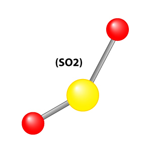
It appears to me that if one wants to make progress in mathematics, one should study the masters and not the pupils. - Niels Henrik Abel.
Nothing is better than reading and gaining more and more knowledge - Stephen William Hawking.
Offline
#2621 2025-10-20 00:01:25
- Jai Ganesh
- Administrator
- Registered: 2005-06-28
- Posts: 52,569
Re: Miscellany
2421) Elevator phobia
Gist
Elevator phobia, or elevatophobia, is an intense, irrational fear of elevators that can stem from claustrophobia (fear of enclosed spaces), acrophobia (fear of heights), or fear of malfunctions. Symptoms include intense anxiety and panic attacks, and it can lead to avoiding elevators by taking the stairs, even in high-rise buildings. Overcoming it often involves techniques like cognitive behavioral therapy (CBT) or exposure therapy, along with relaxation methods and breathing exercises.
Summary:
Where Elevator Phobias Might Originate
It’s different for each person, but there are some common elevator phobia origins. They include the following.
Agoraphobia – This is when someone fears being stuck somewhere that is nearly impossible to escape from. Individuals with agoraphobia could fear the elevator because it closes them in and they begin to panic that they won’t be able to get out again.
Claustrophobia – This is when someone fears being in enclosed spaces. Elevators are typically small in size, making people feel tightly enclosed when they are in them.
Previous Experiences – Whether someone had a previous experience with an actual elevator, or the enclosed space of the elevator makes him or her relive a past trauma, previous experiences could cause fear in someone when riding an elevator.
Hollywood – Even though everyone understands a movie is just a movie, those that include frightening elevator scenes can tell the subconscious that elevators are scary, leading someone to avoid riding in them.
How to Overcome an Elevator Phobia
One of the best ways to overcome many phobias is to understand the thing or situation one is afraid of. Someone might speak with an elevator maintenance worker to learn how the elevator works, then observe it for a time or two before trying to take a ride. If you have tenants who have anxiety surrounding elevators, it may be helpful to call in your elevator maintenance company.
If the phobia is quite extreme, a psychologist may be able to provide more insight on getting over a fear of elevators. If someone lives or works somewhere that an elevator is necessary on a regular basis, this might be a great option.
Details
If you get anxious or panicky while on an elevator, or you go out of your way to avoid taking elevators altogether, you are not alone! Many people have a fear of elevators. If this is you, read on to learn more about this problem and how you can overcome it.
Different Phobias Related to Elevators
A fear of elevators can stem from what’s known technically as a “specific phobia.” About 12.5% of adults in the United States will have a specific phobia in their lifetime. There are different types of specific phobias that can be associated with elevators, as you’ll see described below.
If you have a specific phobia, you’ll experience anxiety symptoms when in the presence of the feared object or situation. These include increased heart rate, shortness of breath, sweating, and nausea.
The phobias related to elevators are:
Claustrophobia
Claustrophobia is the fear of small, confined spaces. It can be triggered by many different places ranging from trains to tunnels to elevators. For many people, being in a small elevator, particularly if it is crowded, might trigger feelings of panic related to claustrophobia.
Cleithrophobia
Cleithrophobia is the fear of being trapped. It is a fear of a situation, rather than a specific place. This phobia is not specific to elevators but is commonly triggered by them. In an elevator, you might feel trapped if you think you might not be able to open the doors or get out. The lack of control over escaping is the defining feature of this phobia.
Acrophobia
Acrophobia is the fear of heights. This might be activated by elevators in tall buildings or skyscrapers. People with acrophobia might have trouble working or living in tall buildings with elevators because of the fear of being high off the ground. If you have acrophobia and live in an area like New York City, where you frequently encounter tall buildings with elevators, you might find it difficult to navigate your daily life.
Basophobia
Basophobia is the fear of falling. While an aversion to falling is a natural human instinct, people with basophobia have an intense fear of falling that is out of proportion to the situation. You might have trouble riding in elevators if you are afraid of the elevator suddenly falling, despite the safety features built into elevators.
Agoraphobia
Agoraphobia is a fear of being in places or situations that might cause feelings of helplessness, anxiety, or panic. You might have trouble leaving your home or other places that feel safe if you have agoraphobia. Going into public or riding an elevator might trigger feelings of panic for someone with this phobia.
Causes of a Fear of Elevators
Previous negative experiences:
You might have a fear of elevators because of a previous scary experience riding in one. For example, you might have been stuck in an elevator for a prolonged period of time. Or maybe you were in an elevator that stalled between floors or felt like it suddenly dropped. Any of these types of experiences could potentially trigger a fear of elevators.
Misconceptions about elevator safety:
Many myths or misunderstandings about elevators and their safety can worsen a fear of elevators. Here are some common misconceptions about elevators:
Running out of air:
A common myth is that elevators only hold a certain amount of air. You might therefore fear that if you get stuck you will have trouble breathing. However, elevators are not air-tight and do not have a limited supply of oxygen! Feelings of breathlessness on elevators are more likely related to panic attack symptoms rather than actually running out of air.
Elevator cable safety:
Some people believe that elevators are suspended by a single rope. This is false. Elevators are constructed with multiple steel cables that allow for safe movement up and down. Learn more about elevator cables here.
Elevators can free-fall:
Many people with a fear of elevators might believe that elevators can free-fall if something goes wrong. This is not the case. Elevators have safety features, both electronic and mechanical, that prevent this type of occurrence.
Safety Tips for Riding in Elevators
When riding in an elevator, it is important to take general safety precautions to ensure a smooth ride. Here are some tips to follow:
* Never hold a door open with your hand or an object. If you need to keep a door open, press and hold the “Door Open” button.
* If you are trying to catch the elevator and the door is closing, don’t stop it. Keeping the doors from closing could result in you getting injured.
* Don’t step onto an elevator if it seems overcrowded. Wait for the next one!
* If the door doesn’t open when the elevator stops at your floor, press the “Door Open” button. If the door doesn’t open after a few seconds, press the “Help” or “Emergency” button and wait for assistance.
* If a problem arises, try not to panic! Take a few deep breaths and press the “Emergency” button.
Additional Information
As a more modern invention, it has no official Greek "phobia" name; however, the fear of elevators is relatively common. According to the National Elevator Industry, Inc., elevators provide 18 billion passenger trips in the U.S. each year with millions of passengers repeatedly arriving safely at their destination. Yet, many people feel at least a slight nervousness when contemplating an elevator ride.
In some people, the fear of elevators is triggered by an existing phobia, but the fear often appears alone. Like any phobia, the fear of elevators ranges from mild to severe.
Fear of Elevators: Are Elevators Safe?
For those of us who work in the elevator industry, it’s hard to imagine anyone having a fear of elevators. Seeing these machines at work and knowing the evolution of elevators, we wouldn’t think twice when stepping into the cab. Yet, we know that elevator phobias are very real, and media is partially to blame for that. Films will often portray elevators in a way that is not accurate in the slightest. Thankfully, we are here to assure you that none of the extreme scenarios you see on the big screen are possible.
In movies, hoistway doors will open when they shouldn’t, characters will get stuck in elevators for days and a superhero will need to save the cab from free falling down the shaft. It may seem like a harmless way to move the plot along, but myths like these contribute to the fear of elevators that a number of commuters suffer from. Elevators are a part of daily life, so being afraid of them can inhibit many from experiencing the ease that they bring to tenants.
So how do you overcome your fear? Perhaps learning more about the many safety features that elevators have is a good place to start.
Are Elevators Safe?
Over the course of one day, elevators will globally carry 325 million people to their destinations. The worldwide popularity of the passenger elevator can be traced directly to its roots in safety. Before the 1800s, elevators were seen as a convenient way to move heavy items or as an attraction.
This all changed at the World’s Fair in 1853 when an inventor showcased his newest idea in front of a crowd. He stood in an elevator and had his assistant cut the cable that was holding him up. To their amazement, he only dropped a couple of feet — his new safety device caught the cab. This revolutionary invention is what we now call a “safety” activated by a governor. It is a component in every elevator you’ve ever ridden in.
Since the debut of the mechanical safety and overspeed governor, elevators have constantly evolved to become the safest form of vertical transportation — even better than stairs. Next time you are debating whether or not to take the stairs, take these safety features into account!

It appears to me that if one wants to make progress in mathematics, one should study the masters and not the pupils. - Niels Henrik Abel.
Nothing is better than reading and gaining more and more knowledge - Stephen William Hawking.
Offline
#2622 2025-10-21 16:44:02
- Jai Ganesh
- Administrator
- Registered: 2005-06-28
- Posts: 52,569
Re: Miscellany
2422) Nebula
Gist
A nebula is a giant cloud of dust and gas in space, which can be a birthplace for new stars or the remnants of a dying star. The term is Latin for "mist" or "cloud" and was once used for any diffuse-looking object, but today specifically refers to these interstellar clouds. Nebulae are often regions of star formation, where gas and dust clump together to form new stars and planetary systems.
A nebula is a giant cloud of dust and gas in space, located between stars. These clouds can be the birthplace of new stars, earning them the nickname "star nurseries," or they can be the remnants of dying stars, such as from a supernova explosion. Gravity causes the material within a nebula to clump together, eventually leading to the formation of stars and planets.
Summary
A nebula (Latin for 'cloud, fog'; pl. nebulae or nebulas) is a distinct luminescent part of interstellar medium, which can consist of ionized, neutral, or molecular hydrogen and also cosmic dust. Nebulae are often star-forming regions, such as the Pillars of Creation in the Eagle Nebula. In these regions, the formations of gas, dust, and other materials "clump" together to form denser regions, which attract further matter and eventually become dense enough to form stars. The remaining material is then thought to form planets and other planetary system objects.
Most nebulae are of vast size; some are hundreds of light-years in diameter. A nebula that is visible to the human eye from Earth would appear larger, but no brighter, from close by. The Orion Nebula, the brightest nebula in the sky and occupying an area twice the angular diameter of the full Moon, can be viewed with the naked eye but was missed by early astronomers. Although denser than the space surrounding them, most nebulae are far less dense than any vacuum created on Earth ({10}^{5} to {10}^{7} molecules per cubic centimeter) – a nebular cloud the size of the Earth would have a total mass of only a few kilograms. Earth's air has a density of approximately {10}^{19} molecules per cubic centimeter; by contrast, the densest nebulae can have densities of {10}^{4} molecules per cubic centimeter. Many nebulae are visible due to fluorescence caused by embedded hot stars, while others are so diffused that they can be detected only with long exposures and special filters. Some nebulae are variably illuminated by T Tauri variable stars.
Originally, the term "nebula" was used to describe any diffused astronomical object, including galaxies beyond the Milky Way. The Andromeda Galaxy, for instance, was once referred to as the Andromeda Nebula (and spiral galaxies in general as "spiral nebulae") before the true nature of galaxies was confirmed in the early 20th century by Vesto Slipher, Edwin Hubble, and others. Edwin Hubble discovered that most nebulae are associated with stars and illuminated by starlight. He also helped categorize nebulae based on the type of light spectra they produced.
Details
A nebula is any of the various tenuous clouds of gas and dust that occur in interstellar space. The term was formerly applied to any object outside the solar system that had a diffuse appearance rather than a pointlike image, as in the case of a star. This definition, adopted at a time when very distant objects could not be resolved into great detail, unfortunately includes two unrelated classes of objects: the extragalactic nebulae, now called galaxies, which are enormous collections of stars and gas, and the galactic nebulae, which are composed of the interstellar medium (the gas between the stars, with its accompanying small solid particles) within a single galaxy. Today the term nebula generally refers exclusively to the interstellar medium.
In a spiral galaxy the interstellar medium makes up 3 to 5 percent of the galaxy’s mass, but within a spiral arm its mass fraction increases to about 20 percent. About 1 percent of the mass of the interstellar medium is in the form of “dust”—small solid particles that are efficient in absorbing and scattering radiation. Much of the rest of the mass within a galaxy is concentrated in visible stars, but there is also some form of dark matter that accounts for a substantial fraction of the mass in the outer regions.
The most conspicuous property of interstellar gas is its clumpy distribution on all size scales observed, from the size of the entire Milky Way Galaxy (about {10}^{20} metres, or hundreds of thousands of light-years) down to the distance from Earth to the Sun (about {10}^{11} metres, or a few light-minutes). The large-scale variations are seen by direct observation, and the small-scale variations are observed by fluctuations in the intensity of radio waves, similar to the “twinkling” of starlight caused by unsteadiness in Earth’s atmosphere. Various regions exhibit an enormous range of densities and temperatures. Within the Galaxy’s spiral arms about half the mass of the interstellar medium is concentrated in molecular clouds, in which hydrogen occurs in molecular form (H2) and temperatures are as low as 10 kelvins (K). These clouds are inconspicuous optically and are detected principally by their carbon monoxide (CO) emissions in the millimetre wavelength range. Their densities in the regions studied by CO emissions are typically 1,000 H2 molecules per cubic cm. At the other extreme is the gas between the clouds, with a temperature of 10 million K and a density of only 0.001 H+ ion per cubic cm. Such gas is produced by supernovae, the violent explosions of unstable stars.
Classes of nebulae
All nebulae observed in the Milky Way Galaxy are forms of interstellar matter—namely, the gas between the stars that is almost always accompanied by solid grains of cosmic dust. Their appearance differs widely, depending not only on the temperature and density of the material observed but also on how the material is spatially situated with respect to the observer. Their chemical composition, however, is fairly uniform; it corresponds to the composition of the universe in general in that approximately 90 percent of the constituent atoms are hydrogen and nearly all the rest are helium, with oxygen, carbon, neon, nitrogen, and the other elements together making up about two atoms per thousand. On the basis of appearance, nebulae can be divided into two broad classes: dark nebulae and bright nebulae. Dark nebulae appear as irregularly shaped black patches in the sky and blot out the light of the stars that lie beyond them. Bright nebulae appear as faintly luminous glowing surfaces; they either emit their own light or reflect the light of nearby stars.
Dark nebulae are very dense and cold molecular clouds; they contain about half of all interstellar material. Typical densities range from hundreds to millions (or more) of hydrogen molecules per cubic centimetre. These clouds are the sites where new stars are formed through the gravitational collapse of some of their parts. Most of the remaining gas is in the diffuse interstellar medium, relatively inconspicuous because of its very low density (about 0.1 hydrogen atom per cubic cm) but detectable by its radio emission of the 21-cm line of neutral hydrogen.
Bright nebulae are comparatively dense clouds of gas within the diffuse interstellar medium. They have several subclasses: (1) reflection nebulae, (2) H II regions, (3) diffuse ionized gas, (4) planetary nebulae, and (5) supernova remnants.
Reflection nebulae reflect the light of a nearby star from their constituent dust grains. The gas of reflection nebulae is cold, and such objects would be seen as dark nebulae if it were not for the nearby light source.
H II regions are clouds of hydrogen ionized (separated into positive H+ ions and free electrons) by a neighbouring hot star. The star must be of stellar type O or B, the most massive and hottest of normal stars in the Galaxy, in order to produce enough of the radiation required to ionize the hydrogen.
Diffuse ionized gas, so pervasive among the nebular clouds, is a major component of the Galaxy. It is observed by faint emissions of positive hydrogen, nitrogen, and sulfur ions (H+, N+, and S+) detectable in all directions. These emissions collectively require far more power than the much more spectacular H II regions, planetary nebulae, or supernova remnants that occupy a tiny fraction of the volume.
Planetary nebulae are ejected from stars that are dying but are not massive enough to become supernovae—namely, red giant stars. That is to say, a red giant has shed its outer envelope in a less-violent event than a supernova explosion and has become an intensely hot star surrounded by a shell of material that is expanding at a speed of tens of kilometres per second. Planetary nebulae typically appear as rather round objects of relatively high surface brightness. Their name is derived from their superficial resemblance to planets—i.e., their regular appearance when viewed telescopically as compared with the chaotic forms of other types of nebula.
Supernova remnants are the clouds of gas expanding at speeds of hundreds or even thousands of kilometres per second from comparatively recent explosions of massive stars. If a supernova remnant is younger than a few thousand years, it may be assumed that the gas in the nebula was mostly ejected by the exploded star. Otherwise, the nebula would consist chiefly of interstellar gas that has been swept up by the expanding remnant of older objects.
Additional Information
A nebula is a giant cloud of dust and gas in space. Some nebulae (more than one nebula) come from the gas and dust thrown out by the explosion of a dying star, such as a supernova. Other nebulae are regions where new stars are beginning to form.
A nebula is a giant cloud of dust and gas in space. Some nebulae (more than one nebula) come from the gas and dust thrown out by the explosion of a dying star, such as a supernova. Other nebulae are regions where new stars are beginning to form. For this reason, some nebulae are called "star nurseries."
How do stars form in a nebula?
Nebulae are made of dust and gases—mostly hydrogen and helium. The dust and gases in a nebula are very spread out, but gravity can slowly begin to pull together clumps of dust and gas. As these clumps get bigger and bigger, their gravity gets stronger and stronger.
Eventually, the clump of dust and gas gets so big that it collapses from its own gravity. The collapse causes the material at the center of the cloud to heat up-and this hot core is the beginning of a star.
Where are nebulae?
Nebulae exist in the space between the stars—also known as interstellar space. The closest known nebula to Earth is called the Helix Nebula. It is the remnant of a dying star—possibly one like the Sun. It is approximately 700 light-years away from Earth. That means even if you could travel at the speed of light, it would still take you 700 years to get there!
How do we know what nebulae look like?
Astronomers use very powerful telescopes to take pictures of faraway nebulae. Space telescopes such as NASA's Spitzer Space Telescope and Hubble Space Telescope have captured many images of faraway nebulae.

It appears to me that if one wants to make progress in mathematics, one should study the masters and not the pupils. - Niels Henrik Abel.
Nothing is better than reading and gaining more and more knowledge - Stephen William Hawking.
Offline
#2623 2025-10-22 16:25:32
- Jai Ganesh
- Administrator
- Registered: 2005-06-28
- Posts: 52,569
Re: Miscellany
2423) Neuromuscular junction
Gist
A neuromuscular junction (NMJ) is the specialized synapse where a motor neuron transmits a signal to a skeletal muscle fiber, triggering muscle contraction. This happens when the nerve impulse reaches the neuron's end, causing it to release the neurotransmitter acetylcholine into the synaptic cleft. Acetylcholine then binds to receptors on the muscle fiber, initiating a series of events that lead to a muscle action potential and subsequent contraction.
When a nerve impulse arrives, it causes the release of the neurotransmitter acetylcholine, which binds to receptors on the muscle fiber, generating an action potential and leading to muscle movement. Disorders affecting the NMJ can lead to muscle weakness and paralysis.
Summary
A neuromuscular junction (or myoneural junction) is a chemical synapse between a motor neuron and a muscle fiber.
It allows the motor neuron to transmit a signal to the muscle fiber, causing muscle contraction.
Muscles require innervation to function—and even just to maintain muscle tone, avoiding atrophy. In the neuromuscular system, nerves from the central nervous system and the peripheral nervous system are linked and work together with muscles. Synaptic transmission at the neuromuscular junction begins when an action potential reaches the presynaptic terminal of a motor neuron, which activates voltage-gated calcium channels to allow calcium ions to enter the neuron. Calcium ions bind to sensor proteins (synaptotagmins) on synaptic vesicles, triggering vesicle fusion with the cell membrane and subsequent neurotransmitter release from the motor neuron into the synaptic cleft. In vertebrates, motor neurons release acetylcholine (ACh), a small molecule neurotransmitter, which diffuses across the synaptic cleft and binds to nicotinic acetylcholine receptors (nAChRs) on the cell membrane of the muscle fiber, also known as the sarcolemma. nAChRs are ionotropic receptors, meaning they serve as ligand-gated ion channels. The binding of ACh to the receptor can depolarize the muscle fiber, causing a cascade that eventually results in muscle contraction.
Neuromuscular junction diseases can be of genetic and autoimmune origin. Genetic disorders, such as Congenital myasthenic syndrome, can arise from mutated structural proteins that comprise the neuromuscular junction, whereas autoimmune diseases, such as myasthenia gravis, occur when antibodies are produced against nicotinic acetylcholine receptors on the sarcolemma.
Details
The body contains over 600 different skeletal muscles and each consists of thousands of muscle fibres ranging in length from a few millimetres to several centimetres. The motor nerve fibres innervating them, which arise in the spinal cord, can be more than 1 m in length. However, the area of apposition between the terminal tip of each nerve fibre and the ‘endplate’ of each muscle fibre is usually less than 50 μm (1/20 mm) in diameter. This particular type of synapse is called the neuromuscular junction (see figure). In order to generate the complex and finely controlled movements that we all take for granted, there has to be a very efficient, fail-safe, and one-way transmission between the nerve and the muscle that ensures that muscle contractions faithfully follow commands from the central nervous system. Such neuromuscular transmission depends on the release from the motor nerve terminal of the chemical acetylcholine (ACh), and its binding to a protein receiver on the surface of the muscle, called the acetylcholine receptor (AChR).
When a nerve impulse reaches the motor nerve terminal, specialized proteins forming ion-channels in its cell membrane open transiently, allowing a short-lived entry of calcium into the terminal. Stored inside the nerve terminal, and attached to special sites on the inside of the cell membrane, are small round vesicles filled with ACh. The sudden inrush of calcium causes some of the vesicle membranes to fuse with the nerve terminal membrane, and to release their contents into the synaptic cleft between the nerve and the surface of the muscle fibre.
ACh diffuses rapidly across the ultramicroscopic 50 nm gap and binds to the AChRs that are very densely packed on the tops of the synaptic folds on the muscle fibre. When two ACh molecules bind to each AChR, its central pore (channel) opens, allowing small positively charged ions, mainly sodium, to enter the muscle, resulting in a local reduction in the potential across the membrane (depolarization). The release of many ACh-containing vehicles by a nerve impulse leads to a large depolarization called the endplate potential, which in turn opens the voltage-sensitive sodium channels situated at the base of each synaptic fold. These are responsible for starting an ‘all or nothing’ action potential that is propagated along the muscle fibre in each direction and initiates muscle contraction.
After about a millisecond, the AChR pore closes and ACh unbinds and is broken down by an enzyme, ACh esterase (AChE), that sits in the synaptic cleft. Choline is then taken back into the nerve terminal by special transporters, and used to make more ACh; this is stored in newly-formed synaptic vesicles, themselves made up of recycled nerve terminal membrane. The whole sequence of events, from the inrush of calcium to the initiation of the action potential, takes place in less than two milliseconds.
Many of the earliest studies on chemical synaptic transmission began with the autonomic nervous system, but they were soon extended to skeletal muscles when Dale and his colleagues (1936) showed that stimulation of motor nerves released ACh, and that ACh can induce muscle contraction. The action of ACh could be increased by using a drug, eserine, that inhibits the ACh esterase, and the action of ACh on the muscle could be blocked by the arrow poison, curare. Katz and his co-workers subsequently used intracellular micro-electrodes to measure the endplate potentials and showed that these followed the release of many vesicles of ACh, and that a similar depolarization of the muscle occurred when ACh was applied directly onto the neuromuscular junction with a micropipette.
The neuromuscular junction, unlike most of the nervous system, is accessible to factors circulating in the blood. This can be both an advantage and a disadvantage. For many surgical operations, one of the important roles of the anesthetist is to relax the patient's muscles using an intravenous injection of the otherwise poisonous curare-like drugs — whilst taking over artificially the muscular function of breathing. Similarly, many species of venomous animals, such as snakes and scorpions, make toxins that paralyse their prey, and in some parts of the world this can also be a serious hazard for humans. Such toxins are rapidly absorbed and carried to the neuromuscular junction where they bind with extraordinary efficiency to the AChRs and other ion channel proteins, leading to muscle paralysis which can prevent breathing. Another important toxin is botulinum, which is produced by bacteria contaminating certain foods. Botulinum toxin blocks the release of ACh from the motor nerve terminals, and can cause fatal paralysis in babies; on the other hand it has recently found use as a treatment by local injection into muscles that are subject to uncontrollable severe spasm.
These neurotoxins have also provided marvellous tools for investigating function. For instance, a particular snake toxin, alpha-bungarotoxin, binds very strongly to AChRs and has been of immense use in the study of diseases that affect neuromuscular transmission. In myasthenia gravis (mys: muscle: aesthenia: weakness), the patient suffers from serious weakness and fatigue that can be life-threatening if it involves swallowing and breathing muscles. Myasthenia was first described in 1672 by the very distinguished London physician and anatomist, Thomas Willis. Over three hundred years later, Jim Patrick and Jon Lindstrom at the Salk Institute in California induced a myasthenia gravis-like disease in rabbits by injecting them with AChR protein purified from the electric organs of certain fish. The rabbits responded to the ‘foreign’ protein by making antibodies to it, but these antibodies gained access to the rabbits' neuromuscular junctions, recognized the muscle AChRs, and reduced their function, producing muscle weakness. Following these experimental observations, radioactively-labelled alpha-bungarotoxin was used to show that patients with myasthenia have reduced numbers of AChRs at their neuromuscular junctions, and subsequently that this is caused by serum antibodies that bind to AChRs — just as in the rabbits. Drugs that inhibit the ACh esterase enzyme cause clinical improvement because they prolong the action of ACh, as first demonstrated in 1934 by Mary Walker, a young doctor in London, but nowadays the most important treatment is to reduce the circulating antibodies that bind AChR.
Additional Information
Nneuromuscular junction is a site of chemical communication between a nerve fibre and a muscle cell. The neuromuscular junction is analogous to the synapse between two neurons. A nerve fibre divides into many terminal branches; each terminal ends on a region of muscle fibre called the end plate. Embedded in the end plate are thousands of receptors, which are long protein molecules that form channels through the membrane. Upon stimulation by a nerve impulse, the terminal releases the chemical neurotransmitter acetylcholine from synaptic vesicles. Acetylcholine then binds to the receptors, the channels open, and sodium ions flow into the end plate. This initiates the end-plate potential, the electrical event that leads to contraction of the muscle fibre.
It appears to me that if one wants to make progress in mathematics, one should study the masters and not the pupils. - Niels Henrik Abel.
Nothing is better than reading and gaining more and more knowledge - Stephen William Hawking.
Offline
#2624 2025-10-23 16:08:25
- Jai Ganesh
- Administrator
- Registered: 2005-06-28
- Posts: 52,569
Re: Miscellany
2424) Chlorophyll
Gist
Chlorophyll is the green pigment in plants, algae, and cyanobacteria that is essential for photosynthesis, the process of converting light energy into chemical energy to create food. It is concentrated in plant cells within structures called chloroplasts and gives plants their characteristic green color. Beyond its primary role in photosynthesis, it's used as a natural green colorant and has been studied for potential antioxidant and anti-aging benefits, though these require more research.
Chlorophyll is a pigment that gives plants their green color, and it helps plants create their own food through photosynthesis.
Chlorophyll is found in the thylakoid membranes of chloroplasts within the cells of photosynthetic organisms, such as green plants, algae, and cyanobacteria. It is concentrated within the grana (stacks of thylakoids) in plant cells, which are the specific sites where the light-dependent reactions of photosynthesis occur.
Summary
Chlorophyll is any of several related green pigments found in cyanobacteria and in the chloroplasts of algae and plants. Its name is derived from the Greek words (khloros, "pale green") and (phyllon, "leaf"). Chlorophyll allows plants to absorb energy from light. Those pigments are involved in oxygenic photosynthesis, as opposed to bacteriochlorophylls, related molecules found only in bacteria and involved in anoxygenic photosynthesis.
Chlorophylls absorb light most strongly in the blue portion of the electromagnetic spectrum as well as the red portion. Conversely, it is a poor absorber of green and near-green portions of the spectrum. Hence chlorophyll-containing tissues appear green because green light, diffusively reflected by structures like cell walls, is less absorbed. Two types of chlorophyll exist in the photosystems of green plants: chlorophyll a and b.
Uses:
Culinary
Synthetic chlorophyll is registered as a food additive colorant, and its E number is E140. Chefs use chlorophyll to color a variety of foods and beverages green, such as pasta and spirits. Absinthe gains its green color naturally from the chlorophyll introduced through the large variety of herbs used in its production. Chlorophyll is not soluble in water, and it is first mixed with a small quantity of vegetable oil to obtain the desired solution.
In marketing
In years 1950–1953 in particular, chlorophyll was used as a marketing tool to promote toothpaste, sanitary towels, soap and other products. This was based on claims that it was an odor blocker — a finding from research by F. Howard Westcott in the 1940s — and the commercial value of this attribute in advertising led to many companies creating brands containing the compound. However, it was soon determined that the hype surrounding chlorophyll was not warranted and the underlying research may even have been a hoax. As a result, brands rapidly discontinued its use. In the 2020s, chlorophyll again became the subject of unsubstantiated medical claims, as social media influencers promoted its use in the form of "chlorophyll water", for example
Details
Chlorophyll is any member of the most important class of pigments involved in photosynthesis, the process by which light energy is converted to chemical energy through the synthesis of organic compounds. Chlorophyll is found in virtually all photosynthetic organisms, including green plants, cyanobacteria, and algae. It absorbs energy from light; this energy is then used to convert carbon dioxide to carbohydrates.
Chlorophyll occurs in several distinct forms: chlorophylls a and b are the major types found in higher plants and green algae; chlorophylls c and d are found, often with a, in different algae; chlorophyll e is a rare type found in some golden algae; and bacterio-chlorophyll occurs in certain bacteria. In green plants chlorophyll occurs in membranous disklike units (thylakoids) in organelles called chloroplasts.
The chlorophyll molecule consists of a central magnesium atom surrounded by a nitrogen-containing structure called a porphyrin ring; attached to the ring is a long carbon–hydrogen side chain, known as a phytol chain. Variations are due to minor modifications of certain side groups. Chlorophyll is remarkably similar in structure to hemoglobin, the oxygen-carrying pigment found in the red blood cells of mammals and other vertebrates.
Additional Information
Chlorophyll is a pigment that gives plants their green color, and it helps plants create their own food through photosynthesis.
Green plants have the ability to make their own food. They do this through a process called photosynthesis, which uses a green pigment called chlorophyll. A pigment is a molecule that has a particular color and can absorb light at different wavelengths, depending on the color. There are many different types of pigments in nature, but chlorophyll is unique in its ability to enable plants to absorb the energy they need to build tissues.
Chlorophyll is located in a plant’s chloroplasts, which are tiny structures in a plant’s cells. This is where photosynthesis takes place. Phytoplankton, the microscopic floating plants that form the basis of the entire marine food web, contain chlorophyll, which is why high phytoplankton concentrations can make water look green.
Chlorophyll’s job in a plant is to absorb light—usually sunlight. The energy absorbed from light is transferred to two kinds of energy-storing molecules. Through photosynthesis, the plant uses the stored energy to convert carbon dioxide (absorbed from the air) and water into glucose, a type of sugar. Plants use glucose together with nutrients taken from the soil to make new leaves and other plant parts. The process of photosynthesis produces oxygen, which is released by the plant into the air.
Chlorophyll gives plants their green color because it does not absorb the green wavelengths of white light. That particular light wavelength is reflected from the plant, so it appears green.
Plants that use photosynthesis to make their own food are called autotrophs. Animals that eat plants or other animals are called heterotrophs. Because food webs in every type of ecosystem, from terrestrial to marine, begin with photosynthesis, chlorophyll can be considered a foundation for all life on Earth.

It appears to me that if one wants to make progress in mathematics, one should study the masters and not the pupils. - Niels Henrik Abel.
Nothing is better than reading and gaining more and more knowledge - Stephen William Hawking.
Offline
#2625 2025-10-24 16:52:19
- Jai Ganesh
- Administrator
- Registered: 2005-06-28
- Posts: 52,569
Re: Miscellany
2425) Gemology
Gist
Gemology is the science of studying and identifying natural and artificial gemstones. A gemologist examines gemstones for their beauty, durability, and rarity by studying their composition, physical and optical properties, origin, and treatments. This field involves techniques like microscopic inspection, hardness tests, and the use of specialized tools like refractometers to identify and grade gems for purposes in the jewelry, astrological, and industrial sectors.
Summary
Gemology or gemmology is the science dealing with natural and artificial gemstone materials. It is a specific interdisciplinary branch of mineralogy. Some jewelers (and many non-jewelers) are academically trained gemologists and are qualified to identify and evaluate gems.
Background
It is often difficult to obtain an expert judgement from a neutral laboratory. Analysis and estimation in the gemstone trade usually have to take place on site. Professional gemologists and gemstone buyers use mobile laboratories, which pool all necessary instruments in a travel case. Such so-called travel labs even have their own current supply, which makes them independent from infrastructure. They are also suitable for gemological expeditions.
Gemstones are basically categorized based on their crystal structure, specific gravity, refractive index, and other optical properties, such as pleochroism. The physical property of "hardness" is defined by the irregular Mohs scale of mineral hardness.
Gemologists study these factors while valuing or appraising cut and polished gemstones. Gemological microscopic study of the internal structure is used to determine whether a gem is synthetic or natural by revealing natural fluid inclusions or partially melted exogenous crystals that are evidence of heat treatment to enhance color.
The spectroscopic analysis of cut gemstones also allows a gemologist to understand the atomic structure and identify its origin, which is a major factor in valuing a gemstone. For example, a ruby from Myanmar (Burma) will have definite internal and optical activity variance from a Thai ruby.
When the gemstones are in a rough state, the gemologist studies the external structure; the host rock and mineral association; and natural and polished color. Initially, the stone is identified by its color, refractive index, optical character, specific gravity, and examination of internal characteristics under magnification.
Details
Gemology is the science of studying, cutting, and valuing precious stones, but the essence of gemology is in identifying the gemstones. One who works in the field of gemology is called a gemologist, and jewelers and goldsmiths also may be gemologists.
Some collectors and investors may be interested only in gems' monetary value, but to distinguish one gemstone from another, they will need to seek out a gemologist. Gemologists examine gemstones—both discovered raw and synthesized in the laboratory—using microscopes, computerized tools, and other grading instruments.
Key Takeaways
* Gemology is the science of identifying gemstones.
* Gemologists examine gemstones—both discovered raw and synthesized in the laboratory—using microscopes, computerized tools, and other grading instruments.
* The field of gemology contains professionals such as appraisers, goldsmiths, jewelers, lapidaries, and scientists.
* Investing in gemstones may be risky, but the precious metals sector can be less speculative for inexperienced investors.
* Unlike other types of investments, gemstones may not be as easily liquidated if you have an urgent need for cash.
Understanding Gemology
At its heart, gemology is about identifying gems. Gemologists identify a gemstone by its specific characteristics and properties, such as cut, color, quality, and clarity. Some rubies and garnets, for example, are impossible to distinguish by their appearance, but their underlying physical properties differ considerably. Many people are familiar with a group of criteria that is used in gemology to identify diamonds—the 4Cs of color, clarity, cut, and carat.
Gemology and Its Professionals
In addition to gemologists, the field of gemology contains numerous other professionals, including appraisers, jewelers, lapidaries, metalworkers, and scientists.
Gemologists may become certified as professional appraisers, whose expertise is useful in many other industries, including jewelry sales and investing. Jewelers need to understand gemology to answer their customers’ questions and identify any gems brought to them. Goldsmiths and other metalworkers need specific knowledge about the physical characteristics of gems to create appropriate settings. For example, a setting that would be ideal for a diamond could damage an opal, and the amount of pressure used to set the prongs on a garnet could break a stone of tanzanite.
Lapidaries, or gem cutters, also need special knowledge, as appropriate cutting and polishing techniques vary from gem to gem. What would work well for one gemstone would be a waste of time or even disastrous for another gem. Scientists with degrees in geology, chemistry, and even physics make up the smallest group of gemologists, although they are very influential. Scientists add to gemology's knowledge base by developing new testing techniques and researching new gemstones.
Tip
The International Gem Society offers an online Professional Gemologist certification course while The Gemological Institute of America offers a Graduate Gemologist program.
Gemstones as Investments
When returns in the stock market decline, aggressive investors often seek out alternatives that may hold more promise of increasing returns on invested capital (ROIC) than traditional investment types. Or, some investors might want to consider tangible assets simply as a way to diversify their holdings even during good market conditions. Investing in gemstones—in particular, those that are rare or of exceptional quality—likely would at least retain, and probably increase in value.
However, unlike other types of investments, gemstones may not be as easily liquidated if you have an urgent need for cash. This drawback is especially founded for rare, precious stones and jewelry that would appeal to elite buyers only. Gemstone investing can seem exciting to those who want to make quick returns, but it is highly speculative and should only be undertaken by experienced professionals. Investing in the precious metals sector, however, is different because there are standards as well as specific investment vehicles for them in the financial markets.
The term "investment-grade" is often tossed around by those who want to sell gems or try to convince other people to invest in them. However, this practice is frowned upon in financial services because there are no formal standards for what constitutes investment-grade gemstones, as there are for investment-grade bonds, for example.
Careers in Gemology
With advances in gemstone synthesis, gemology has become an important field of study. A credential in gemology can offer numerous career paths:
* Appraiser. Evaluate gemstones, antique and contemporary jewelry, and fine watches. Write detailed descriptions and determine valuation.
* Auction Specialist. Oversee buying and selling during the lively process of auctioning privately owned one-of-a-kind jewelry.
* Bench Jeweler. Manufacture and repair fine jewelry using craftsmanship skills and expert techniques.
* Buyer. Monitor industry and consumer trends and seek out gems and finished jewelry pieces to sell profitably.
* Designer. Create unique jewelry designs using precious gemstones.
* Lab and Research Professional. Investigate new gem finds, treatment processes, and detection methods in the field and laboratory.
* Retailer. A career in the fast-paced environment of retail jewelry sales can be rewarding, exciting, and lucrative.
* Wholesaler. Import and sell diamonds, colored stones, cultured pearls, finished jewelry, and watches from locations around the world.
How to Become a Gemologist
In the field of gemology, there are many career opportunities. Some of the most common include appraisers, retail associates, lab gemologists, and jewelry designers. However, it can be tough to break into these fields; most require at least some formal training. In general, here are the steps you should follow if you want to break into a career in the field of gemology:
Determine What Area of Gemology You Want to Work In
As a professional gemologist, there are a number of different careers you can pursue. Before you can figure out the right educational path, you must first decide what area of gemology you want to pursue. You might consider reading about different career paths or speaking to people that already work in these professions.
Assess Your Skills
Any profession should utilize or enhance your current skills. The most general job requirements for a gemologist are being detail-oriented and having good interpersonal skills, hand-eye coordination, and finger dexterity. In addition, being a good salesperson may make you particularly successful in a retail outlet or as a gemstone wholesaler. If you are creative or have a special interest in fashion, pursuing a career as a gemstone designer might be a good fit. Finally, if you are very meticulous or pay close attention to detail, working as an appraiser or as someone who repairs jewelry might be a good fit for you.
Additional Information
Gemology is the scientific study of gemstones. Although there may be investors and collectors who are only interested in the monetary value of gems, they'll need a scientific approach when the time comes to distinguish one gemstone from another. Whom will they seek out? Gemologists.
Goldsmiths (and other metalworkers) need specific knowledge about the physical characteristics of gems in order to create appropriate settings. For example, a setting that would be ideal for a diamond could damage an opal, and the amount of pressure used to set the prongs on a garnet could break a tanzanite. Some gems can withstand the heat of repair work involving high temperature soldering. If metalworkers take precautions, they can leave them in their settings. Other gemstones are so heat sensitive they would need to remove them.
Lapidaries, or gem cutters, also need special knowledge. Appropriate cutting and polishing techniques vary from gem to gem. What would work well for one gemstone would be a waste of time or even disastrous on another gem. Faceting and gemstone color management go hand in hand. How cutters orient the rough can greatly impact the appearance of the finished gem. Cutting style is also a part of color management.
The choice of cut can lighten or darken a gem, which will considerably affect both the appearance and the value of the stone. The shape, number, and location of facets influence the brilliance of the gem. Lapidaries much choose angles for facet cutting carefully. They must consider all these factors to minimize the amount of gemstone rough sacrificed to create a beautiful faceted gem.
The Scientists
Although scientists with degrees in geology, chemistry, and even physics make up the smallest group of gemologists, they're influential. The systematic measurement and recording of the physical and optical properties used to identify gemstones is a well-established but ongoing scientific process.
For centuries, the lapidary was in the best position to recognize the differences in gems with similar appearances. The faceting process offered a perspective on gemstones no other gemologist had. Many inclusions, materials trapped inside gemstones, and physical characteristics, such as hardness, were readily apparent when cutting and polishing a gem.
Scientists continue to add to this knowledge by developing new testing techniques and researching new gemstones discovered in nature and synthesized in the laboratory.
Gemstone Identification
Gem identification is the heart of gemology. For example, some rubies and garnets are impossible to distinguish by their appearance, but their physical properties differ considerably. Ruby and garnet crystallography varies greatly. While the visible shapes of individual stones may vary, the crystal structures of these gems at the atomic level are distinctive. Garnets form in the isometric or cubic system, while rubies form in the hexagonal system.
Mineralogical techniques are also used to help identify gemstones. Scratch tests, in which various substances are used to scratch an unknown gem, determine hardness. A gem's reaction to acid and even heat can yield important clues to its identity. Of course, these destructive tests aren't appropriate for cut gems.
Scientists have also devised non-destructive tests to identify gemstones. They have designed instruments to measure the physical and optical properties of gems — like specific gravity and refractive index — without damaging them. Today, even people without extensive scientific training or expensive laboratory equipment can use these methods for gem identification.
Getting Started in Gemology
If you're interested in learning about gems, first, learn how they're categorized and the terms used to describe them. Next, study their physical and optical properties. With this background, you can start learning how to identify gemstones.
Of course, there are many side roads to travel as you study gemology. Perhaps you'll become fascinated with phenomenal gems or with inclusions found in natural gems. People interested in gemstone collecting may also become interested in learning how to cut gems and make jewelry.

It appears to me that if one wants to make progress in mathematics, one should study the masters and not the pupils. - Niels Henrik Abel.
Nothing is better than reading and gaining more and more knowledge - Stephen William Hawking.
Offline